Mendenhall wetlands area to get first new full map since 1979
Published 9:30 pm Sunday, January 7, 2024


The first comprehensive new map for the Mendenhall wetlands area since 1979 is nearing completion and the cartographer for the project — who started drawing local maps around that time — says things are going to look rather different for visitors and habitat managers used to the old map.
“The land is rising at roughly half an inch a year, so at that rate it doesn’t take long,” said Richard Carstensen, part of a team that compiled the map for The Southeast Alaska Land Trust (SEALT). “If you change just one foot of elevation within the intertidal zone you can have a whole different community.”
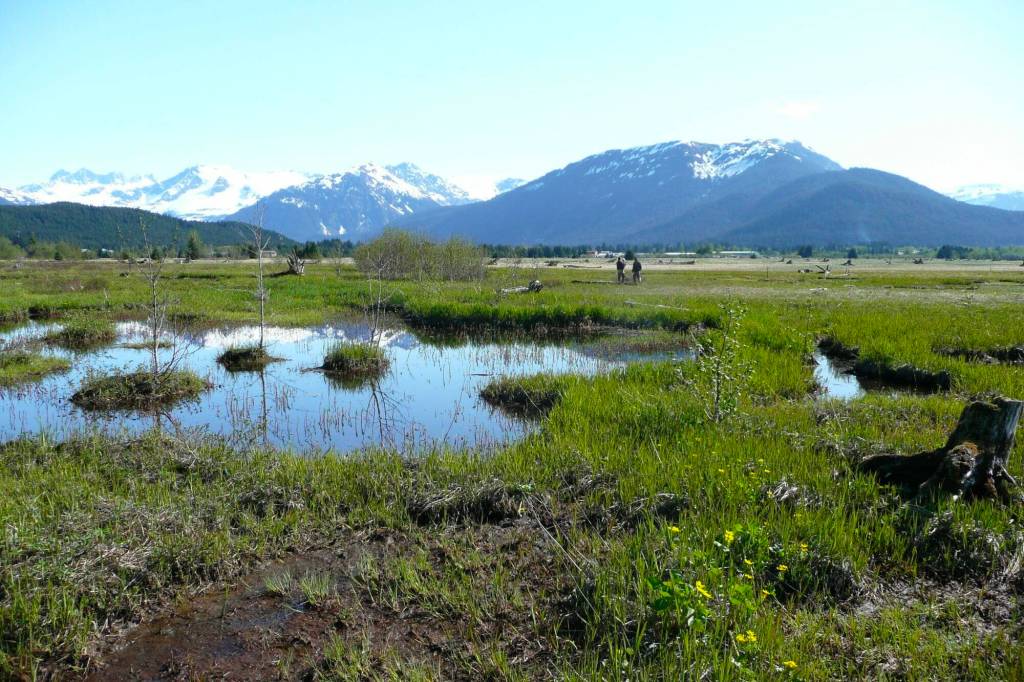
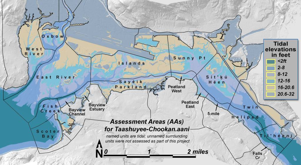
The digital map covers 5,252 acres, including the roughly 4,000-acre area officially known as the Mendenhall Wetlands State Game Refuge, plus nearby tidal and recent post-glacial uplift areas, according to SEALT. The trust owns and has stewardship of 22 properties around the wetlands complex. The Alaska Department of Fish and Game has stewardship of the refuge.
Among the first changes people are likely to notice looking at the new map is the area’s name — Taashuyee-Chookan.aani — Lingít for “river/tide flats-grassy land,” according to SEALT. Some subsections of land also have Lingít names.
The 1979 map and a partially updated version done in 2003 don’t have such references. Carstensen said he’s “trying to wean myself from commemorative names or colonial names and go back to the original Lingít” in his cartography, which reflects a broader effort by many officials and others in the community.
“It’s something that’s exciting, to see this happening all over our community,” he said. “People are recognizing that it’s not renaming, it’s prenaming because you’re coming back to pre-existing name.”
The project team — usually consisting of seven people at a time in the field, but with different individuals at times — spent about two months gathering biological and other data, taking ground and areal photography, and compiling historic models that will allow past as well as future insight in the wetlands, said SEALT Executive Director Margaret Custer.
While deciding to compile a new map wasn’t officially SEALT’s responsibility, “we decided that we wanted to take ownership of prudent management of the wetlands in 2023,” Custer said. She said the map, as with the previous ones, will assist ADF&G with its habitat management and the changes that have occurred over decades.
“The habitat has shifted over that time due to isostatic rebound (land rising after heavy ice sheets covering it disappear) and development pressures, and so forth,” she said. “So the vegetation communities, as well as the elevation, have just shifted a lot over 44 years. So it’s not that it’s redefining the habitat. It’s just showing where it is now.”
Carstensen, who said he’s still familiar with how the wetlands looked in 1979, said a vast number of factors from sediment flowing down the Mendenhall River to development at the adjacent airport that affected tidal flow are factors in the evolution of the area.
“You add all that together and it would hardly be a recognizable distribution of vegetation communities out there,” he said, referring to the area during the late 1970s.
The new map will categorize habitat types including uplift meadows, grass high-marsh, sedge low marsh, succulent low-marsh and mussel-barnacle-rockweed beds, according to SEALT. Those classifications can also be compared to the original 1979 map.
The area has undergone drastic changes before since in earlier times it was a mudflat with little vegetation, higher tides and more vigorous currents, Carstensen said.
“So that made it pretty hard for the salt marsh to get developed out there,” he said.
Carstensen said he was able to create a fairly detailed update in 2003, although it involved drawing many hundreds of polygons by hand of different wetlands types and relying on digital photos considered state-of-the-art at the time.
“You carry that forward to today and it’s unbelievable how much data we have for this, way more than I could really use,” he said. “But I flew my drone about 50 times during the surveys.”
Custer said there isn’t a set date yet for when the updated map will be made available to the public since work on it is still ongoing.
SEALT’s previous maps have assisted fish and game officials with refuge management decisions such as hunting and researcher access, said Carl Koch, ADF&G’s area biologist and refuge manager. He said the maps also are useful for a variety of ongoing issues related to habitat, such as a suitable location for a second crossing between Juneau and Douglas.
Koch said the state has experts to conduct data and map work similar to SEALT, but it generally is done for more limited and specific purposes.
“In general it’s advantageous to have these folks doing the planning they’re doing,” he said, referring to the trust. “My understanding is this is a real thorough, ground-truth map with lots of time on the ground,” he said.
• Contact Mark Sabbatini at mark.sabbatini@juneauempire.com or (907) 957-2306.