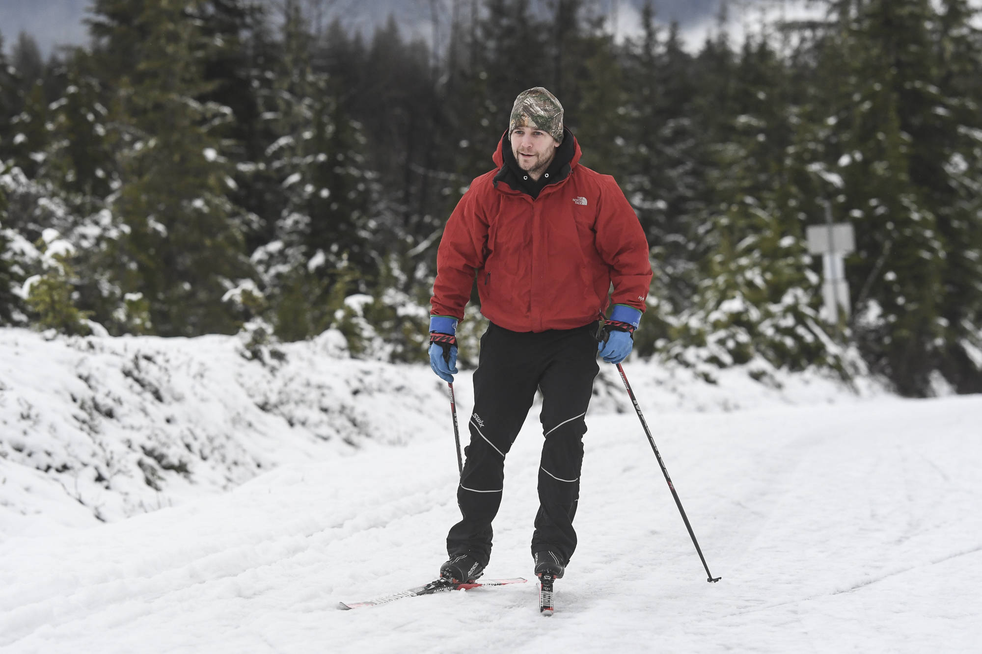
Nick Yankee takes advantage of the remaining snow along Montana Creek Road to ski on Wednesday, Dec. 18, 2019. The National Weather Service is calling for a mixture of rain and snow going into the weekend. (Michael Penn | Juneau Empire)

Nick Yankee takes advantage of the remaining snow along Montana Creek Road to ski on Wednesday, Dec. 18, 2019. The National Weather Service is calling for a mixture of rain and snow going into the weekend. (Michael Penn | Juneau Empire)

Wet and warm December likely to continue

Just 3 inches of snowfall at airport this month

A white Christmas isn’t looking especially likely.

A short-term climate outlook released Wednesday by the National Oceanic and Atmospheric Administration shows a strong probability Southeast will experience warmer and wetter conditions to finish out the year.

That could equate to a December snowfall total far below the average. Through the first two weeks of the month, 2.9 inches of snow has fallen at the Juneau International Airport, less than a fifth of the monthly average of 15.6 inches.

“We are unfortunately are not hitting our normals there, or anywhere close to them at all,” said meteorologist Greg Spann of the National Weather Service in Juneau. “It is important to note that there are some differences depending on where you are located in Juneau with how much snow you’re receiving.”

Spann added snowfall totals are highly variable between downtown and the Mendenhall Valley, and even within different parts of the Mendenhall Valley. Almost 10 inches of snowfall has been recorded this month at the NWS Forecast Office on the Back Loop Road, he said.

“The valley is definitely experiencing and getting a little bit more snow than downtown or the airport, but no matter which way you cut it, we’re still below normal,” Spann said.

There’s a 40-50% probability the panhandle will be wetter than normal and 33-40% probability the state will have warmer than normal over the next 8-14 days, according to the climate outlooks created by NOAA’s Climate Prediction Center,

“The winter outlook is probabilistic in nature, meaning that the maps show those areas that are most likely to be warmer or colder than normal, or wetter or drier,” said Mike Halpert, deputy director of the Climate Prediction Center, in a conference call with reporters upon the release of the 2019-20 U.S. winter climate outlook. “However the nature of a probabilistic forecast means that other outcomes are always possible, just less likely.”

The average temperature last month in Juneau was 38.5 degrees. That’s five degrees warmer than normal, according to the National Weather Service.

Additionally, the total precipitation last month of 10 inches was four inches higher than normal, according to the National Weather Service. The climate normal period is taken from records between 1981-2010.


• Contact sports reporter Nolin Ainsworth at 523-2272 or nainsworth@juneauempire.com.

More in News

A house on Telephone Hill stands on Dec. 22, 2025. (Mari Kanagy / Juneau Empire)
Court sets eviction date for Telephone Hill residents as demolition plans move forward

A lawsuit against the city seeks to reverse evictions and halt demolition is still pending.

Juneauites warm their hands and toast marshmallows around the fire at the “Light the Night" event on winter solstice, on Dec. 21, 2025. (Mari Kanagy / Juneau Empire)
A mile of lights marked Juneau’s darkest day

Two ski teams hosted a luminous winter solstice celebration at Mendenhall Loop.

A Capital City Fire/Rescue truck drives in the Mendenhall Valley in 2023. (Clarise Larson / Juneau Empire file photo)
Juneau man found dead following residential fire

The cause of the fire is still under investigation.

CBJ sign reads “Woodstove burn ban in effect.” (City and Borough of Juneau photo)
Update: CBJ cancels air quality emergency in Mendenhall Valley Sunday morning

The poor air quality was caused by an air inversion, trapping pollutants at lower elevations.

A dusting of snow covers the Ptarmigan chairlift at Eaglecrest Ski Area in December 2024. (Eaglecrest Ski Area photo)
Update: Waterline break forces closure at Eaglecrest Friday, Saturday

The break is the latest hurdle in a challenging opening for Juneau’s city-run ski area this season.

Patrick Sullivan stands by an acid seep on July 15,2023. Sullivan is part of a team of scientists who tested water quality in Kobuk Valley National Park’s Salmon River and its tributaries, where permafrost thaw has caused acid rock drainage. The process is releasing metals that have turned the waters a rusty color. A chapter in the 2025 Arctic Report Card described “rusting rivers” phenomenon. (Photo by Roman Dial/Alaska Pacific University)
Ecosystem shifts, glacial flooding and ‘rusting rivers’ among Alaska impacts in Arctic report

NOAA’s 2025 report comes despite Trump administration cuts to climate science research and projects

The U.S. Capitol in Washington, D.C., on Oct. 1, 2025. (Photo by Jennifer Shutt/States Newsroom)
Moderate US House Republicans join Dems to force vote on extension of health care subsidies

WASHINGTON — Republican leaders in the U.S. House will face a floor… Continue reading

The National Weather Service Juneau issues a high wind warning forDowntown Juneau, Southern Douglas Island and Thane due to increased confidence for Taku Winds this afternoon. (National Weather Service screenshot)
Taku winds and dangerous chills forecast for Juneau

Gusts up to 60 mph and wind chills near minus 15 expected through the weekend.

Chloe Anderson for the Juneau Empire
Fallen trees are pictured by the Mendenhall river on Aug. 15, 2025. Water levels rose by a record-breaking 16.65 feet on the morning of Aug. 13 during a glacial outburst flood.
Lake tap chosen as long-term fix for glacial outburst floods

The U.S. Army Corps of Engineers and Juneau leaders agreed on the plan.

Most Read