
Scientists with the National Forest Service have proven that a massive rockslide near Cowee Creek, north of Juneau, caused a rare “alpine tsunami” in late 2016, sending a 30-foot tall wave of water, ice and rock cascading down a channel, knocking down trees and remapping the creek.
The find took more than a year of research and collaboration with partnering scientific agencies. It all culminated in a public lecture at the Mendenhall Glacier Visitor Center on Friday.
The tsunami was caused by a rockslide, or a landslide made up primarily of rock, USFS’ Rick Edwards explained, which registered on seismographs and was originally thought to be a conventional 3.4 magnitude earthquake.
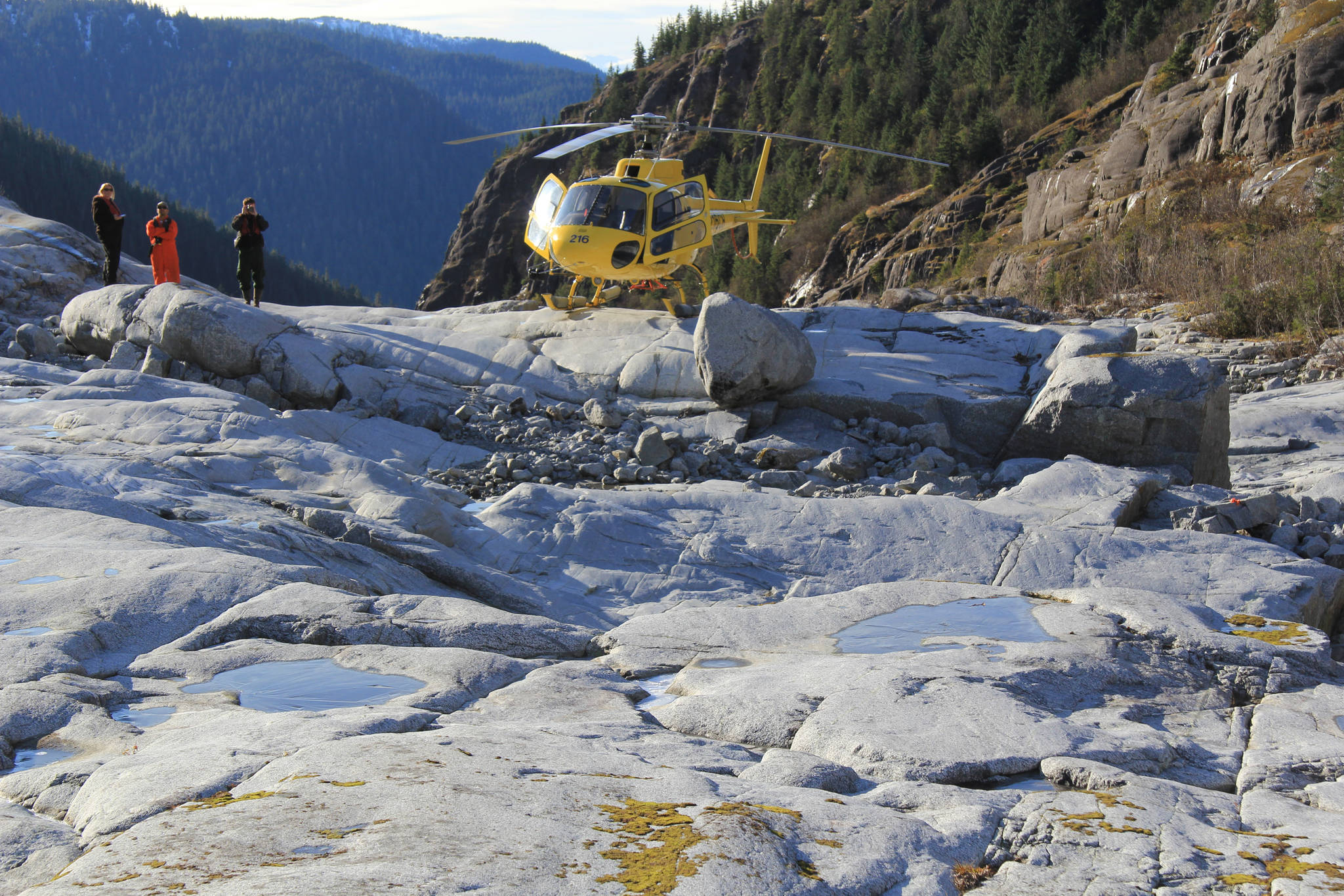
But when Edwards and his team toured the Cowee Creek area by helicopter sometime after the supposed quake, they were awestruck to discover a massive rockslide had totally remapped part of Cowee Creek. The crew was up there putting up temperature logging equipment.
Being a part of the Heen Latinee Experimental Forest, the whole area is well-studied.
“We were up there anyway and we saw the scar, and that’s a very significant change, so we were like, ‘Woh,’” Edwards said. “It was awe-inspiring.”
The site lies about 8 miles from Glacier Highway and about 40 miles north of Juneau. There, a massive chunk of rock next to a small, unnamed hanging glacier broke off and fell into a 34-acre lake.
Edwards said the sliding rock weighed about 1.4 million tons. That’s the equivalent of 5.3 federal buildings worth of rock, he explained, referencing a building in downtown Juneau.
It all worked like this, Edwards said: likely, a nearby fault and years of precipitation, ice and water had weakened a crack behind the rock. Then it finally gave way, dropping all at once into the water below.
Imagine dropping a potato into a bathtub, he said. What happens? First the potato creates a splash and an initial wave across the tub. As it becomes submerged and sinks to the bottom, it then displaces water.
The lake at the bottom of the slide was “brimful” Edwards said: It’s likely as full or nearly as full as it can be. So while the initial splash and wave was massive, so too was the amount of water the rockslide displaced, and because the lake was already full or nearly so, all of that displaced water went over the edge, or the brim, of the lake.
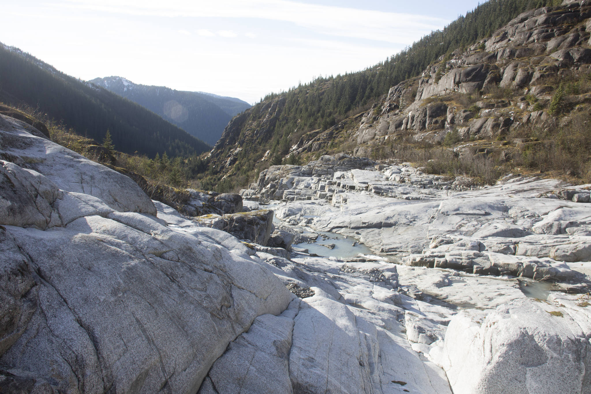
The “alpine tsunami,” as it’s called, followed the path of least resistance and crashed downhill in the general direction of Cowee Creek. The wave’s violence and massive size, however, allowed it to bowl over about 1,500 trees in the area and cut vein-like offshoots into the surrounding forest.
By the time the tsunami reached the highway below, Edwards said, the wave had dropped all of its trees and carried with it only sand, so it was no danger to cars on the highway and the wave had dissipated to about six feet by that time.
Curiously, the destruction wrought by the 2016 rockslide brought about a silver lining for the salmon-bearing stream. Trees and other “woody debris” knocked down and deposited by the tsunami makes for good salmon habitat, Edwards said.
“This took an entire forest stand out in a matter of minutes and washed it downstream. That’s what makes pools for salmon habitat and that’s not a bad thing,” Edwards said.
While it’s common knowledge by now that Juneau isn’t in immediate danger from more familiar, ocean-borne tsunamis, alpine tsunamis could be a lurking threat to Southeast communities, Edwards said. Many Southeast towns and cities — including Ketchikan, Juneau and Sitka — lie below large alpine lakes. Massive landslides like the one that caused the 1958 “megatsunami” in Lituya Bay, which by some accounts reached 1,700 feet, are common in Southeast.
To find out just how vulnerable Juneau is, University of Alaska Southeast Dr. Brian Buma is currently conducting a landslide hazard analysis, Edwards said.
“It is truly awe-inspiring, the power of this event and what happened out there. But when you start thinking of the implications, it gets even more sobering. It’s a poorly-recognized hazard,” Edwards said.
• Contact reporter Kevin Gullufsen at 523-2228 and kevin.gullufsen@juneauempire.com. Follow him on Twitter at @KevinGullufsen.
Rock exposed by the Cowee Creek alpine tsunami. (Photo courtesy the U.S. Forest Service and Rick Edwards)
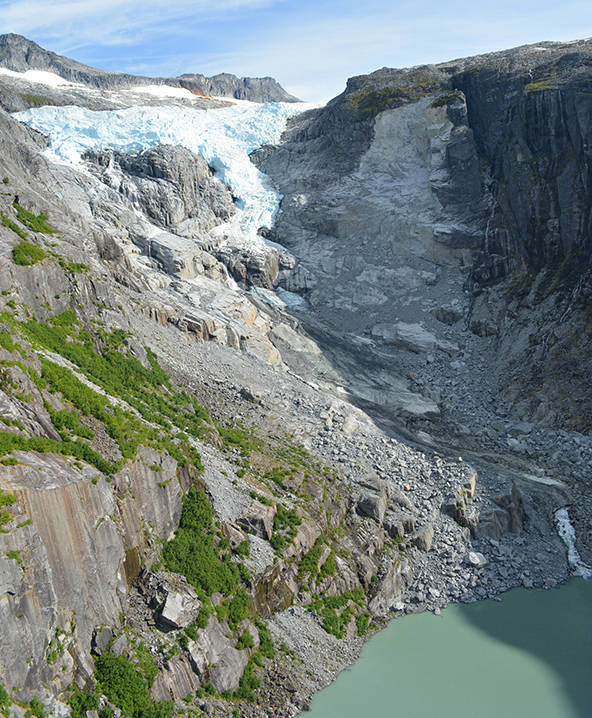
On Dec. 30, 2016, a rock face detached from the mountainside next to this unnamed glacier, crashing into the lake below and causing a 30-foot tall “alpine tsunami” to scour Cowee Creek channel. Researchers were noticed the rare event because of ongoing research in the H&
