
I have been putting off hiking Mount McGinnis this summer, mostly because the first half of the hike is West Glacier Trail, which seems like a never ending walk of pain. Well, maybe it’s not that bad. But that’s what it feels like when walking back from the ice, because West Glacier Trail is the most common way to access the Mendenhall Glacier. When you go to the glacier a lot, you end up walking the same three mile stretch a bazillion times.
With an entirely intact summer attitude I joined Katie McCaffrey and Claire Helgeson last Sunday up the mountain. I brought a cotton T-shirt and a really old rain shell. I was thinking, “Yeah, that should do the trick.” The sun was out and it was warm downtown. Why not?
We started way too late because I couldn’t decide which donut holes I wanted from Breeze In. Seriously. Do you get the cake ones or the puffy ones? Blueberry or red velvet? Powdered sugar or regular sugar? Way too many options. Glad I finally got them, though. It’s been a while since I had the proper hiking nutrition.
It became apparent that my T-shirt wasn’t nearly enough protection from the temperature in the early October shade plus the breeze off the glacier. I definitely should’ve brought at least a warm Pop-Tart, but also nah. Do it for the ‘Gram.
No big animal encounters on this hike, although we had our bear spray ready. We did see a couple ptarmigan along West Glacier Trail and again directly at the summit. Right as we were stepping up on the peak, we saw five ptarmigan waddling alongside us. They were in between their summer and winter colors and had a white belly and darker back. We noticed lots of little flies directly at the summit that we didn’t notice anywhere else along the trail. Must’ve made for good eating for the ptarmigan.
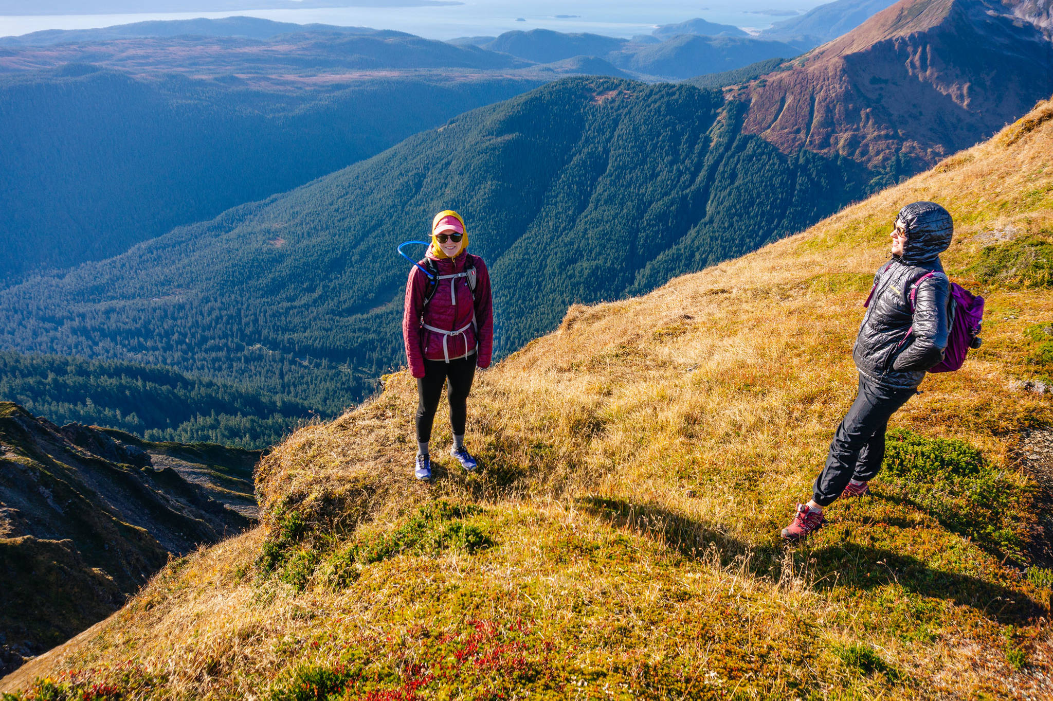
From McGinnis’s summit after about three or five hours at 4,225 feet you have a 360 degree view of Mendenhall and Suicide Glaciers, the valley and airport, Douglas and Admiralty Islands, Chilkat Range, Grandchild Peaks, and Mendenhall Towers. Definitely a Gucci view.
You can see the impact the glacier had on the valley. The valley is super flat because the glacier carved it out, which makes it perfect for people to build neighborhood after neighborhood. McGinnis does not seem to be a nunatak because its peak is rounded, implying the grinding movement of the glacier rounded out the top. Maybe the Mendenhall’s thickness was all the way beyond the summit of McGinnis at one point. Peaks such as the Mendenhall Towers are so jagged because they’re tall (over 5,000 feet) and may have never been completely covered by ice.
The coniferous trees (trees with cones and needles) stay green while the grass, mosses and low brush goes yellow, red, or brown. It is amazing that something withering makes up such great colors. This is the first time I’ve spent any time actually realizing what happens to create these patterns in the environment. I guess it’s that adult brain creeping up on me telling me to slow down, breath and do yoga or something.
• California-born and Alaska-bred, Gabe Donohoe is an adventurer and photographer. He is a graduate of the University of Alaska Southeast Outdoors Studies Program. His photo archives can be seen on www.gabedonohoe.com. “Rainforest Photos” photo blog publishes every other Friday in the Empire’s Outdoors section.
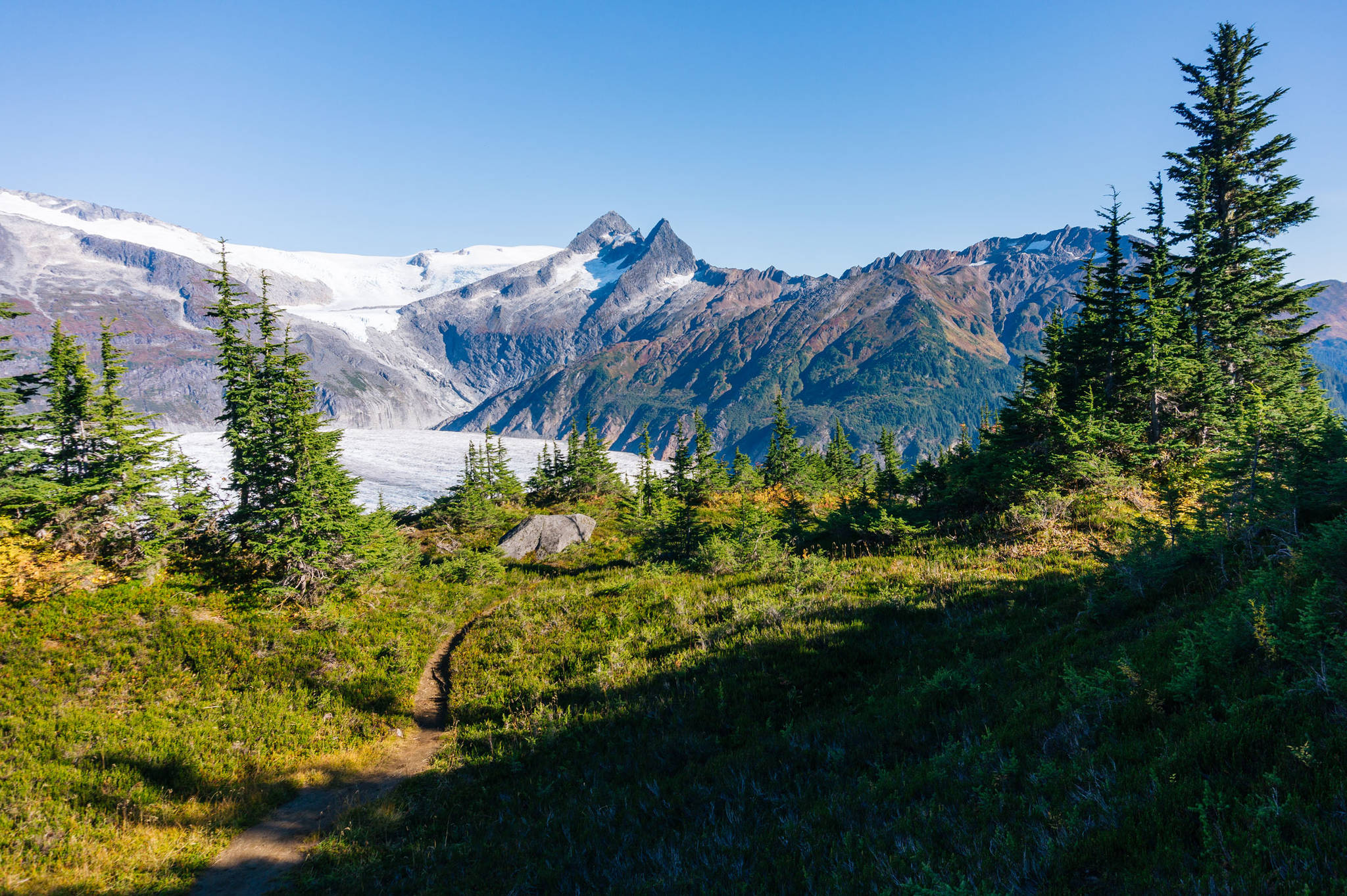
A view of the the Nugget Towers off in the distance from Mt. McGinnis trail. (Gabe Donohoe | For Juneau Empire)
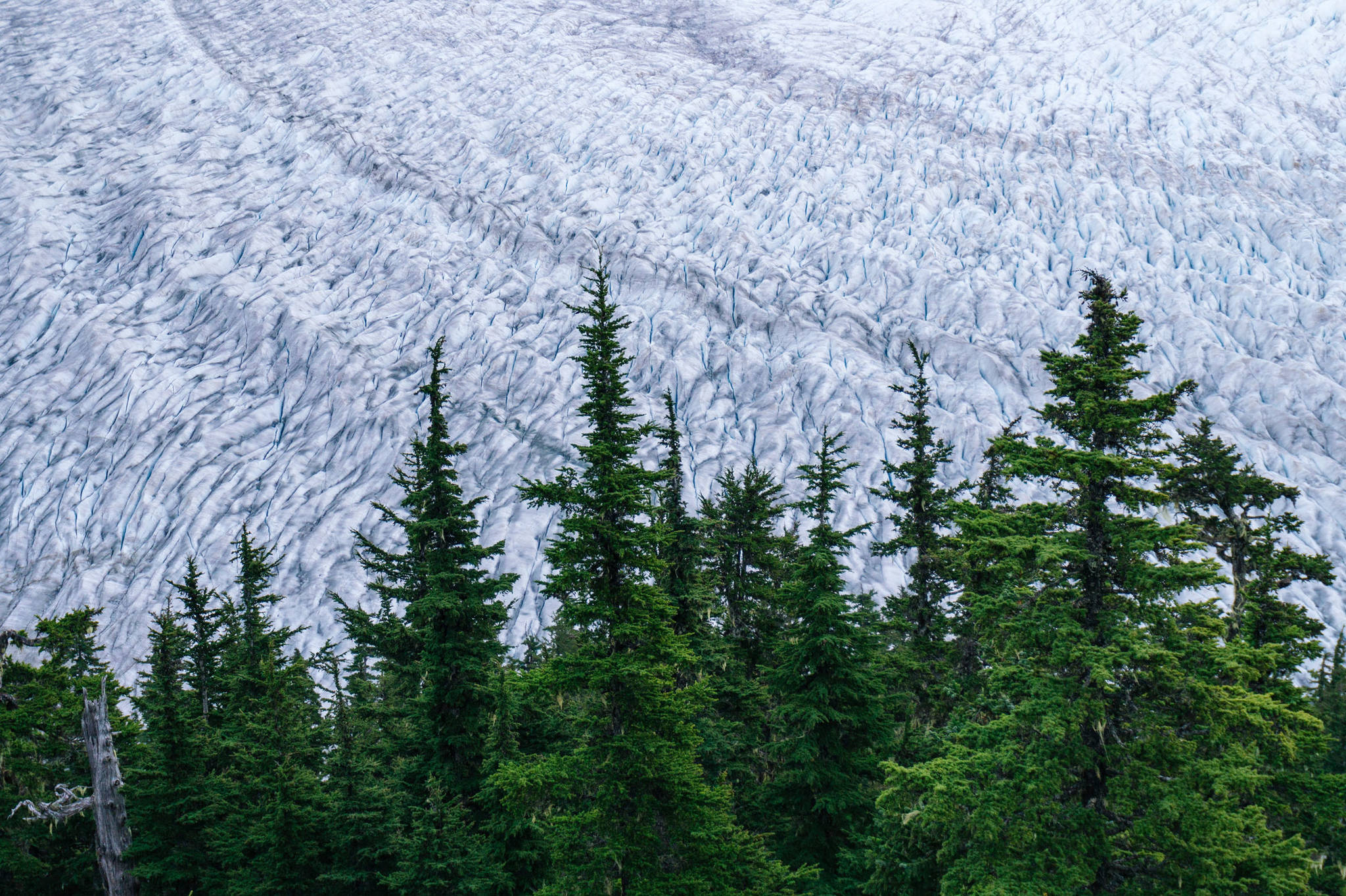
Nothing but Mendenhall ice behind the Mt. McGinnis treeline. (Gabe Donohoe | For Juneau Empire)
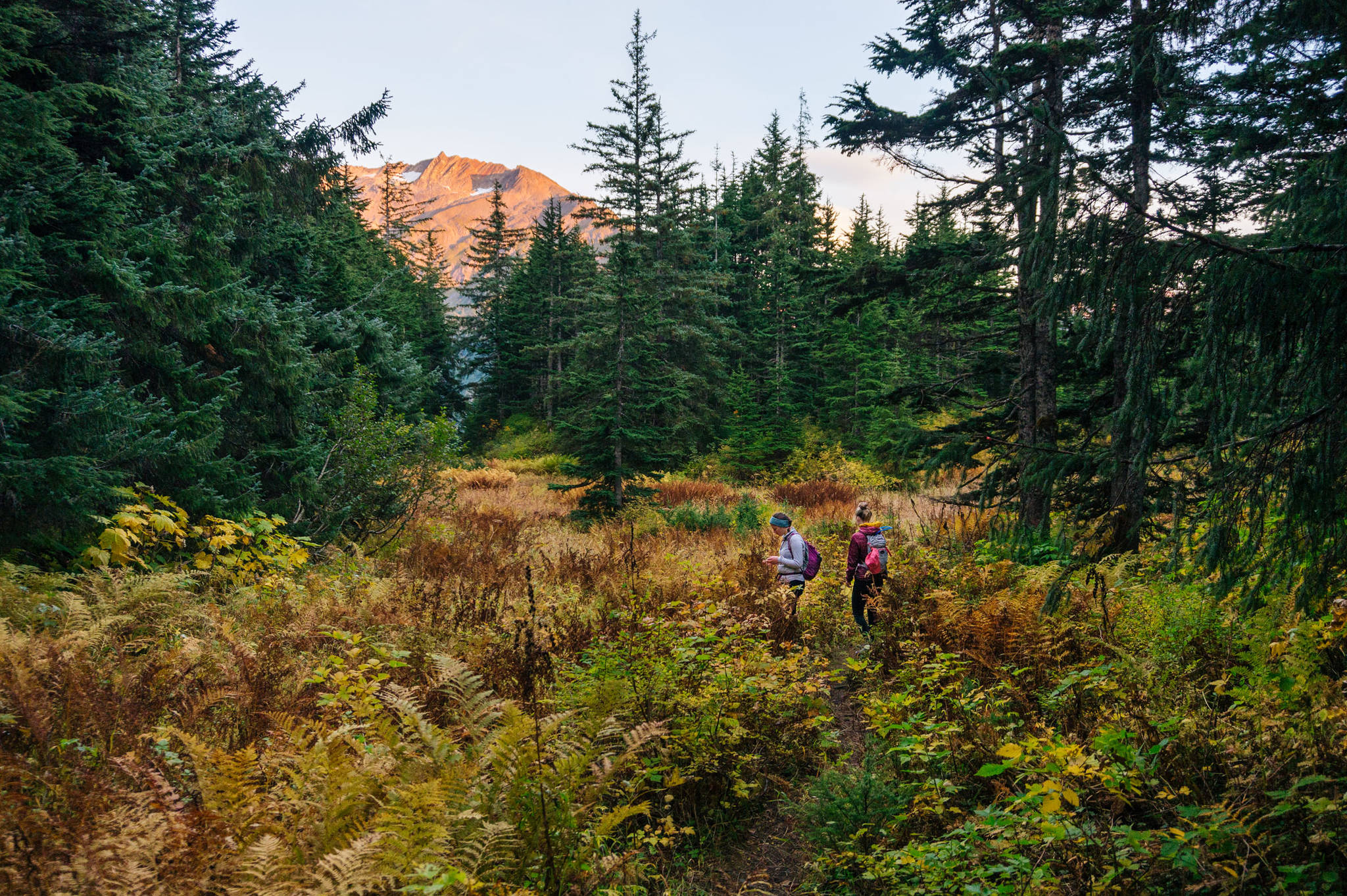
Fall colors in a little meadow halfway up the Mt. McGinnis trail. (Gabe Donohoe | For Juneau Empire)
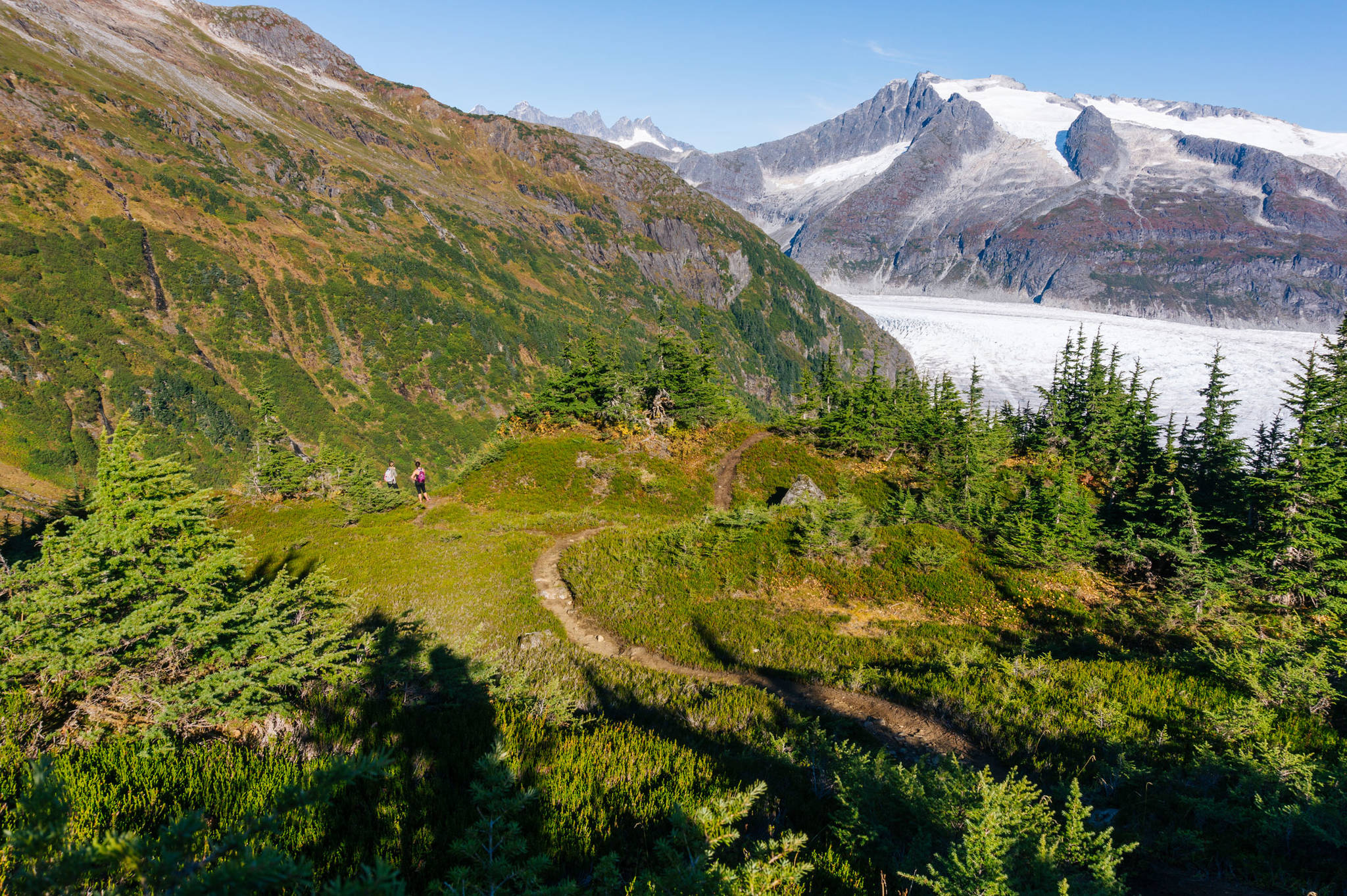
The trail as it winds up and down side to side. (Gabe Donohoe | For Juneau Empire)
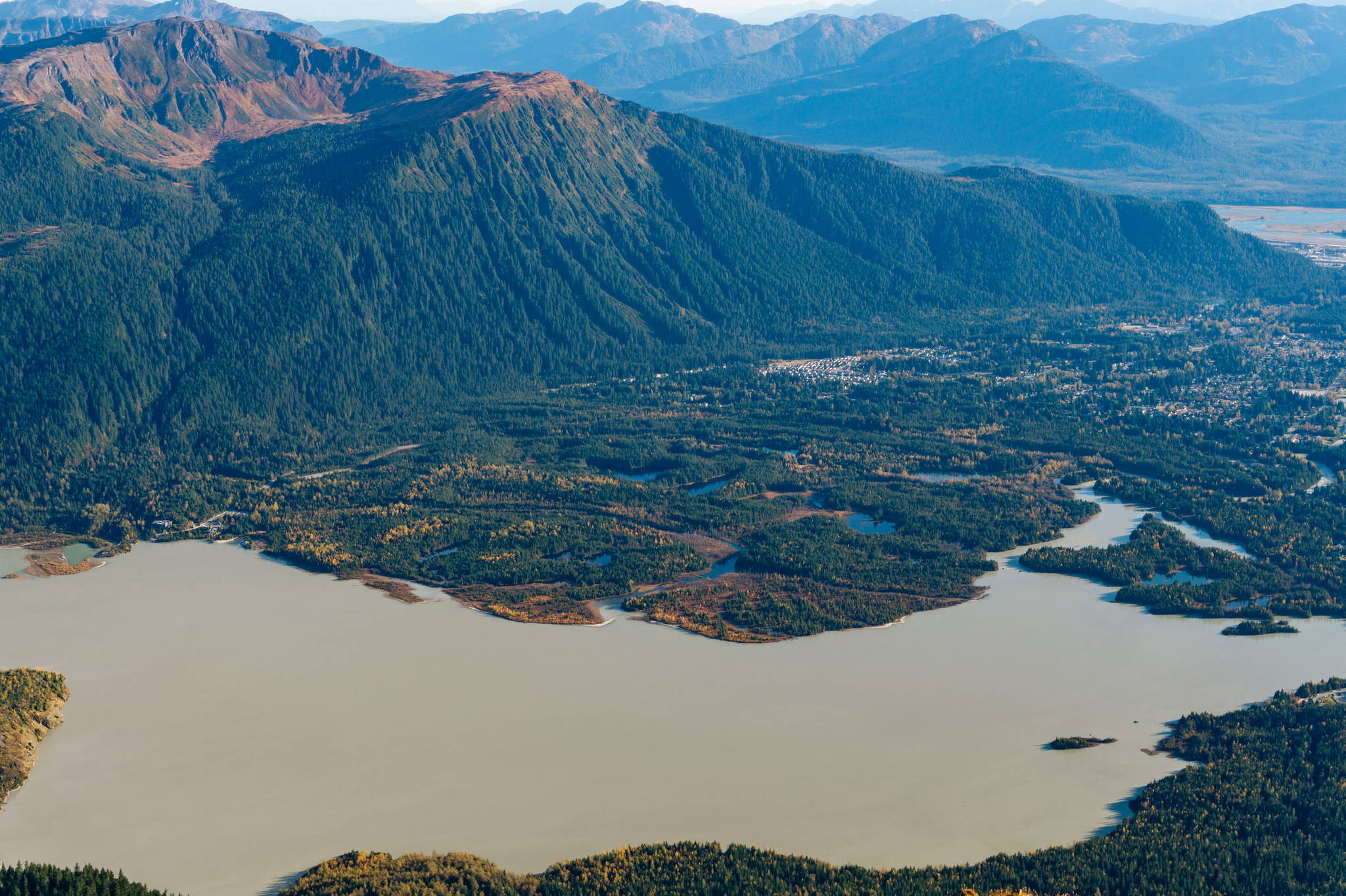
Golden hour shines upon Mendenhall Lake and valley. (Gabe Donohoe | For Juneau Empire)
