University of Alaska Southeast professor of environmental science Christian Kienholz gets his drone ready for flight on a rock outcrop near Suicide Basin on Friday, June 21, 2019. (Nolin Ainsworth | Juneau Empire)

University of Alaska Southeast professor of environmental science Christian Kienholz gets his drone ready for flight on a rock outcrop near Suicide Basin on Friday, June 21, 2019. (Nolin Ainsworth | Juneau Empire)

Drones on ice: Scientists take to the air to study Suicide Basin

UAS students use drones for environmental science research

Standing over an iceberg-littered Suicide Basin on a sunny Friday, University of Alaska Southeast environmental science professor Christian Kienholz gives some background on glacier lake outburst floods, or jökulhlaups, that originate here.

“There’s some kind of pipe that it finds down there and then it just drains,” said Kienholz, making a small circle with his thumb and pointer finger. “It might be a small pipe at the beginning, a small conduit, and because you have more and more water going out, it’s this exponential increase of this pipe.”

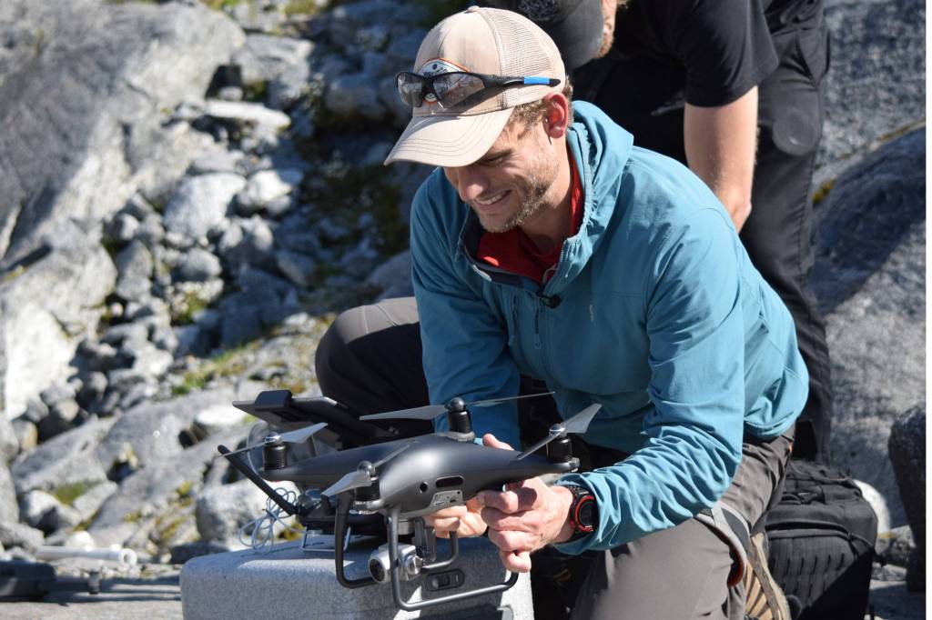
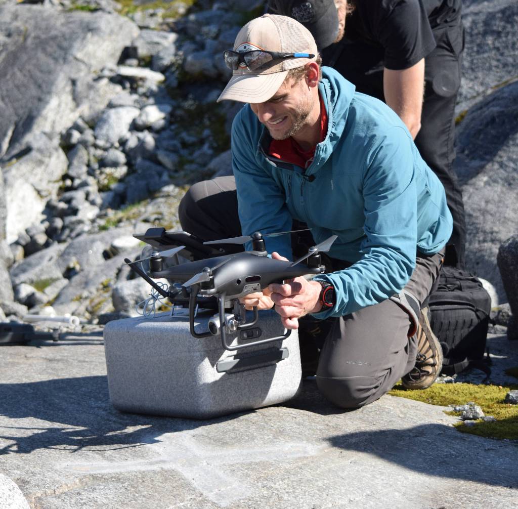
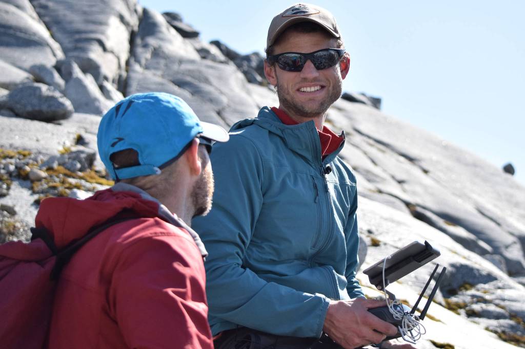
A number of local scientists are studying changes to Suicide Basin, but Kienholz is one of the only ones using drones to analyze ice and water levels in the basin. The use of drones for environmental monitoring has become so common in the professional arena that Kienholz started to teach the methods to students.

“The whole glacier is thinning, it changes year to year, so we’re using drones to measure how fast the ice dam is thinning because that affects the volume of water that can be stored behind the ice dam,” Kienholz said.

Suicide Basin, with Suicide Glacier in the top left corner, seen on Friday, June 21, 2019. (Nolin Ainsworth | Juneau Empire)

Suicide Basin, with Suicide Glacier in the top left corner, seen on Friday, June 21, 2019. (Nolin Ainsworth | Juneau Empire)

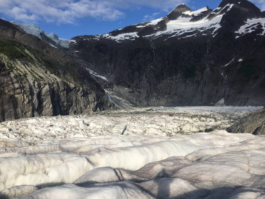
Most Juneau residents first became acquainted with Suicide Basin in 2011, when water from the bowl adjacent to the Mendenhall Glacier flooded Mendenhall Lake and Mendenhall River. The jökulhlaup has taken place every summer since then, sometimes flooding riverside homes and campsites.

The Suicide Glacier, a hanging glacier located high above the basin, once occupied Suicide Basin. However, sometime in the last 30 years, the glacier split in two parts, with the lower part eventually forming a lake bordered on one side by the Mendenhall Glacier.

The aerial images collected from the drones — flown in a grid pattern over the basin— are turned into photo maps and digital elevation models using special software. By taking comparing these maps and models over time, Kienholz and others can measure things like the lowering of the ice dam, volume of ice in the basin and how much water has left the basin in a flooding event.

Christian Kienholz, research assistant professor of environmental science at the University of Alaska Southeast, speaks with Gabriel Wolken, research assistant professor at the University of Alaska Fairbanks, while surveying Suicide Basin using a drone on Friday, June 21, 2019. (Nolin Ainsworth | Juneau Empire)

Christian Kienholz, research assistant professor of environmental science at the University of Alaska Southeast, speaks with Gabriel Wolken, research assistant professor at the University of Alaska Fairbanks, while surveying Suicide Basin using a drone on Friday, June 21, 2019. (Nolin Ainsworth | Juneau Empire)

The United States Geological Survey (USGS) and Alaska Climate Adaption Science Center have worked closely with UAS to carry out the research.

“We’re doing all the drone work and elevation models, but then we use all the USGS products to actually analyze it more in depth,” Kienholz said. “We’re tracking it over time and seeing how the water is going up using camera images.”

Skye Hart, 20, was one of the students in the drones class, and is helping with the research on Suicide Basin. In the class, students learned drone operation, photogrammetry, GIS (Geographic Information System) skills and GPS skills while studying the erosion of the banks of the Mendenhall River.

“It was really relevant to what we do now,” Hart said. “I get to learn more about what we did in the class and actually use the skills I learned directly.”


• Contact reporter Nolin Ainsworth at 523-2272 or nainsworth@juneauempire.com.


More in News

Jasmine Chavez, a crew member aboard the Quantum of the Seas cruise ship, waves to her family during a cell phone conversation after disembarking from the ship at Marine Park on May 10. (Mark Sabbatini / Juneau Empire file photo)
Ships in port for the week of July 20

Here’s what to expect this week.

Left: Michael Orelove points out to his grandniece, Violet, items inside the 1994 Juneau Time Capsule at the Hurff Ackerman Saunders Federal Building on Friday, Aug. 9, 2019. Right: Five years later, Jonathon Turlove, Michael’s son, does the same with Violet. (Credits: Michael Penn/Juneau Empire file photo; Jasz Garrett/Juneau Empire)
Family of Michael Orelove reunites to celebrate the 30th anniversary of the Juneau Time Capsule

“It’s not just a gift to the future, but to everybody now.”

Sam Wright, an experienced Haines pilot, is among three people that were aboard a plane missing since Saturday, July 20, 2024. (Photo courtesy of Annette Smith)
Community mourns pilots aboard flight from Juneau to Yakutat lost in the Fairweather mountains

Two of three people aboard small plane that disappeared last Saturday were experienced pilots.

A section of the upper Yukon River flowing through the Yukon-Charley Rivers National Preserve is seen on Sept. 10, 2012. The river flows through Alaska into Canada. (National Park Service photo)
A Canadian gold mine spill raises fears among Alaskans on the Yukon River

Advocates worry it could compound yearslong salmon crisis, more focus needed on transboundary waters.

A skier stands atop a hill at Eaglecrest Ski Area. (City and Borough of Juneau photo)
Two Eaglecrest Ski Area general manager finalists to be interviewed next week

One is a Vermont ski school manager, the other a former Eaglecrest official now in Washington

Anchorage musician Quinn Christopherson sings to the crowd during a performance as part of the final night of the Áak’w Rock music festival at Centennial Hall on Sept. 23, 2023. He is the featured musician at this year’s Climate Fair for a Cool Planet on Saturday. (Clarise Larson / Juneau Empire file photo)
Climate Fair for a Cool Planet expands at Earth’s hottest moment

Annual music and stage play gathering Saturday comes five days after record-high global temperature.

The Silverbow Inn on Second Street with attached restaurant “In Bocca Al Lupo” in the background. The restaurant name refers to an Italian phrase wishing good fortune and translates as “In the mouth of the wolf.” (Laurie Craig / Juneau Empire)
Rooted in Community: From bread to bagels to Bocca, the Messerschmidt 1914 building feeds Juneau

Originally the San Francisco Bakery, now the Silverbow Inn and home to town’s most-acclaimed eatery.

Waters of Anchorage’s Lake Hood and, beyond it, Lake Spenard are seen on Wednesday behind a parked seaplane. The connected lakes, located at the Ted Stevens Anchorage International Airport, comprise a busy seaplane center. A study by Alaska Community Action on Toxics published last year found that the two lakes had, by far, the highest levels of PFAS contamination of several Anchorage- and Fairbanks-area waterways the organization tested. Under a bill that became law this week, PFAS-containing firefighting foams that used to be common at airports will no longer be allowed in Alaska. (Yereth Rosen/Alaska Beacon)
Bill by Sen. Jesse Kiehl mandating end to use of PFAS-containing firefighting foams becomes law

Law takes effect without governor’s signature, requires switch to PFAS-free foams by Jan. 1

(Michael Penn / Juneau Empire file photo)
Police calls for Wednesday, July 24, 2024

This report contains public information from law enforcement and public safety agencies.

Most Read