Alaska Science Forum: Feet on the ground right after the big one
Published 9:30 pm Wednesday, July 5, 2023


On March 27, 1964, California geologist George Plafker was attending a research conference in Seattle when news came of a big earthquake in Alaska.
“It was almost quitting time for the day at the meeting when some guys came back from the Space Needle and said they felt rocking,” Plafker said recently at his office in Menlo Park, California. “We said, ‘That’s a serious earthquake.’”
It was, of course, the second-strongest earthquake in the era of instruments able to measure them, one that would change the direction of Plafker’s career and what people thought about great earthquakes on the Pacific basin’s Ring of Fire.
Plafker, now 94, was then a 35-year-old U.S. Geological Survey researcher who knew a lot about basic geology and mapping, but very little about earthquakes. Then assigned to the “Alaska Division,” he was one of three scientists from the Menlo Park office sent northward right after the earthquake to see what had happened.
He flew to Alaska for a one-week trip after the earthquake. During that time he traveled much of Prince William Sound to inspect the torn, uplifted and sunken landscape. Realizing a once-in-a-lifetime opportunity, he and other scientists ended up returning to spend most of the summer of 1964 in Alaska.
On the initial trip a few days after the earthquake, two of his colleagues focused on Anchorage and Alaska’s road system. Plafker caught military helicopter rides and flew in Bush planes to villages and unoccupied islands in Prince William Sound. He covered much of that country with Jim Osborne, a pilot for Cordova Airlines, who took Plafker to what was left of some villages on Osborne’s mail route.
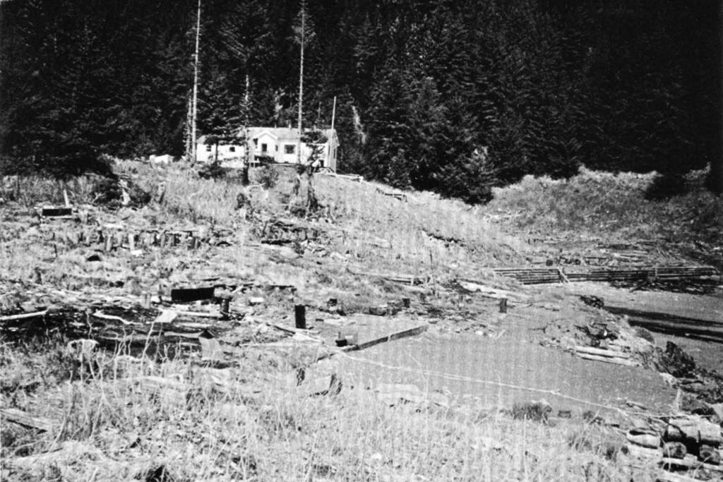
Plafker remembers flying to Chenega Bay, where 76 people lived before the earthquake. A wave caused by the earthquake drowned 25 of those people.
“There was not one single livable house there,” said Plafker, who snapped a photo of a naked hillside with only one building — a schoolhouse — visible above a hillside of tree stubs. He interviewed a survivor who described a “wall of water 90 feet high.” Plafker saw with his own eyes that ocean water had entered the school building almost 100 feet above sea level.
The earthquake-caused wave at Chenega Bay, which Plafker attributed to a small group of nearby islands focusing the onrushing water, was one example of the water displaced by the great earthquake. More than 100 people died in Alaska and others as far south as Oregon when tsunamis rushed down the west coast of the U.S. and Canada.
“A movement similar to that of water in a tilted pan could have resulted from the sudden tectonic uplift of the western part of Prince William Sound and the contiguous continental shelf during the earthquake,” Plafker wrote with co-authors Arthur Grantz and Reuben Kachadoorian in the USGS publication based on their first Alaska trip.
A few days after the earthquake, Plafker hoped to find clean marks of ripped earth that would point to the fault that caused the earthquake, but the most striking visual was of barnacles on oceanside rocks. Some were high as his belt buckle despite the fact that the creatures needed salt water to survive.
“On that first go-round, we saw those things uplifted all over the place,” he said.
On later trips, including when he spent most of the summer exploring from a converted tugboat, the barnacles became more obvious signs of ground uplifted by the earthquake. Besides the stink of decay, the high and dry barnacles, mussels and other marine life stood out like a whitewashed wall.
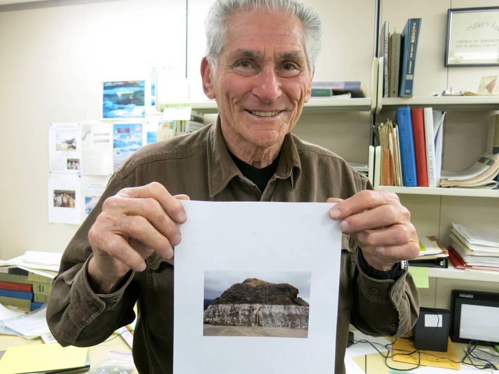
“The whole of Prince William Sound looked like that,” he said, holding a photo that shows a pale band on shoreline rocks. “You could really see these critters knew exactly where they should be. If they got a little too high, they were dead.”
Using the barnacles as one of many clues, Plafker made more than 800 measurements that summer of land shoved upward. In other places forests and shrubs had dropped, becoming flooded with salt water. Plafker and his colleagues calculated that an area about the size of Washington had been lifted toward the sky.
On all his Alaska travels that summer, Plafker did not see what he was looking for — the clean line of damage from a fault like the San Andreas in California. That’s because Plafker and his colleagues were gathering evidence for what author Jerry Thompson described in Cascadia’s Fault as “the exciting idea that a slab of the Pacific Ocean floor might be sliding underneath the state of Alaska.”
Plafker’s work helped prove the existence of the subduction zone that causes many earthquakes off the coast of Alaska and elsewhere on the Pacific’s Ring of Fire. He may be the only scientist to have walked the ground in Alaska in 1964, in Indonesia following the tsunami forty years later, and in Japan following the earthquake and tsunami in 2011. He still marvels that the great Alaska earthquake killed so few people 50 years ago.
“It’s a miracle,” he said. “An earthquake of the exact same size killed 225,000 people in Sumatra.”
Since the late 1970s, the University of Alaska Fairbanks’ Geophysical Institute has provided this column free in cooperation with the UAF research community. Ned Rozell is a science writer for the Geophysical Institute. A version of this story ran in 2014.
• Since the late 1970s, the University of Alaska Fairbanks’ Geophysical Institute has provided this column free in cooperation with the UAF research community. Ned Rozell is a science writer for the Geophysical Institute.
images:
1. George Plafker holds up a photo of uplifted Alaska shorelines he took after visiting the southern coast following the March 1964 magnitude 9.2 earthquake. Plafker was standing in his office in Menlo Park, California, when this photo was taken in 2013. Photo by Ned Rozell.
2. George Plafker took this photo of Chenega Bay, Alaska, in 1964 following the great earthquake. A schoolhouse survived the earthquake and tsunami that followed. The tsunami destroyed houses lower than the schoolhouse. George Plafker photo.