
Suicide Basin has started flowing over the top of its ice dam and people downstream from the Mendenhall Glacier should be preparing for flooding impacts, but there was no indication as of mid-morning Friday a release of water from an outburst flood is occurring, according to National Weather Service Juneau officials.
The basin, which has experienced annual releases known as jökulhlaups since 2011, is full and “a water level drop consistent with water overflowing the ice dam was detected early Thursday morning,” according to a NWS Juneau statement issued at 11 a.m. Thursday on the Suicide Basin monitoring website. The statement notes it took six days from the time the basin was full until the main release of water occurred last year.
“As soon as evidence of sub-glacial drainage is detected, a Flood Warning will be issued,” the statement notes.
An update published at 9 a.m. Friday stated “the status has not changed” during the past day.
Andrew Park, a meteorologist at the station located near the glacier, said in an interview Thursday morning the spillover of water “doesn’t mean that a release is happening right now.”
“That’s the main message — that we are aware are of it and stand by for further information,” he said.
However, for people in the area “now is the time to start preparing for potential flooding impacts,” a statement issued by NWS Juneau notes.
As of Thursday morning, the water level of the Mendenhall River was 6.43 feet, compared to about four feet at the start of last year’s release. But Park said a key factor in the severity of any flooding this year will be how quickly the water drains from the basin when the ice dam breaks.
“If you have a small leak it’s not really a problem,” he said. “But drain all that water at once you’ve got big problems.”
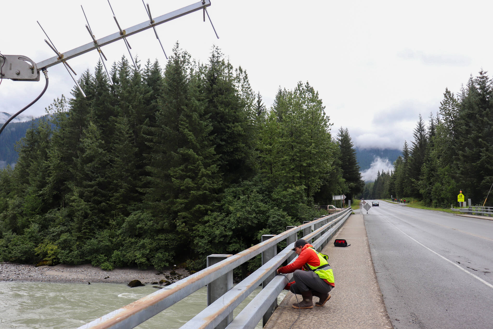
The U.S. Geological Survey installed new monitoring equipment on the Mendenhall River bridge on Back Loop Road on Thursday morning to help guide discharge preparations for Suicide Basin’s release. Last year when a record release of water occurred on Aug. 5, USGS relied solely on its Mendenhall Lake stream gauge.
Randy Host, a hydrologist with USGS, said the velocity metric will allow for additional surveillance of the floodwater through the river.
“It’s gonna do the stage, what we call gage height, like how high the river is,” he said. “And then it’s also going to do surface velocity. It’s going to measure how fast the water is on the surface.”
Jonathan Tuttle, a hydrologist with the U.S. Geological Survey, installs monitoring equipment at the Mendenhall River bridge on Back Loop Road Thursday morning. Beyond the bridge, a Juneau resident living along the Mendenhall River looks out at the water. (Jasz Garrett / Juneau Empire)
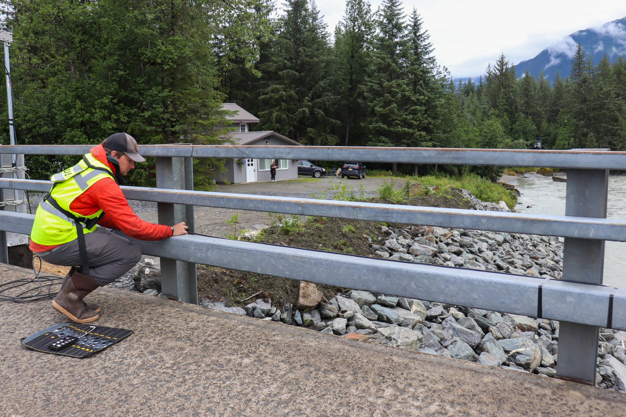
Jonathan Tuttle, another USGS hydrologist, explained how the box he installed measures the depth and velocity of water moving down the river to calculate how much water is moving down it.
The Alaska Department of Transportation closed the Mendenhall River bridge during the 2023 flood. Host said DOT will be able to use the USGS data to determine how close the water is to touching the bottom of the bridge.
“We’re gonna do some models and just try to figure out how much water comes through here,” he said.
Host said they decided to move the monitoring equipment to the downstream side of the Mendenhall River on Thursday since the flow is more mellow. Moving the instruments away from the white, choppy water will allow for cleaner data, he said.
Host said he and the other USGS hydrologists installing the equipment had just visited Suicide Basin before coming to the Mendenhall River bridge and it’s “very full.”
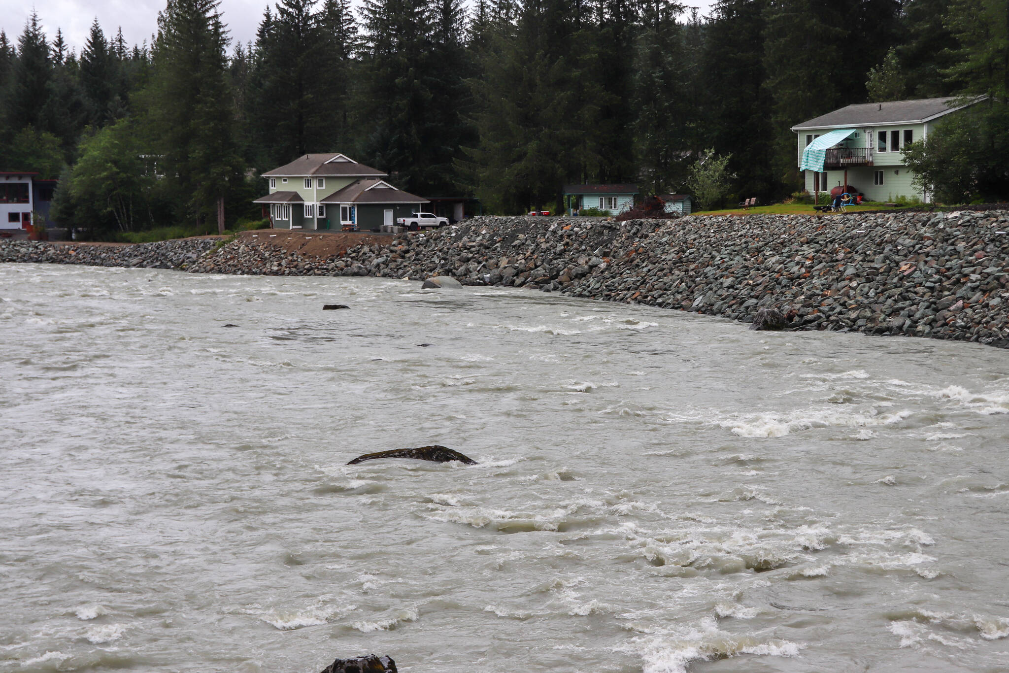
Rock fill added after last year’s flood aims to protect homes along the Mendenhall River. (Jasz Garrett / Juneau Empire)
Much of the Mendenhall River is now lined with rock fill to protect structures after last year’s flooding severely eroded the riverbanks. The flooding partially or completely destroyed three homes and more than three dozen other residences experienced varying degrees of damage.
Amanda Hatch, whose home was flooded with eight inches of water in the crawl space last year, said a major renovation to further safeguard her family’s home was just completed.
“We aren’t terribly worried because we’ve lifted the house four feet,” she said. “But we do have an electric car, so if it floods we’ll be moving the car up the street to a friend’s house. But we’re ready.”
The crawl space of the house was also reinforced to protect it from flooding, Hatch said. She said insurance didn’t cover the damage last year, but disaster relief and financing sought through the federal Small Business Association helped make the repairs and upgrades possible.
Beyond that, Hatch said, there isn’t much to do except to monitor what’s happening.
“There’s no telling how it’s going to go, right?” she said. “It could be higher. It could be less. It could be slower. We just have to wait to see. I’m glad our list is done so we don’t really have to worry about it.”
Marty McKeown, whose home suffered extensive damage that left a gaping hole along the underside of the living room, said he is still making repairs to the home as well as the patio that washed away — and aside from an SBA loan didn’t get the relief he hoped for from the city or other government entities. He said he’s got “a high level of concern” about the current situation, but he’s not panicking as he monitors the basin’s status.
“We’ll watch the river and take action if needed,” he said. “I’m not going to start moving out of my house. We’ll have time if something happens.”
A new rainfall record for July was set in Juneau during the past month, with a preliminary report showing 12.21 inches of precipitation at Juneau International Airport compared to the previous high of 10.4 inches in 2015. There was measurable rainfall on all but two days of the month, including 0.77 inches measured on Wednesday.
The forecast through early next week calls for clearing skies and highs reaching into the 70s.
Robert Barr, deputy city manager for the City and Borough of Juneau, said the heavy rainfall in Juneau is concerning because when the river is higher, there’s less space for the release of water to fill the river. He said CBJ receives daily situational reports from NWSJ.
“They give us their best guess about what a jökulhlaup would look like at different levels of release if it were to release at the time of that report,” he said. “So every afternoon we get that. And basically what that tells us is if the jökulhlaup released right now, at 20% to 60% of the total volume of Suicide Basin, here’s what a jökulhlaup would look like. If it released at 100% of the volume of Suicide Basin — which last year it released at 96% — here’s what a jökulhlaup would look like. And right now if it released at 100% it would be worse than last year.”
The basin does not usually release at 100%, Barr said. Last year was the most volume the basin had released at once. But there’s no way to tell how fast the water will unleash.
Barr said CBJ will communicate through press releases, emails and its Facebook page once a release occurs.
• Contact Mark Sabbatini at mark.sabbatini@juneauempire.com or (907) 957-2306. Contact Jasz Garrett at jasz.garrett@juneauempire.com or (907) 723-9356.

A screenshot from a National Weather Service video shows activity in Suicide Basin on Thursday morning. (National Weather Service Juneau)
