
This story has been updated with additional information.
Short-term upgrades are underway to improve safety at the Fred Meyer intersection, with a traffic signal planned by 2026 and other improvements still being considered, according to state Department of Transportation and Public Facilities officials.
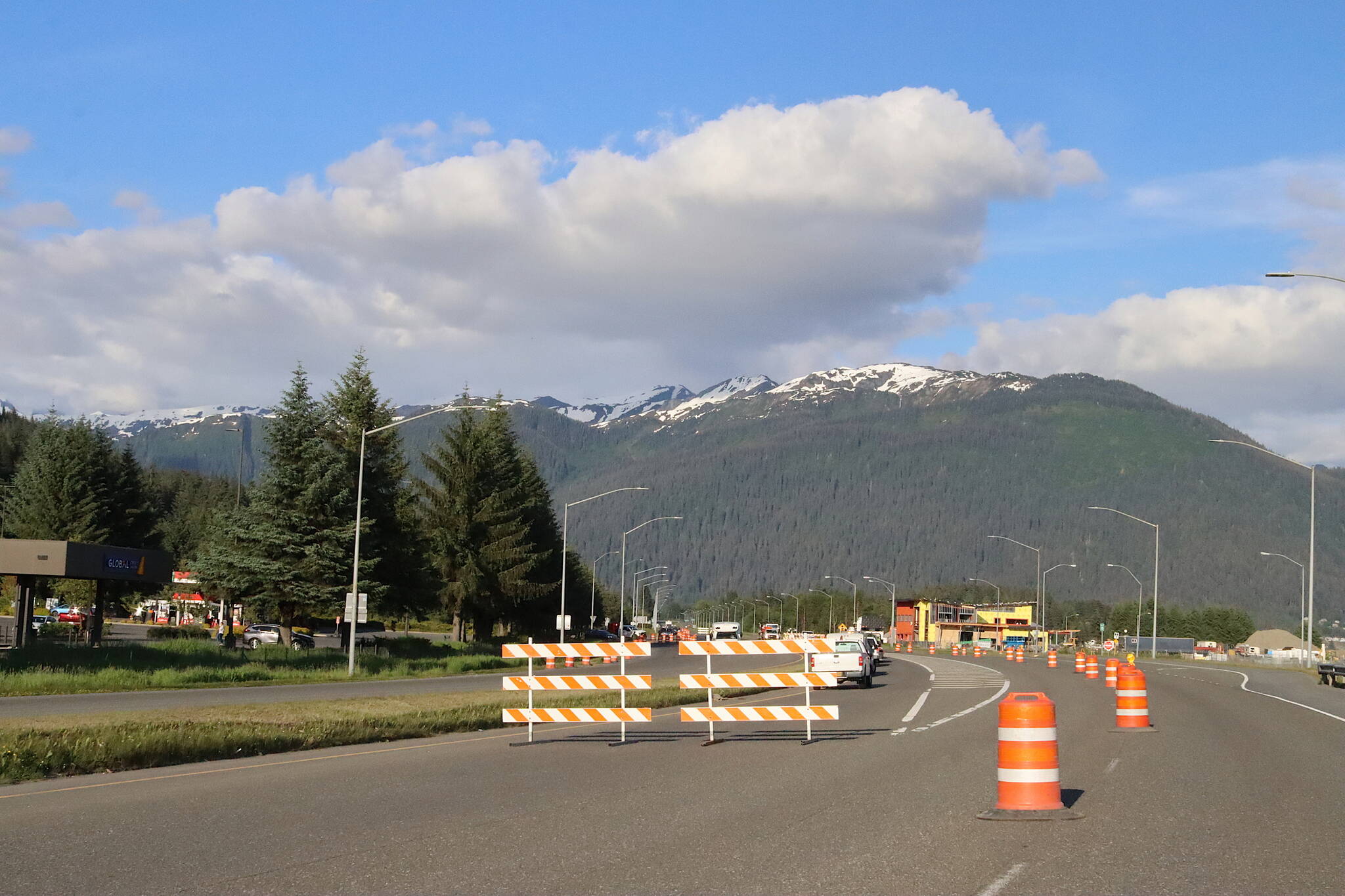
The current improvements include altering the left-turn delineations on Egan Drive to improve drivers’ line-of-sight and reduce the distance to clear opposing traffic, according to a project notification posted online Monday by DOT. The project also seeks to better define the right-turn lane for northbound Egan traffic to help southbound drivers evaluate the intentions of oncoming traffic.
“It was a project to try and get something on the ground as quickly as possible, to try and make as many safety improvements as we can in the short-term while we get together our funding for our long-term project goals,” Nathan Purves, DOT Southcoast regional traffic and safety engineer, said in an interview Wednesday. “This is a kind of a first step if you will.”
The changes are among the recommendations by DOT and other officials following a series of accidents, some with fatalities, at the intersection.
Work on the current upgrades is scheduled from 7 p.m. to 9 p.m. Wednesday, with only one traffic lane open in each direction on Egan Drive
Then, from 9 p.m. Wednesday to 5 a.m. Thursday, there will be no northbound access on Egan Drive. Traffic will be detoured at the Sunny Point overpass onto Old Glacier Highway to access Egan Drive and bypass construction. There will be no left turns from Egan Drive onto Yandukin or Old Glacier Highway. Egan Drive is scheduled to fully reopen at 5 a.m.
The current work is meant to simplify drivers’ awareness of the intentions of oncoming traffic, Purves said.
“In talking with the public we also found that some folks had an issue when turning left towards Fred Meyer onto Glacier Highway — technically off of Egan — that they had trouble discerning if people were in the right-turn lane, or if they were continuing to travel through,” he said.
Purves said the current project, part of the federally funded Highway Safety Improvement Program, is set to continue through this summer as weather allows.
The project involving DOT and the road construction company SECON Southeast Alaska will include seasonal speed limit reductions on Egan Drive to 45 miles per hour instead of 55 in the vicinity of the intersection at Yandukin Drive. DOT has also installed flashing radar feedback signs to make drivers aware of their speed, but the signs have yet to be turned on.
The speed limit reduction is scheduled to go into effect this fall, according to DOT. The decision comes from historical crash data showing the highest amounts of accidents occur from November to January at the intersection, with the lower speed offering more reaction time.

A chart shows a comparison of crash severity frequencies for southbound left-turn related crashes at the E-Y intersection compared to the severity of other crashes in the study area as well as the average of all crashes in the whole Juneau area using data from 2013 through 2017. (Data from Planning and Environmental Linkages Study Report, Egan Drive and Yandukin Drive Intersection Improvements, provided by the Alaska Department of Transportation and Public Facilities)
“Seasonally, wet pavement, ice on the pavement, or fog if you can’t see as well, those combined, that’s why we’re suspecting the rate of instance of crashes is higher during that time frame,” Purves said.
DOT will notify Juneau’s drivers of the speed limit reduction by installing permanent signs along Egan Drive, with DOT maintenance crews changing the speed limit placards twice a year.
“The way that we get funding for the Highway Safety Improvement Program, which is what this project is being done through, is we use vetted engineering studies that show an anticipated reduction in crashes,” Purves said. “It’s known as the crash modification factor. And speed limit reduction has a studied and anticipated reduction percentage.”
The speed limit reduction will also help reduce the severity of crashes, according to DOT.
Crash data is surveyed for three years of operation after the improvement has been implemented and compared with the same crash analysis conducted previously to analyze the improvement’s effectiveness.
“All of this work is related to improving safety,” Purves said. “I know from our regional director that this is one of the highest priorities for our region. So we’re working on it. We continue to work on it.”
Jim Brown, design group chief for the Southcoast region, said long-term improvements for the Fred Meyer intersection are in the works. He said the need for safety improvements was raised back in 2020, and a Planning and Environmental Linkages study was completed in 2021.
Their long-term plan, Brown said, is to follow a recommendation by the PEL study to design a signalized intersection by 2026.
“This (the Highway Safety Improvement Program) is the intermediate step to get there,” Brown said. “We wanted some improvement really as quickly as we can, and it was kind of a modular staged approach to putting the improvements that Nathan discussed out there versus the second piece, which I’ve actually started on. Starting this summer, I’ll begin surveying places to bring a contractor or consultant on board to start designing a partially signalized intersection.”
He said the objective of the signalized intersection is to protect the left-turning movements, which is where DOT sees a higher instance of crashes, according to the historical crash data.

A map shows a recommended alternative of a partial access signal with pedestrian crossing and a Glacier Lemon Spur extension. (Data from Planning and Environmental Linkages Study Report, Egan Drive and Yandukin Drive Intersection Improvements, provided by the Alaska Department of Transportation and Public Facilities)
As far as the 2021 PEL recommendation to add a route extension for expanding the grid from behind Fred Meyer to the McNugget intersection and a pedestrian crosswalk, Brown said they are still looking at potential grant funding options.
Brown added if the need arises, DOT may also consider a pedestrian overpass at the Fred Meyer intersection. The decision to move forward with the expanded grid, the pedestrian crosswalk and overpass will be based on new data collected after the signalized intersection is complete.
• Contact Jasz Garrett at jasz.garrett@juneauempire.com or (907) 723-9356.
