UAS releases Juneau Glacial Flood Dashboard to help community plan for flooding
Published 9:30 pm Tuesday, May 27, 2025


The University of Alaska Southeast and the Alaska Climate Adaptation Science Center launched a flood preparedness website on Wednesday to help Juneau residents prepare for this year’s Suicide Basin release.
The new website offers an interactive experience, incorporating the flood-fighting inundation maps released May 8 by the City and Borough of Juneau (CBJ).
For those who found the maps difficult to navigate, this new site offers an interactive experience. The Juneau Glacial Flood Dashboard allows Juneau residents to search for individual addresses and toggle through inundation maps at various flood levels. The site demonstrates how flooding will change when HESCO barriers are in operation.
The site also provides flood forecasting information for Mendenhall Valley homes, businesses, utilities and schools under various glacial lake outburst flood scenarios, including the worst-case scenario — a 20-foot flood stage.
Contracted by CBJ, the 2D models are available as PDFs and show which areas could be inundated by flood waters. The maps also show what parts of the Mendenhall Valley are protected by Phase One of the HESCO barriers.
“The Juneau Flood Dashboard provides a new way to visualize flood inundation maps,” said Eran Hood, a hydrologist and UAS professor who led the website development. “Making the maps easily accessible and viewable will increase residents’ ability to make informed decisions and protect themselves and their property.”
Elizabeth Figus, a View Drive resident, said juneauflood.com comes as a relief. When she first saw the inundation maps, Figus thought they had “extremely limited use” to her household.
“I am waiting with bated breath to see the depth maps,” she said a day after the city released the models, which were completed through a Michael Baker International study.
Her neighborhood has been excluded from the HESCO barrier project so far, but in scenarios shown on the city’s inundation maps, View Drive is submerged in water. Figus said it would be impossible for her to plan without knowing the possible depths.
With the floods becoming a major public concern over the past two years, the community has been seeking easily accessible flood information with increasing desperation. To help prepare for potential evacuations, color-coded flood stages show roads that may become inundated during an outburst flood. Residents can also find answers to frequently asked questions, explore flood-stage definitions, access historical flood data, and learn more about the science behind the Mendenhall Glacier and Suicide Basin.
Figus is still unsure what the future holds for her home, but she is preparing for possible flooding in the ways she can. She is a member of the Juneau Mendenhall Flying Lions Club, which is holding a National Flood Insurance Program awareness and sign-up event at the Mendenhall Valley Library Large Meeting Room on June 7 from 12:30 p.m. to 4 p.m.
General preparedness information and National Oceanic and Atmospheric Administration weather alert radios will be distributed at the event. Local insurance agents will provide guidance on how to enroll in NFIP flood insurance. A drawing will also take place to pay partial costs of an NFIP premium, even if someone has already paid it.
CBJ and the Central Council of the Tlingit and Haida Indian Tribes of Alaska are hosting a free sandbag pickup and general flood preparation event at Thunder Mountain Middle School beginning this Saturday and continuing on June 7 and June 14. Tlingit and Haida will also provide a free Community Emergency Response Team training at its Generations Southeast Juneau campus on June 14, 21, and 28 from 9 a.m. to 4 p.m. Pre-registration is required.
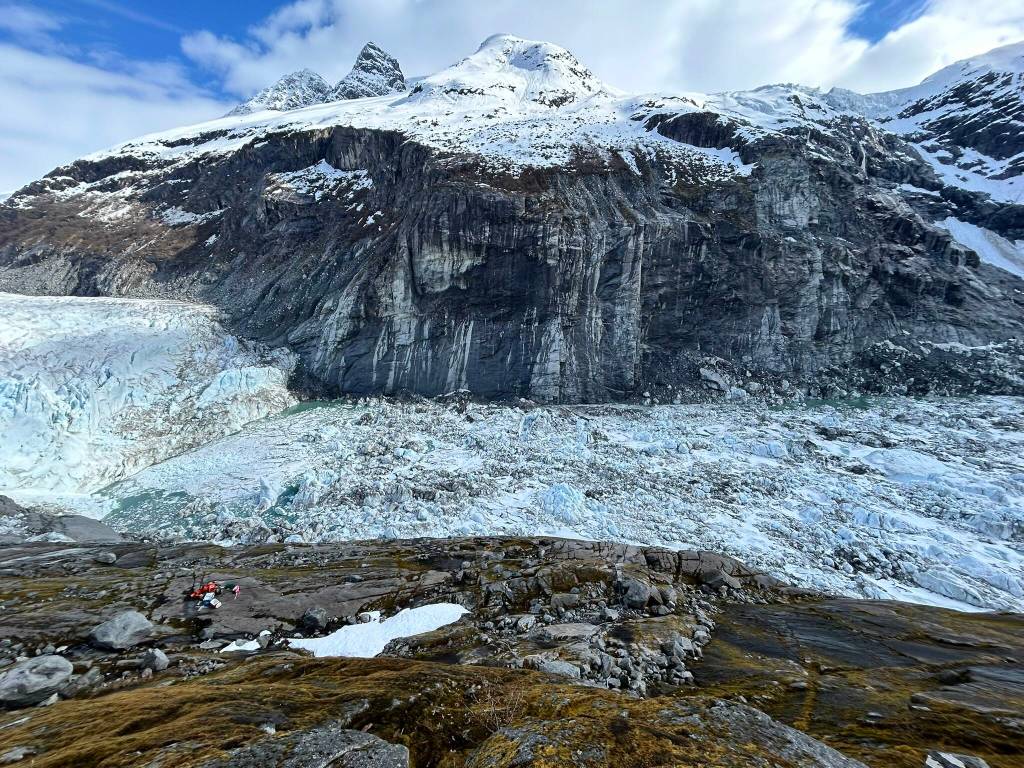
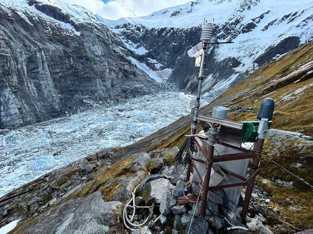
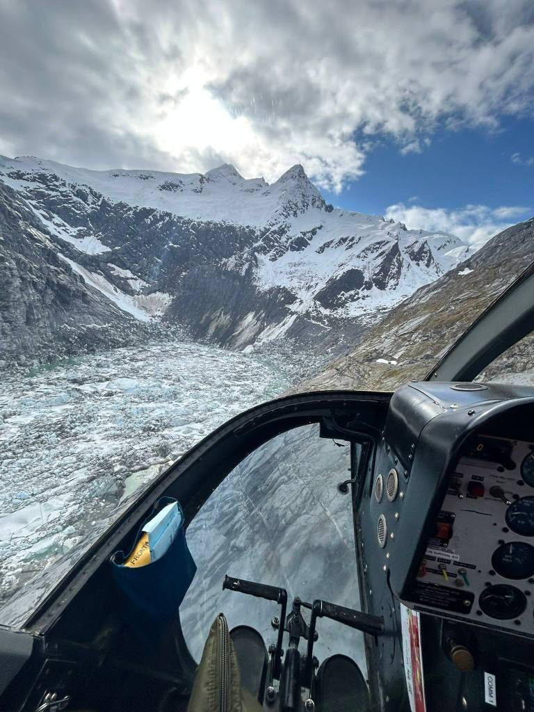
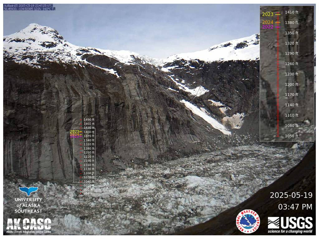
The Alaska Climate Adaptation Science Center collaborated closely with its federal partners and CBJ to create the glacial flood dashboard. Mendenhall Lake gauge readings, collected by the U.S. Geological Survey, and alerts issued by the National Weather Service (NWS) are refreshed on the website every 15 minutes. Jamie Pierce, a hydrologic technician with USGS, reopened the monitoring station earlier this month. The USGS tracks Suicide Basin using time-lapse cameras with elevation scale bars and precise laser range finders. Monitoring is active from spring through fall.
“In the future, depending on how the basin evolves, the flood could get bigger,” Hood said. “We know that this event will last for several decades, which is why studying it and improving our understanding of how it will evolve is critical.”
Hood said the website will be updated to reflect how the basin is likely to change, although those results are expected to be at least a year away. Day-to-day updates will be on the Suicide Basin monitoring page. If Michael Baker International completes additional modeling, including studies of more HESCO barriers, the new maps will be added to the dashboard.
Much of what is known about Juneau’s annual flood is the result of more than a decade of research by the Climate Adaptation Science Center. It has invested in myriad projects dedicated to understanding cryospheric change and forecasts in and around Suicide Basin since the first flood in 2011.
In 2018, the Climate Science Center funded a drone monitoring project that remains a critical source of data for ensuring the accuracy of the annual NWS flood forecasts. Continuing the program will enable researchers to track the basin’s development and accurately forecast flood volumes resulting from future annual outburst floods.
NWS Meteorologist Aaron Jacobs said the agency’s Suicide Basin monitoring page regularly receives close to one million page visits annually and is one of the highest hits for the entire NWS Alaska region.
Jacobs and the NWS collaborated closely with UAS and the Climate Science Center to ensure the new Juneau Glacial Flood Dashboard complemented the existing Suicide Basin monitoring website and addressed a critical community need for user-friendly access to the inundation maps.
“It was a collaborative effort of trying to make it more streamlined for planning, educational purposes for this new flood dashboard that the university put together,” Jacobs said. “Then it streamlined the weather service’s monitoring page, so we were able to take off some of that information and just really have current conditions and forecasts within Suicide Basin, and then the forecast going downstream into Mendenhall Lake and River. We’re making it easier for any user to plan and understand outburst floods at the university page, and then the Weather Service monitoring page’s current conditions and forecasts and then impacts from this forecast moving forward. The weather service did just push out our new monitoring page, made it more streamlined, changed around how people view the camera images and hydrographs.”
For questions or comments on the flood dashboard, contact UAS-GLOF-info@alaska.edu.
• Contact Jasz Garrett at jasz.garrett@juneauempire.com or (907) 723-9356.