Update, 9:30 a.m., Sunday: Thane Road was reopened on Sunday morning, Alaska Department of Transportation and Public Facilities, announced.
Also on Sunday, City and Borough of Juneau lowered the avalanche risk from high to considerable. People are still advised to avoid the Flume Trail and the gated area above the Behrends neighborhood, according to the city’s urban avalanche advisory.
***
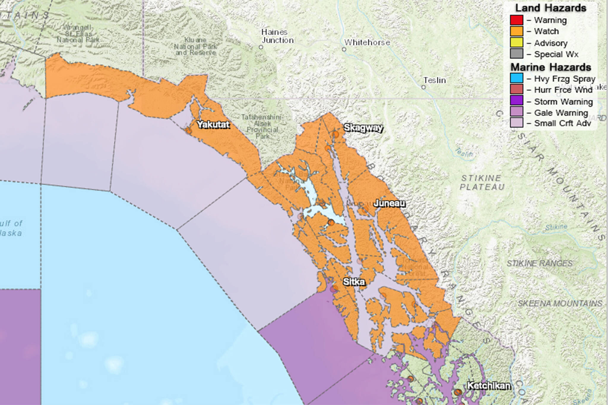
New daily rainfall records were set Friday around Southeast Alaska, according to the National Weather Service, and more rain is in the forecast.
That’s led to flood advisories, elevated avalanche risk and road closures.
The CBJ avalanche advisory was Level 4 —High as of Saturday morning and will remain at that level through 7 a.m. Sunday.
“Expect to see Loose Wet and Wet Slab avalanches at lower to mid elevations and expect to see Wind Slab and Storm Slab avalanches at upper elevations,” wrote CBJ emergency programs manager Tom Mattice in an advisory issued Saturday. “If we see much warming the loose wet and wet slab avalanches will transition to uppermost elevations and yet it appears we may stay just cold enough to keep seeing a mix. Cornices will also be quite weak at all elevations and have built a great deal at uppermost elevations around the region. The snowpack has now started draining water at mid elevations and combined with high rains and warm temps again today could create full depth avalanches.”
Mattice advised avoiding the Flume Trail and to stay out of gated areas above the Behrends Avenue area. Both are avalanche-prone areas.
The Alaska Department of Transportation and Public Facilities announced Saturday morning Thane Road would be closed at the avalanche gates until further notice. In a later email, the department said an update would be provided at 8 a.m. Sunday. Similarly, Alex Holden Way near the Juneau International Airport, also called Air Cargo Road, is closed until further notice, according to CBJ.
Tenants that need access to the west side of the airport may do so through Gate E, according to the city.
Nearby, two flood advisories were in effect on Saturday. Those included an advisory in low-lying areas near Jordan Creek with a crest of nearly 10 feet expected at 9 p.m. on Saturday. Flood stage for the creek is 9.7 feet, according to the National Weather Service in Juneau. That advisory is set to expire at 6 p.m. on Sunday.
An advisory in effect through 6 p.m. on Saturday was issued for the Montana Creek area, too. A crest of 16.5 feet is expected around 3 p.m. Saturday. Flood stage for the creek is 15.5 feet, according to the National Weather Service.
Both advisories included the rhyming advice: “Turn around, don’t drown when encountering flooded roads. Most flood deaths occur in vehicles.”
Why all the rain?
“Right now, we have an atmospheric river passing through the area,” said Cody Moore, meteorologist for the National Weather Service in Juneau. “It’s been pretty stationary in the area for the past 24 hours.”
An atmospheric river is a long, flowing region of the atmosphere that carries water vapor through the sky, according to the National Oceanic and Atmospheric Administration. They typically begin in tropical regions. Moore said in this case, the moisture is coming from Hawaii.
The atmospheric river led to a recorded 3.48 inches of rainfall at Juneau International Airport, a new single-day high, and 4.25 inches at the National Weather Service’s Juneau office.
“The heaviest precipitation will continue through today,” Moore said.
However, once the atmospheric river passes, dryer times aren’t necessarily ahead.
New rainy systems are expected both Monday and Wednesday producing “very classic Juneau Weather,” Moore said.
He said those systems look weaker than the weekend’s atmospheric river, but flooding will likely remain a concern.
“Even though the flood watch expires tonight, that doesn’t mean we’re not looking at more potential for flooding in the coming week,” Moore said.
• Contact Ben Hohenstatt at (907)308-4895 or bhohenstatt@juneauempire.com. Follow him on Twitter at @BenHohenstatt.

