
This story has been updated with additional information.
The latest: 2 a.m. Tuesday
The National Weather Service canceled a flood warning Monday night, after the second release of Suicide Basin came to an end earlier that evening. The Mendenhall Lake crested at 9.6 feet at around 7:30 p.m., according to a 10:30 p.m. update from NWS.
Earlier predictions by the Weather Service put the expected crest time between 8 a.m. and noon on Tuesday, with a crest height of between 11 and 12 feet expected. That estimate was later revised to an expected crest happening between 2 a.m. and 6 a.m.
The weather service reported as of 10:30 p.m. Monday that the Mendenhall River was observed at a height of 8.22 feet and falling. As of 2 a.m. Tuesday, river levels near Auke Bay were reported at just below 7 feet.
The weather service said it will continue to monitor conditions as water levels drop.
Original story:
The National Weather Service in Juneau issued a flood warning Monday morning as Suicide Basin began its second yearly release. The flood warning states that Mendenhall Lake gauge levels, water temperatures, and water levels within the basin all indicate that the basin has begun to release water into Mendenhall Lake.
Affected areas are expected to include areas surrounding the Mendenhall Lake and River, including the glacier visitor center, the Mendenhall campground, Skaters Cabin Road, View Drive, and possibly below Back Loop bridge.
The river is expected to crest at between 11 and 12 feet on Tuesday morning, between 8 a.m. and noon.
The flood forecast is based on an estimated volume of water within the glacier-dammed lake and an estimated release rate based on previous events.
The City and Borough of Juneau has advised residents to avoid potentially impacted areas and to avoid driving on inundated roadways. The NWS notes that most flood deaths occur in vehicles, and cautions that cold water temperatures can increase the threat and severity of hypothermia.
The recent flood warning comes after the record-breaking flooding just over a month ago, which crested at 16.65 feet on Aug. 13. Last year, a second release from the basin occurred in October, peaking at 10.77 feet.
UPDATE: 2:30 p.m. Monday
During a press briefing on Monday morning, Ryan O’Shaughnessy, emergency programs manager, encouraged residents to avoid the bridges and HESCO barriers while the flood warning was in effect. He also advised residents from the View Drive area to consider evacuating until the flood warning passes.
Denise Koch, operations chief and CBJ director of Engineering & Public Works, said that areas where barriers were damaged or there was reported seepage during the August flood were getting extra attention today, in light of the flood warning. She said that they had already had concerns about North Meander Way after “excessive seepage” transpired during the August event.
Koch said they had planned to rebuild a section of the barriers there starting this week. Instead, with the flood warning issued Monday, Koch said CBJ has switched gears to more immediate work, including refilling and compacting barriers with additional sand and placing additional sandbags along the base of the barriers. She said pumps are pre-positioned in some areas in case of seepage and the barriers downstream of the Brotherhood Bridge that have been closed, out of “an abundance of caution.”
O’Shaughnessy said that Dimond Park facilities and schools in the Mendenhall Valley will remain open as of Monday morning.
An earlier crest than first reported is now expected, with the NWS forecasting that waters will crest between 2 a.m. and 6 a.m. tomorrow morning.
The forecast predicts that water levels will go above the minor flood stage this afternoon, between 3 and 7 p.m., and reach above moderate flooding between 7 and 11 p.m.
As of 1:45 p.m. Monday, the river had reached 7.9 feet. The flood stage is reached at 9 feet
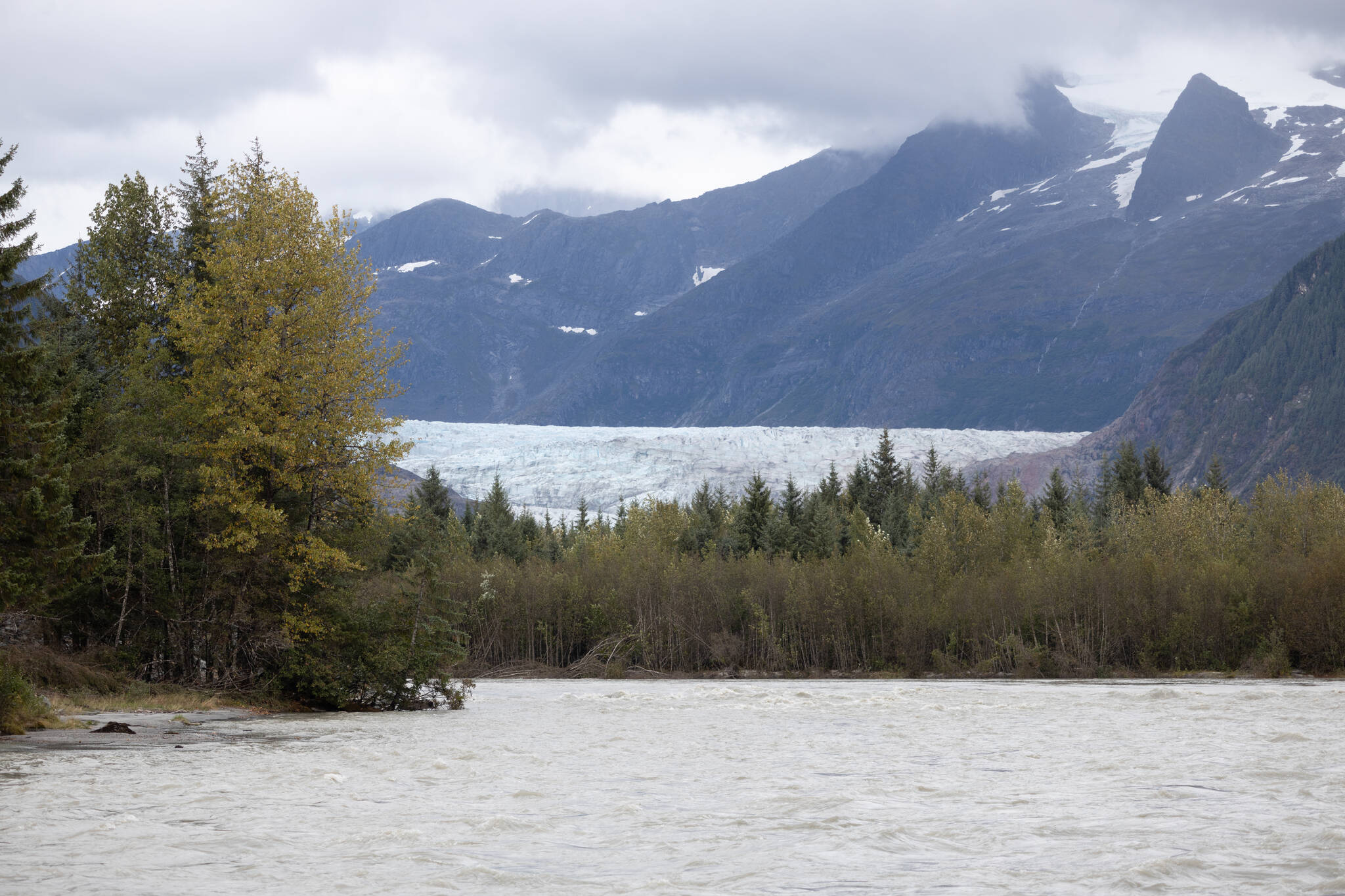
The Mendenhall River is pictured with Mendenhall glacier in the background on Sept. 15, 2025, in Juneau, Alaska. According to a statement issued by the National Weather Service Monday, Suicide Basin started emptying into Mendenhall Lake on Monday. (Chloe Anderson/Juneau Empire)

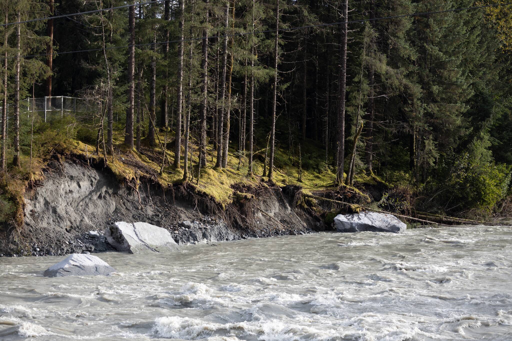
Homes along the Mendenhall River are pictured from Back Loop Bridge on Sept. 15, 2025, in Juneau, Alaska. (Chloe Anderson/Juneau Empire)
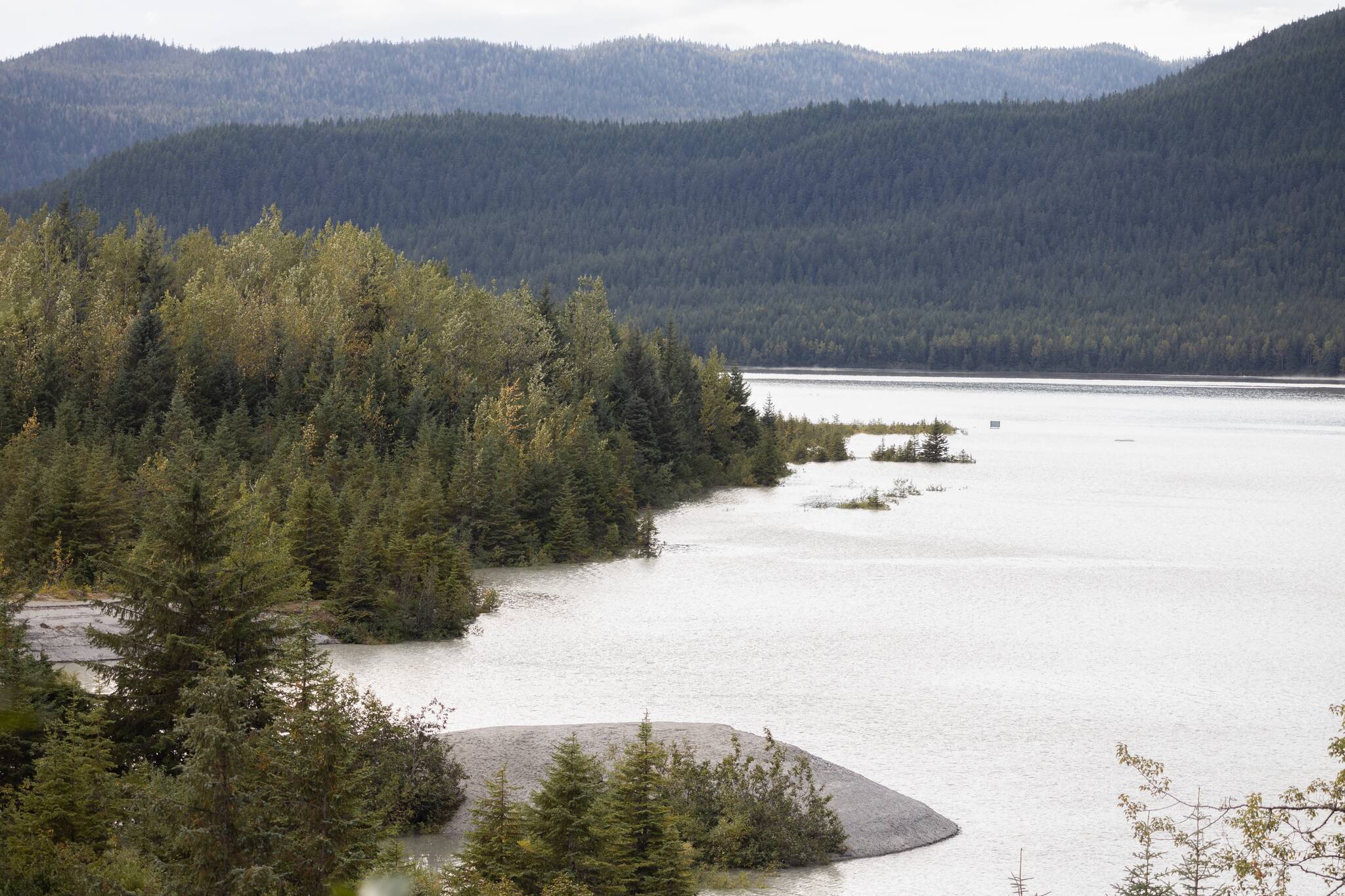
Trees standing in water on the flooded shore of Mendenhall Lake are pictured from the Mendenhall Glacier Visitor’s Center on Sept. 15, 2025, in Juneau, Alaska. (Chloe Anderson/Juneau Empire)
