City breaks ground on new road, first step to develop West Douglas
Published 10:00 am Sunday, February 5, 2017


A new project at the end of North Douglas Highway will bring the City and Borough of Juneau two and a half miles closer to realizing long-held dreams of developing West Douglas Island — also known as the backside of Douglas — for nearly 2,000 new residential units as well as commercial, industrial and recreational facilities.
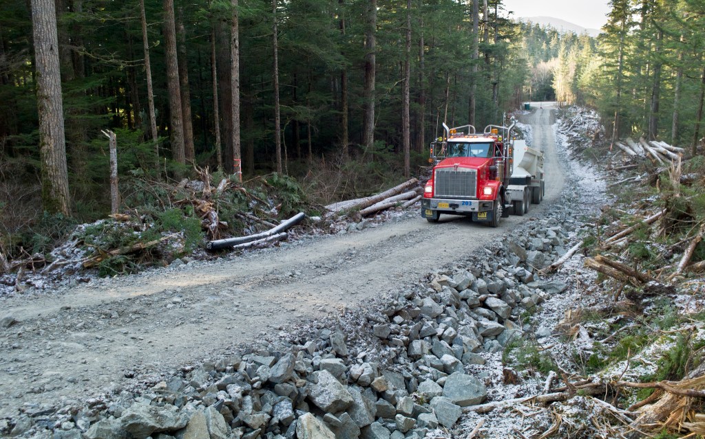
Partnering with local contractor Enco Alaska Inc. construction company, CBJ broke ground on the West Douglas Pioneer Road on Jan. 18. The road begins about a mile from the end of North Douglas Highway and climbs into the benches and terraces below Mount Meek before running parallel to the coastline toward its terminus above Middle Point.
Currently about a half mile long, the West Douglas Pioneer Road won’t be fit for public use after this phase of construction, but is more of a “long driveway,” as managing project engineer Alan Steffert put it, built with the option of revamping as a highway down the line.
The new road will bring recreational opportunity to the backside of Douglas in the short term, and in the long term, access to prized “New Growth Areas” marked by the city for phased development in accordance with a conceptual plan. Project officials expect the two-and-a-half mile road will be done in June.
Access to “New Growth”
City developers and Goldbelt Inc., a for-profit Native corporation that holds 1,827 acres of largely coastal land on Douglas, have long looked to the West Douglas as an area of opportunity. The new construction road was created with $1.5 million dollars of CBJ money sourced from a state of Alaska grant, said city Assembly member Jesse Kiehl.
Though the city hasn’t yet greenlit further development on West Douglas, the construction road will allow them further access to see what potential “New Growth Areas” on the backside hold. A New Growth Area, as defined by the city, are “self-contained towns or villages within remote areas of the CBJ.”
The road ends right where the first New Growth Area on West Douglas would potentially begin. These “nodes,” will separate different land uses so that future residents of will have access to grocery stores, schools, and industrial and recreational facilities while not setting industrial lands “next to somebody’s porch,” Kiehl said.
The design would allow for plenty of open space between development areas.
“I think [the New Growth Areas] are going to play a major part in Juneau’s future, especially this idea that you see in this West Douglas plan about nodes,” Kiehl said.
The West Douglas Concept Plan, first penned in 1997 and since revisited by the Assembly, notes that the nodal design isn’t typical for Juneau, where industrial spaces sometimes run right up against residential areas.
The concept plan identifies five nodes on West Douglas, with sizes ranging from 50 to 200 plus acres. Development Area 1-A, which begins right where the West Douglas Access Road will end, is planned to accommodate 700 homes, a fire station, schools and retail shops. The land there is largely held by Goldbelt.
The largest node, Development Area 1-B, would be low-density residential, with 200 plus acres of sparsely-dotted housing adjacent to a golf course. This node is owned entirely by CBJ.
Development Areas 2 (50-70 acres) and 3 (80 acres) lie on coastal lands owned by Goldbelt. Area 2 would be used primarily for “water-oriented” industrial and commercial uses as the water is deep enough at this location and to accommodate year-round deep draft vessel use.
The focus of Development Area 3 will be for housing, recreation and a large marina. Waterfront property in Development Area 4 (100 acres) is owned by Goldbelt with the uplands owned by CBJ. Development of this area is likely to be further into the future because of its location on the other side of Hilda Creek.
Breaking ground
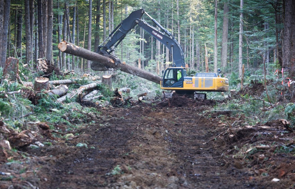
In development for several years, the new road posed a few problems for architects and city officials. West Douglas is owned by three primary groups: Goldbelt, CBJ and the U.S. Forest Service.
Land ownership in West Douglas can be generally described by elevation: Goldbelt owns the majority of coastal land, the city owns land above Goldbelt’s and the USFS holds the mountainous regions towering over everything. CBJ originally planned a coastal route for the road but butted up against legal and environmental concerns.
“There was this idea that we’d work out easements and partial land swaps (with Goldbelt),” Kiehl said. But legal finagling to work out such a deal would be costly, so it was eventually decided that, if the city wanted to develop the road, they’d need to do it on their land.
What could have been seen as a setback for West Douglas development was actually a blessing in disguise, project developers said. In having to move the road upward, the city found a more environmentally-friendly route. The middle route takes the road mostly above the rich salmon habitat of Peterson Creek’s tributaries, and in doing so avoids much of the potential harm to salmon.
Fish and Game Division of Habitat supervisor Jackie Timothy was tasked with cataloging fish habitat in the access road’s area. Timothy’s crew spent months out in the Peterson Creek watershed cataloging habitat. She said they were given ample time to find the least impactful route.
“The city came to us years ago when this was just a dream in their eye and asked us to characterize all the habitat out there,” Timothy explained in a Friday phone interview. “So we sent a crew out to document the anadromous fish habitat. … (The road) is really not affecting any fish habitat at all, basically.”
Avoiding salmon habitat was not only good for fish but helped with the project’s bottom line: Because the road crosses fewer salmon streams, the cost per mile goes down, said Keihl.
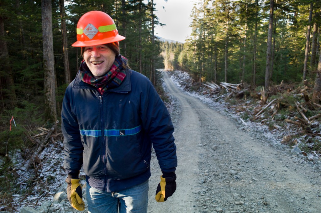
During a Friday walking tour of the road, CBJ project manager Alan Steffert reported that contractors are currently in the earliest stages of construction. They’ve punched a road far enough back to reach a rock quarry, from which they will blast “shot rock” to fill in the road.
For now, the Enco crew is utilizing rock leftover from previous contracting work at Mike Pusich Douglas Harbor. Once completed, the road will be open to hiking and biking, but an access gate will bar entry to ATVs and civilian vehicles.
• Contact reporter Kevin Gullufsen at 523-2228 or kevin.gullufsen@juneauempire.com.