
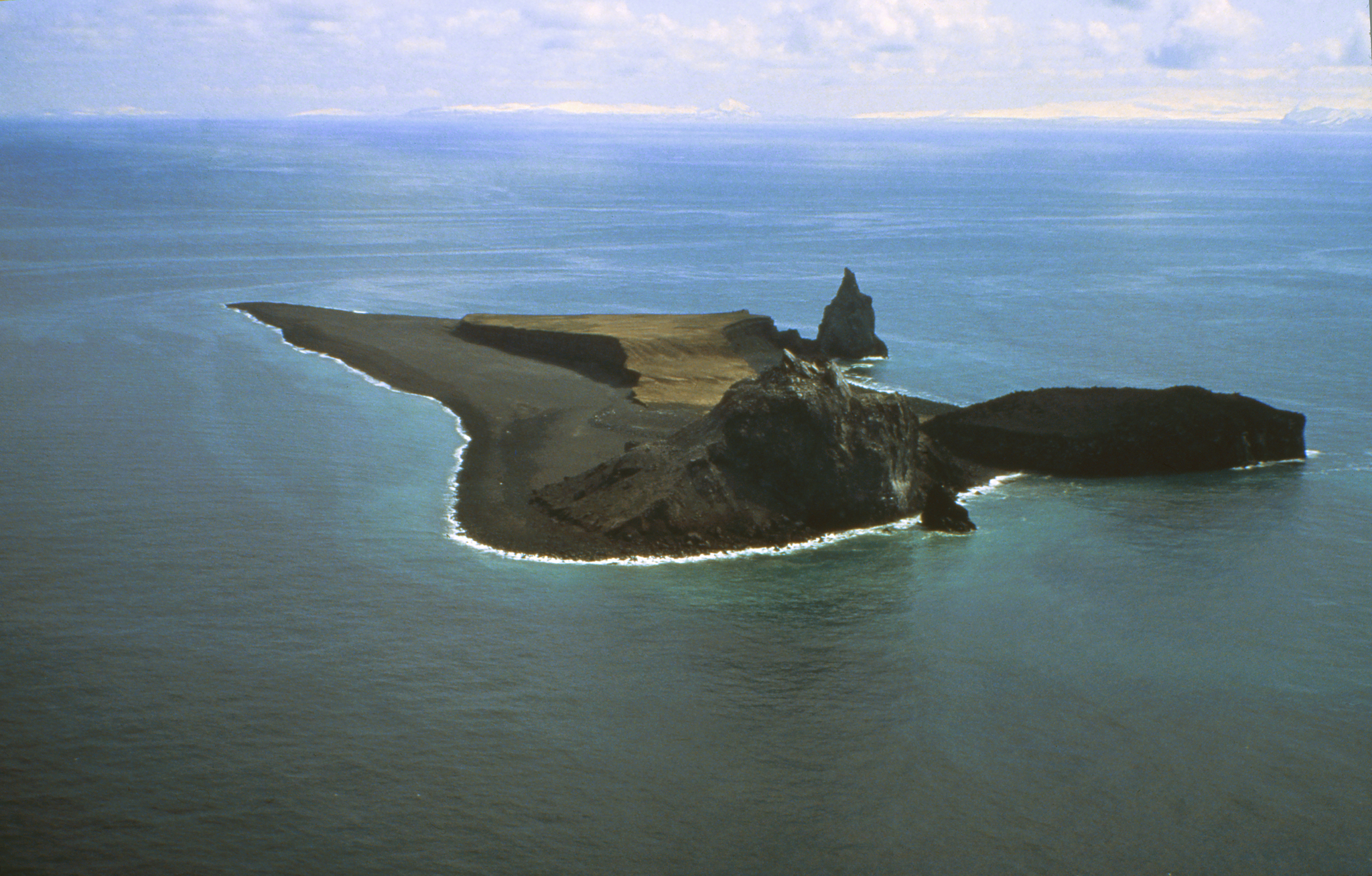
ANCHORAGE — Alaska’s remote Bogoslof Island is only 169 acres, a third the size of the average American farm. And its highest “peak” is just 490 feet, half as tall as the Eiffel Tower.
Like other Aleutian islands, it’s swarming with sea lions. But it’s what’s below the surface that sets Bogoslof apart.
The tiny island is the summit of an active, underwater volcano that extends down 5,500 feet, with its base on the floor of the Bering Sea.
Since mid-December, the volcano has erupted more than two dozen times, sending up clouds of ice crystals and rock fragments that airliners must dodge as they fly between North America and Asia.
The explosiveness is partly due to the volcano magma’s interaction with seawater, and the ash clouds could be a regular feature in 2017, said Chris Waythomas, a U.S. Geological Survey research geophysicist at the Alaska Volcano Observatory.
“Some of the previous, historical eruptions have lasted many months,” he said.
Bogoslof is younger than the United States. The island appeared after an underwater eruption in 1796, the year John Adams defeated Thomas Jefferson to become the nation’s second president. Castle Rock, a lava plug left by that eruption, stands like a Gothic church spire on the island’s southwest side.
In 1883, Bogoslof Volcano erupted again and created a lava dome. The dome was once part of the island but because of erosion, now stands as a rock pillar 2,000 feet off shore.
Last month, Bogoslof blew from a vent in shallow water off its northeast side. The first confirmed ash emission was Dec. 14. Two acres on the island’s east side disappeared in the eruptions.
Since then, Bogoslof has erupted more than two dozen times, sometimes sending ash clouds higher than 20,000 feet — potentially in the path of jetliners.
Air traffic controllers receive an advisory after eruptions, said Allen Kenitzer, a Federal Aviation Administration spokesman. Bogoslof so far has caused no major interruptions. Flights have been slightly rerouted above or around ash clouds, Kenitzer said in an email response to questions. In years past, major eruptions have led airlines to cancel flights.
The Aleutian Islands are part of the Pacific Ocean “Ring of Fire,” a horseshoe-shaped zone of frequent earthquakes and volcanic eruptions. Under the theory of plate tectonics, the Pacific plate of the planet’s outer shell is being shoved under the North American continental plate.
That action creates magma, or molten rock, roughly 6 to 12 miles deep. With a lower density than surrounding rock, magma rises toward the Earth’s surface. Volatile dissolved gases under pressure also push up magma. Whether a volcano explodes or oozes out lava depends on the dissolved gases and their ability to escape rapidly from the magma.
“It’s not all that different from opening a can of soda on a warm day,” Waythomas said. “The gas that’s dissolved in the liquid comes out rapidly, and as it comes out, it brings magma with it. It fragments it as it expands. That produces the fine particles.”
At Bogoslof, magma also interacts with seawater and water-saturated soils.
Typically, Waythomas said, when magma meets water, the Leidenfrost Effect kicks in. That’s the phenomenon in which a liquid near an object that’s much hotter produces an insulating vapor that keeps it from boiling rapidly.
“When you make pancakes, and you sprinkle water on your griddle, the water skates around on a film of vapor,” Waythomas said. “If you break that vapor film down, and brought the water right into contact with the hot griddle, you’d produce a steam explosion. That’s basically what’s going on with Bogoslof.”
Shockwaves from earthquakes break down the vapor film between hot magma and seawater, triggering explosions. Explosions cause more shockwaves and more direct contact between magma and water, leading to an eruption, Waythomas said.
Without an analysis of ash, it’s difficult to know which explosions are driving the eruptions, Waythomas said.
Eruptions could end when the system runs out of shallow magma.
“Once the vent really pushes above sea level, that might change the eruption dynamics,” Waythomas said. “Then seawater will play less of a role, and it’s just a function of how gassy the magmas are. That might herald the end.”
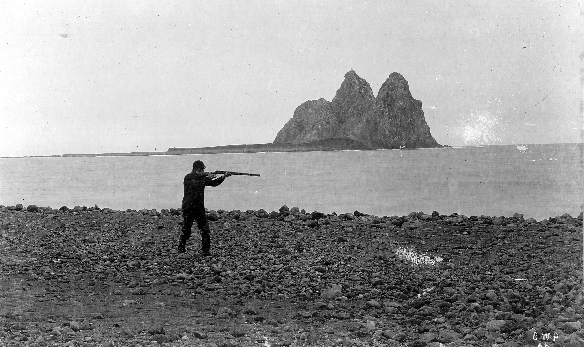
An 1895 photo shows the Bogoslof Island from the northwest. Bogoslof Island or Agasagook Island is the summit of a submarine stratovolcano located along the southern edge of the Bering Sea, 35 miles northwest of Unalaska Island of the Aleutian Island chain. (USGS Denver Library Photographic Collection | The Associated Press)
