
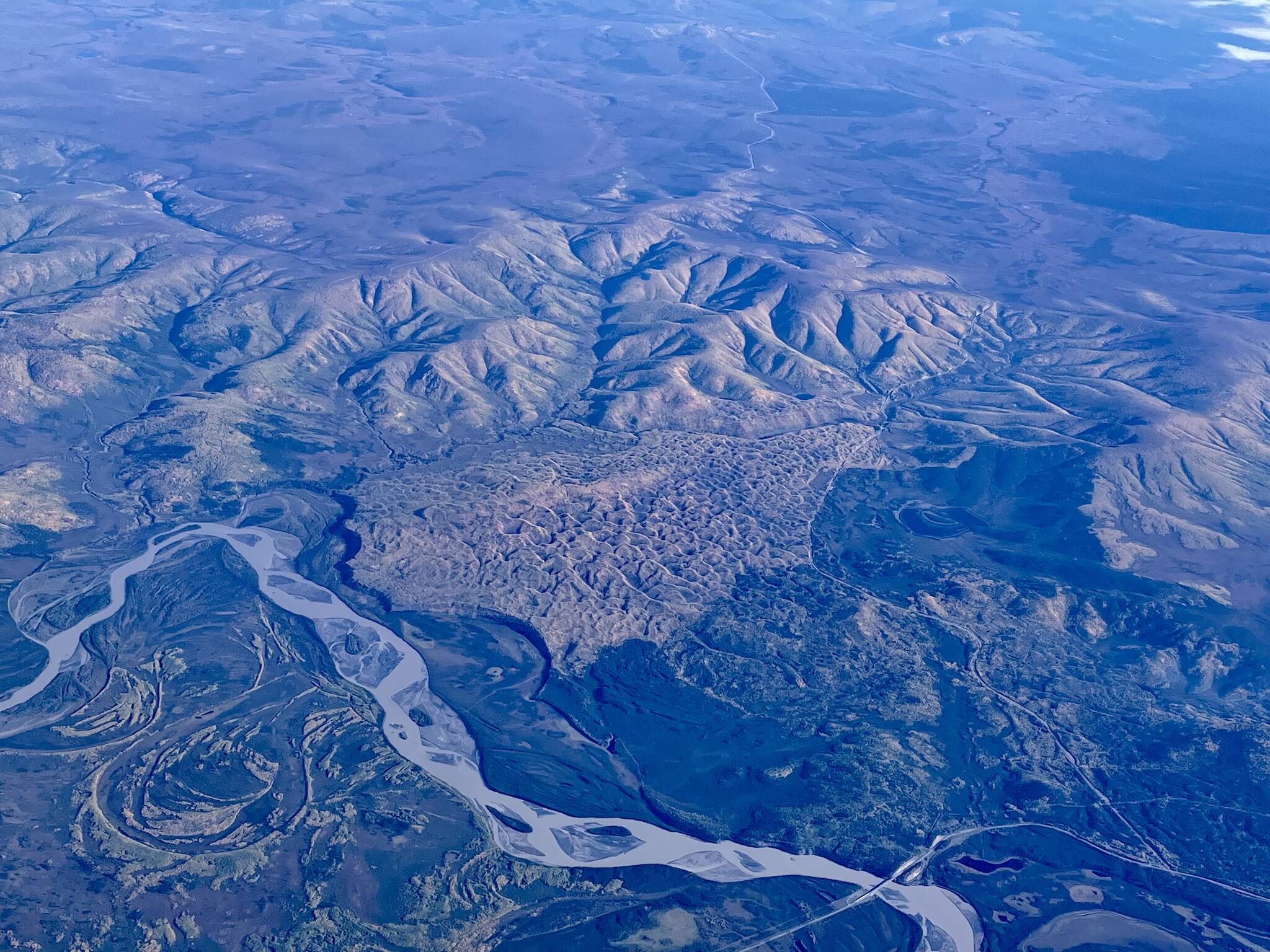
Sitting at a window seat on a recent flight from Seattle to Fairbanks, I looked down on Alaska from 35,000 feet.
There was my home river, the Tanana, flowing gray and braided from near the Canada border. The Alaska Highway followed the river’s curves.
Near the town of Tok, a wedge of sharp hills looked different from the surrounding, more rounded ones. Alaska Highway 5 — the Taylor Highway — cut through the strange bumps.
The landform, accentuated by the glow of fall foliage, was a large sand dune complex. When you drive the 160-mile Taylor Highway to Eagle or use it to get to Dawson City in the Yukon, you notice a road cut where people over the years have set rocks in the sand to spell out their names.
I sent a window-seat photo of the scene to Dan Mann, a University of Alaska Fairbanks scientist. He said the Taylor Highway runs through sand dunes that formed a long time ago.
“You can see from their orientation that they were fed by sand blowing northwards off a barren and expanded Tanana (River) floodplain.
“The sand was coming from glaciers in the Wrangell and Nutzotin mountains to the south and east. There are smaller patches of dune all along the Tanana River up to the Canada border, and just across the border there is an enormous dune field that I think is much older.”
The vegetated dune at the Taylor Highway turn is small compared to some in Alaska that make you feel you are in the Sahara, except for the moose tracks.
The Nogahabara Sand Dunes — west of the Koyukuk River and the villages of Hughes and Huslia — are a whitish splotch on the face of Alaska that covers 26 square miles.
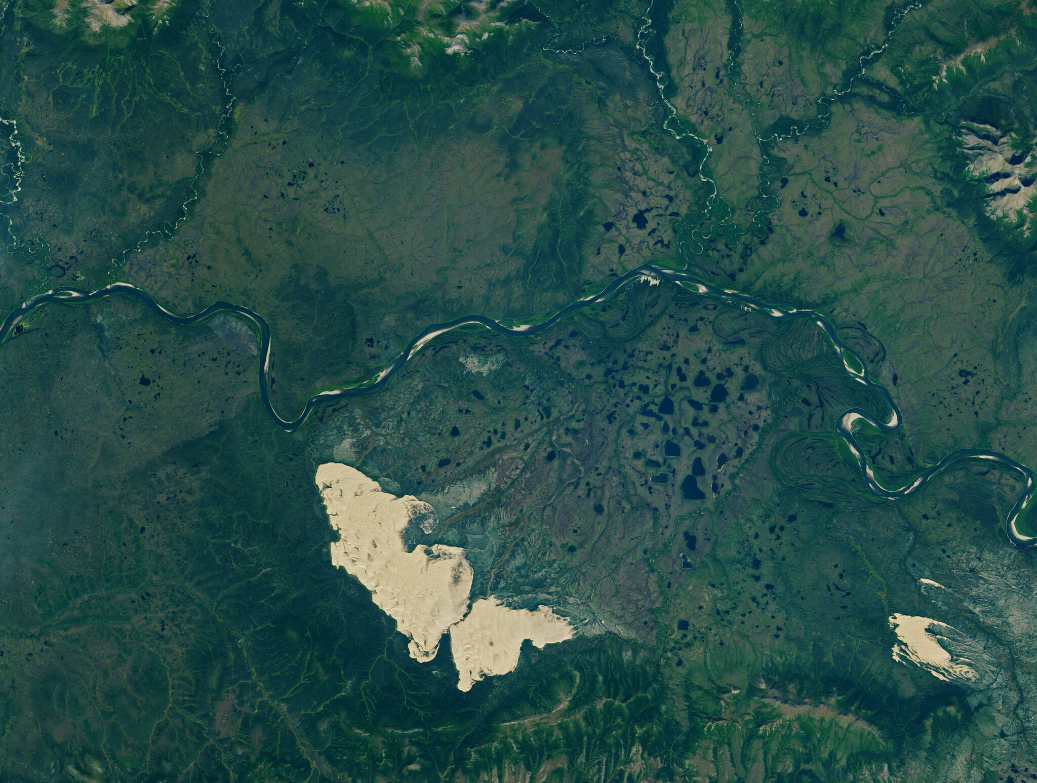
The Kobuk Sand Dunes, left, Little Kobuk Sand Dunes and the Kobuk River in northwestern Alaska as seen from space on Aug. 16, 2020. NASA Earth Observatory image by Lauren Dauphin, using Landsat data from the U.S. Geological Survey.
Even larger and more visited for their proximity to the Kobuk River in northwest Alaska are the Great Kobuk Sand Dunes (38 square miles). Not far from them are the Little Kobuk Sand Dunes (5 square miles). Like the Nogahabara dunes, both sets of Kobuk dunes are active, still migrating via the wind at speeds up to three feet per year. This movement smothers tree seedlings before they can make a go of it.
In a 1990 paper, Peter Lea and Chris Waythomas mapped out the active and inactive sand bodies in Alaska. Sand is just about everywhere that glaciers were not during the last ice age, but most of the dunes are now covered with trees and shrubs. Large sand deposits remain on Alaska’s North Slope, the Seward Peninsula and all through Southwest and Interior Alaska (where the Taylor Highway dune is located).
In a study of the Nogahabara dunes, scientists including Mann wrote that one of the active dunes’ values is continuing to host plants like an Asian sedge that are relics from the time of the Bering Land Bridge. The Nogahabara is also home to the sandy tiger beetle and the Alaska tiny shrew, which are both found almost nowhere else in the state.
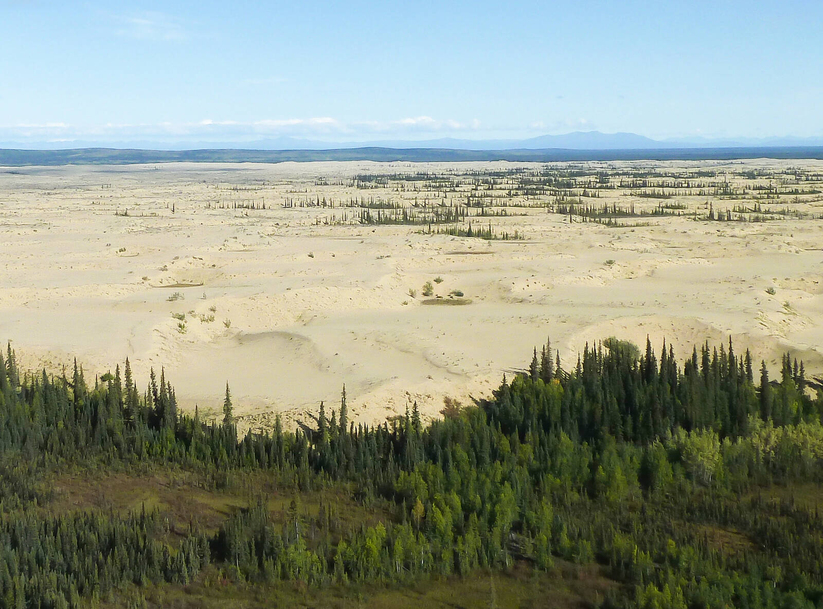
Pale sand dunes stretch out beyond a line of spruce trees in Koyukuk National Wildlife Refuge. Thousands of years ago, sand exposed by receding glaciers drifted into large dunes against the Nulato Hills, known today as the Nogabahara Sand Dunes. (Courtesy Photo / Keith Ramos,USFWS)
Sand deposits everywhere in Alaska harken back to a time thousands of years ago when big winds blasted fine particles of glacier-ground mountain a long way. It must have been an unpleasant time to be walking around Alaska, but scientists like Mann are fascinated with what it left behind.
“Alaska’s sand seas are super interesting and poorly understood,” Mann said.
• Since the late 1970s, the University of Alaska Fairbanks’ Geophysical Institute has provided this column free in cooperation with the UAF research community. Ned Rozell, ned.rozell@alaska.edu, is a science writer for the
