A new road ahead? There’s a proposal for an access road at Montana Creek
Published 10:30 pm Monday, March 29, 2021


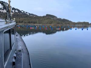
The perennially popular Montana Creek recreation area could get busier and offer a wider variety of recreational activities if a proposal to construct a new trail and campsite moves forward.
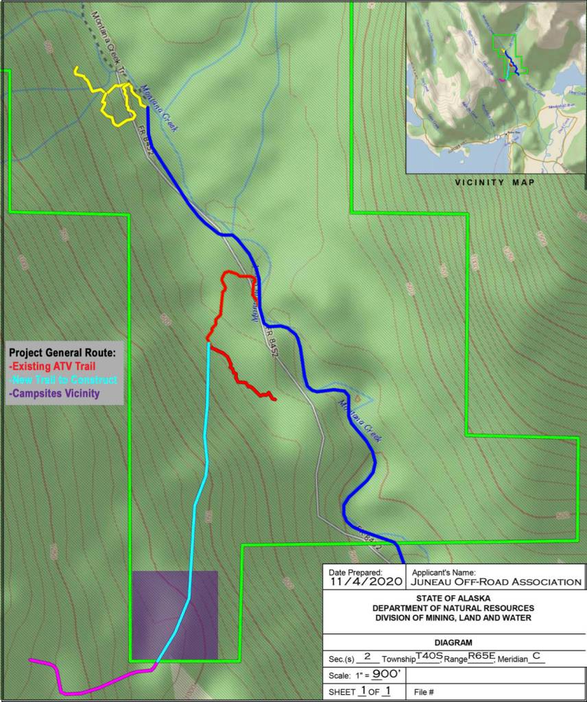
The Juneau Off-Road Association submitted a request to build a hardened trail in the Montana Creek area, making it easier for people to operate all-terrain vehicles. The proposed trail is approximately 6,800 feet long and 25 feet wide, containing about 3.90 acres and an additional quarter acre for a campsite.
Because the plans require easement on state property, a public notice describing the project recently appeared on the state’s website. Members of the public may comment on the proposal until April 21.
Several local groups with members who use the Montana Creek area say they are planning to comment—and in some cases, oppose—the proposal.
Origins of the idea
According to Darrin Crapo, president of the Juneau Off-Road Association, the trail would be open to all users and provide transport options for people who would like to visit natural areas but cannot travel there on foot.
“Here in Juneau, we have a lot of opportunities for a narrow segment of the population. We have first-rate trails, but we need better access,” he said in a phone interview Tuesday morning.
Crapo explained that his experience with seven children and elderly parents helped him see the need for trails that support motorized transport to campsites and other recreational opportunities.
“We have seven kids, and my parents are in their 70s. These opportunities are not available to the elderly and people with little kids,” he said. “As I’ve traveled around and gone to other places, I wondered why we have millions of acres that are only available to foot traffic.”
Crapo said that construction of the trail would be funded by the Juneau Off-Road Association and that volunteers will build the trail over two years with work beginning this July.
“We have several dozen people willing to work,” he said. Crapo said the volunteer crew includes various skill sets, including construction equipment operators, loggers, and bankers.
Local groups express concern
Other local groups who use the Montana Creek area offered the idea a cool reception.
“We are still trying to digest it,” said Frankie Pillifant, president of the Nordic Ski Club. “The proposal is pretty thin on details. It’s a nice idea but maybe in the wrong place,” she added.
Pillifant said that the Nordic Ski Club has over 1,000 local members and that the group routinely grooms the Montana Creek trails for skiers to use. In addition to skiers, she said that motorized users are often on the trail sharing it with people walking dogs, those participating in archery, snow bikers, anglers and seasonal hunters.
“It gets a lot of use and has a lot of users,” she said.
Crapo said that he expected a mixed reaction to the request.
“There are lots of people crying out for something like this for it for a long time,” he said. “That demographic is growing. But, there’s a group of people who like it the way it is.
“I’d invite those with concerns to come to visit and talk to me and explain their concerns,” he continued. “A lot of it is education. When something is new, you can get a lot of fear. When you get better information, you know what’s really going on.”
Grab your skis and phone —it’s time for ski-o’caching
Safety concerns
Pillifant said her group is considering safety concerns as they review the proposal and consider how to respond during the public comment period.
“Shared use of motorized and non-motorized trails is not done anywhere, as far as I know. It’s a nice idea. But I don’t think it will work,” she said.
Trail supporters don’t see a safety issue with a mixed-use trail.
“It’s about a reasonable trail layout. It’s not intended to be high-spirited riding,” Crapo said. “Up north, you have all kinds of trails that people use. These are transit areas where people use them, too.”
Crapo said this trail is specifically for transit.
“It works if it’s just a transit corridor,” he said. “You don’t mix spirited riding with foot traffic. This is not intended for that. This is low-speed transiting. It’s like sidewalks next to highways. I’ve heard the argument that you can’t mix it. But that makes no sense because it’s mixed all over town. We have roads with bike lanes and sidewalks.”
Fish habitat
Jon Heifetz, president of the Tongass Chapter of Trout Unlimited, said that he’s worried about how the trail could affect local fisheries.
“The watershed in Montana Creek is very special. It’s a great fishery in an urban area, and we are very concerned about all-terrain vehicles in this area,” Heifetz said in a phone interview on Tuesday.
He said that increased noise from motorized vehicles could displace other users in the area and that increased ATV traffic could damage fish habitat.
“This is a long-standing issue with ATV vehicles,” he said. “Currently, there’s some illegal use in the area. People cross streams despite signs. We are concerned this project will increase the number of ATVs out there and going off-road.
“From our point of view, we’d like to see it closed to ATVs,” he continued. “We know they want a place to ride. But, the upper watershed could pose a danger to fish habitat. Also, it affects the quality of the angler experience.”
Heifetz said that the size of the project and the equipment used to build the trail concerns him.
“They are proposing a 25-foot trail. Basically, that’s the size of a road,” he said.
Heifetz said that the group’s board of directors is currently reviewing a letter to submit during the public comment period.
On The Trails: Eagle Beach at equinox time
Long-term planning
Although the proposal does not involve land owned by the City and Borough of Juneau, the Parks and Recreation Department recently announced that they plan to start a comprehensive master plan for the area.
“CBJ is planning to do a master plan for the area,” Michele Elfers, deputy director of CBJ’s Parks and Recreation Department, said in an email to the Empire. “There are many user groups and landowners with interests in developing this area for recreation, which is why a master planning process with public input is so timely and important right now.”
She said the city is seeking grant funding for the master plan project and hopes to start the public planning process this summer or fall.
“We hope that the master planning process will help to identify the community’s current use and shape the future use of the area. Going forward, requests for development and new facilities can be addressed with the public process from the master plan to help inform decision making,” she said.
Elfers said she didn’t know if the city would comment on the proposal.
Pillifant said she thinks a master plan is a step in the right direction.
“We know that CBJ has proposed doing a comprehensive plan for Montana Creek, and I think that’s a good move because Montana Creek is so important to so many Juneauites,” she said. “It’s been an important part of Juneau. We are excited about that.”
Crapo said that the pending master plan should not affect the evaluation of this request.
“The project is entirely on state land,” Crapo said. “The city’s parcel is down below, but we are working with them.”
The proposal does skirt the edges of land managed by the Forest Service.
“The Juneau Ranger District is communicating with the City and Borough of Juneau and the State of Alaska regarding how the proposal would impact USDA Forest Service managed lands in the area,” said Tristan Fluharty, Juneau district ranger in an email to the Empire.
More about the project
According to the petition filed with the state, the trail would be made of hardened gravel and suitable for multi-modal use.
“The requested trail is approximately 6,800 feet long and 25 feet wide, containing approximately 3.90 acres. The requested campsite area is approximately ¼ acre. The total area requested under this easement application is 4.15 acres,” the document reads.
The request continues, “the trail will be constructed off Montana Creek Road (beyond the Hank Harmon Rifle Range) and will climb up to the 1,200-foot level to the southwest, terminating at the end of DMLW-owned, state-managed land bordering United States Forest Service (USFS) land. Where the trail terminates, the applicant proposes to clear and level up to a ¼ acre aggregate area to establish a terraced series of hardened campsites (up to 6), each suitable for equipment parking, tents, and a firepit. The applicant proposes to clear trees and brush only as required in the immediate camp space.
“We did some surveying and submitted our package. We have a nice project. On state land, it’s pretty reasonable. We can punch in something wide enough that people can take a walk and go up there with a dog. It’s a great project,” Crapo said.
• Contact reporter Dana Zigmund at dana.zigmund@juneauempire.com or 907-308-4891.