
Research led by the University of Victoria discovered that the Tintina Fault in the Klondike region of Yukon has the potential to produce earthquakes as large as magnitude 7.5, a previously unrecognized hazard for nearby communities.
The Tintina Fault has unleashed powerful earthquakes over millennia and researchers say the ground beneath Yukon’s Klondike may be far less stable than once believed, a hazard that until now has flown under the radar.
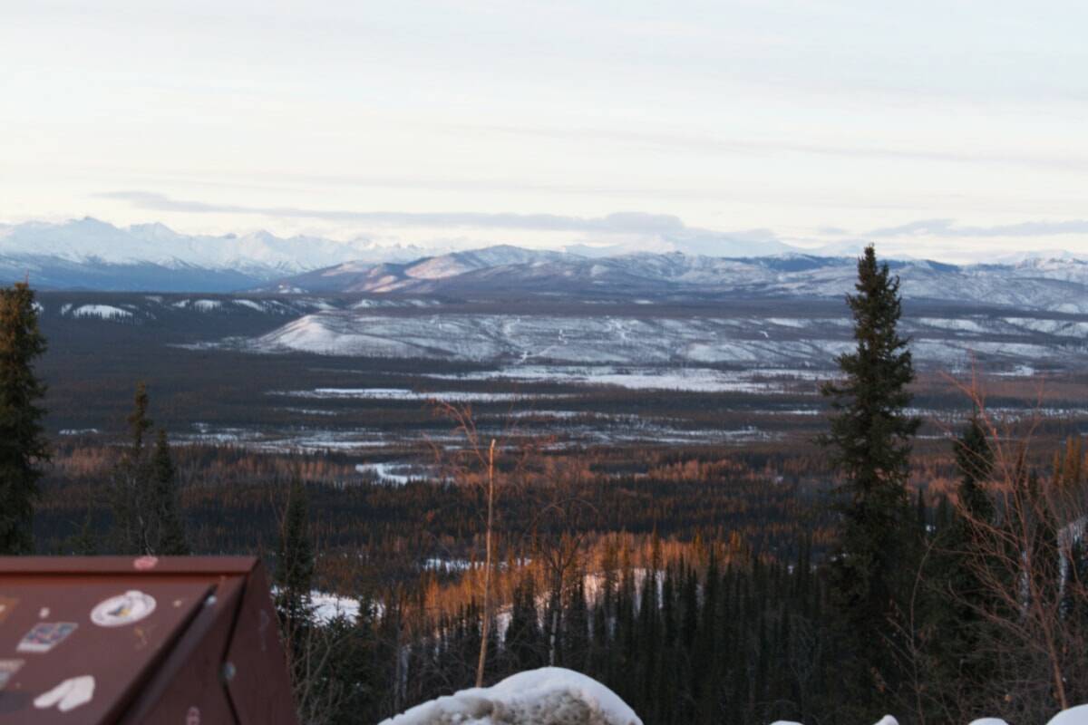
Dawson City is less than 20 kilometres from a section of the Tintina Fault that researchers say could produce large earthquakes strong enough to shake the city and damage key roads and nearby mining operations.
A surface rupture along the Tintina Fault could damage the Klondike and Dempster highways, researchers warn, potentially cutting off Dawson City and nearby communities from critical access routes.
Researchers add that landslides in the Klondike could worsen if geological events caused by shifting formations occur.
The Moosehide slide, just north of Dawson, and the newly identified Sunnydale landslide, directly across the Yukon River, both show signs of instability, researchers said.
The peer-reviewed study published in the 2025 volume of Geophysical Research Letters reported on newly found geological hazards in Yukon’s Klondike region. The research was led by Theron Finley, who is set to join the Yukon Geological Survey in August, according to Geoscience Research Manager Jan Dettmer.
Fault lines mapped in the study ran southeast from Dawson City, cuts across a stretch of the Dempster Highway and traces through Flat Creek, where ancient glacial deposits revealed evidence of past powerful surface-rupturing earthquakes.
Stretching southeast from Dawson City, the fault lines cut across a 130-kilometre corridor of Yukon wilderness, where researchers say million-year-old glacial landforms bear the scars of past earthquakes. Despite its quiet surface, scientists warn the fault is far from dormant.
Using high-resolution topographic data gathered by satellites, planes and drones, researchers discovered that geological formations along the Tintina Fault, one about 2.6 million years old and another roughly 132,000 years old, have shifted sideways by approximately 1,000 metres and 75 metres, respectively.
While the total offset suggests multiple past earthquakes, the exact timing and frequency remain unknown. Researchers cannot definitively state that the fault is currently “building pressure” or predict when the next earthquake might occur.
Researchers found evidence of one earthquake approximately 12,000 years ago, which suggests the fault is more active than previously thought.
“We don’t know exactly when these have occurred, so you can’t actually then make statements about recurrence periods, so that’s key information that’s still missing. I would think that one of the next studies that either the authors or potentially even YGS would carry out, although we don’t have plans for this currently, would be to actually trench, like you would dig into the fault, and try to understand better these histories of multiple earthquakes,” Dettmer told the News by phone on July 24.
While the study indicates that the fault remains active because of accumulated stress, Dettmer cautioned against making definitive predictions about future seismic events and emphasized the need for additional studies to fully understand the fault’s earthquake potential.
Dettmer said this study offers the first evidence of seismic activity on the Tintina Fault in 12,000 years, prompting a major shift in how the region’s geological risk is viewed.
However, Dettmer said the paper isn’t a formal hazard assessment. It confirms past quakes, one 12,000 years ago, others over millions of years, but more research is needed to understand the fault’s behaviour and assess future risk.
Despite its size and history, researchers say the Tintina Fault has not been recognized as a hazard in Canada’s national models. Unlike more active fault lines across the country, they say Tintina was overlooked because faults in the region move very slowly and there are few instruments to detect earthquakes.
The study notes that the fault’s straight, unbroken geometry could allow a rupture to travel long distances, increasing the potential of an earthquake. Such an event could release enough energy to trigger ground shaking, landslides and infrastructure damage across the Klondike.
Researchers say Canada’s current earthquake risk maps don’t fully reflect the hazards posed by the Tintina Fault, which researchers say should be further studied as part of potential updates to risk maps
“I expect this will trigger many studies in the next few years to much better understand what’s going on there,” Dettmer said.
Contact Jake Howarth at jake.howarth@yukon-news.com.
