

The weekend’s storm clouds will roll out of town, leaving in their wake over ten inches of snow. “Unusually cold,” sub-zero temperatures are ahead, the National Weather Service says.
NWS has issued a cold weather advisory from midnight Monday through noon on Tuesday, warning of “dangerously cold wind chill temperatures” as low as -15 degrees Fahrenheit in Juneau and Gustavus. NWS predicts northeast wind 15 to 20 mph, with gusts as high as 40 mph tonight.
Frostbite and hypothermia are possible under these circumstances, NWS says. People showing signs of hypothermia should move to a warm place, remove wet clothing, and wrap in dry layers. Skin affected by frostbite should be warmed gently with warm — not hot — water.
Temperatures are more severe further north. Skagway is under a separate extreme cold warning, with wind chills forecast to reach -35 degrees.
The cold snap follows Juneau’s first significant city-level snowfall of the season. NWS measured 9.6 inches of snow on Saturday, Dec. 6, surpassing the previous Dec. 6 record of 7.2 inches set in 1975.
On the afternoon of Dec. 6, Juneau Police Department received multiple reports of vehicles crashing or sliding into ditches within the span of just a few hours.
The remainder of the week is expected to be mostly clear, with a 30% chance of snow before 9 p.m. Monday before skies turn largely sunny. Mid-week temperatures are forecast to stay cold, ranging from the single digits to high teens.
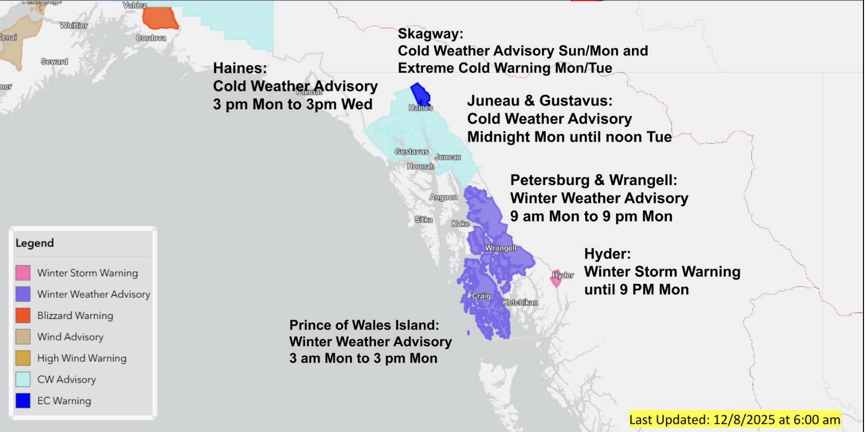
The National Weather Service issues a cold weather advisory for Juneau and Gustavus from midnight Monday through noon on Tuesday, with winter weather conditions expected across Southeast Alaska. (National Weather Service screenshot)
