
Juneau, much of northern Southeast Alaska, far northwestern British Columbia and the Yukon shook Saturday afternoon as a Magnitude 5.2 earthquake hit the region. No damage was immediately reported.
According to the U.S. Geological Survey and the Alaska Earthquake Information Center, the earthquake came at 3:38 p.m. Alaska time, just as the City and Borough of Juneau’s Disaster Preparedness Expo was winding down in Centennial Hall. This reporter counted six seconds of noticeable shaking.
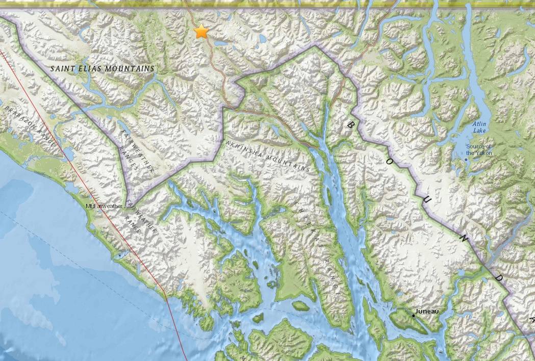
The quake was centered in the narrow sliver of British Columbia that separates Southeast Alaska and the Yukon. According to preliminary measurements, the earthquake took place along the Haines Highway, in much the same place as a series of larger earthquakes earlier this year.
That string of earthquakes topped out with a magnitude 6.3 that was 10 times as strong as the one felt Saturday in Juneau.
Saturday’s earthquake, as in the earthquakes earlier this year, came from the vicinity of the Eastern Denali Fault, which roughly follows the Haines Highway to Haines, then splits into the Chatham Strait Fault and the Coastal Shear Zone near the northern end of Lynn Canal.
Chastity Aiken, a postdoctoral fellow at the University of Texas who has studied the Eastern Denali Fault, told the Empire earlier this year that the Eastern Denali is in the area, but so are many other fault lines.
“That area is kind of riddled with faults,” she explained.
In the Gulf of Alaska, just offshore of Southeast Alaska, the Pacific Plate is moving the seafloor 55 millimeters per year to the northwest, sliding beneath the North American Plate that underlies Southcentral Alaska.
The Pacific Plate’s movement is shoving the Yakutat Terrane, a smaller (but still vast) piece of tectonic plate northeast, underneath Yakutat. That northeastern movement is forcing the St. Elias Mountains upward, year by year.
If that collision were a front-end car accident, the Eastern Denali Fault ─ on the far side of the mountains ─ would be the portion of the car’s hood closest to the windshield. It’s crumpled by the impact but not directly struck.
Strong earthquakes are unusual in Southeast Alaska, but not rare. Alaska is the most earthquake-prone state in the United States, and the capital region is not immune from shaking. The state’s sparse population and low level of infrastructure can mean even significant earthquakes can be unremarkable. A magnitude 7.9 earthquake hit Yakutat in November 1987. In 1972, a magnitude 7.6 earthquake rattled Sitka and Juneau.
