
This story will be updated throughout the day.
Updated 11:55 p.m. Sunday: A glacial outburst flood from Suicide Basin is expected to cause the Mendenhall River to crest at 11.31 feet between 1 and 4 a.m. Monday — when temperatures in the Mendenhall Valley are about 20 degrees — flooding some homes on View Drive and backyards on Meander Way, according to official updates published Sunday.
An update at 11:30 p.m. states that while the river is at 10.6 feet, it appears the rate of rise is slowing down.
The forecasted river crest is far below the record 15.99 feet on Aug. 6 that damaged nearly 300 homes, but the cold temperatures and recent snowfall will add additional complications, according to officials.
“Residents in this area are strongly advised to take immediate precautions,” an advisory published by the City and Borough of Juneau states. “Take steps to protect your property and prepare for possible power outages in the area…All members of the public should avoid the Mendenhall River until further notice for the safety of yourself and others. Banks are unstable and slippery with recent snow.”
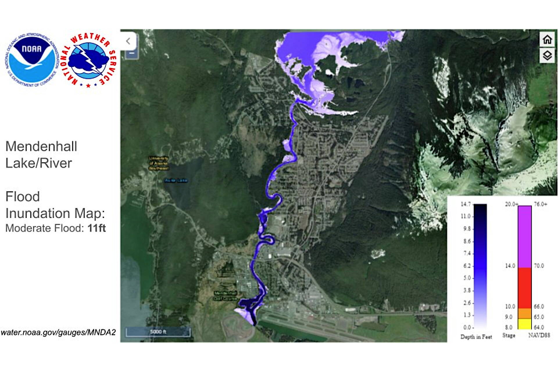
A flood inundation map shows areas near the Mendenhall River expected to be affected if a glacial outburst flood from Suicide Basin causes the river to crest above 11 feet. (NOAA National Water Prediction Service map)
Mendenhall Lake reached a level of 10.6 feet as of 11:30 p.m. Sunday, surpassing the moderate flood stage according to an update at the National Weather Service Juneau’s Suicide Basin Facebook monitoring website.
“While the level continues to rise, we are seeing early evidence that the rise is slowing down,” the update notes. “Data from the laser pool elevation gauge continues to show a dropping level in the basin with a change of 170+ feet since Thursday night. Mariners should be advised during the outburst event, numerous trees and debris have been reported in the river and have may washed downstream.”
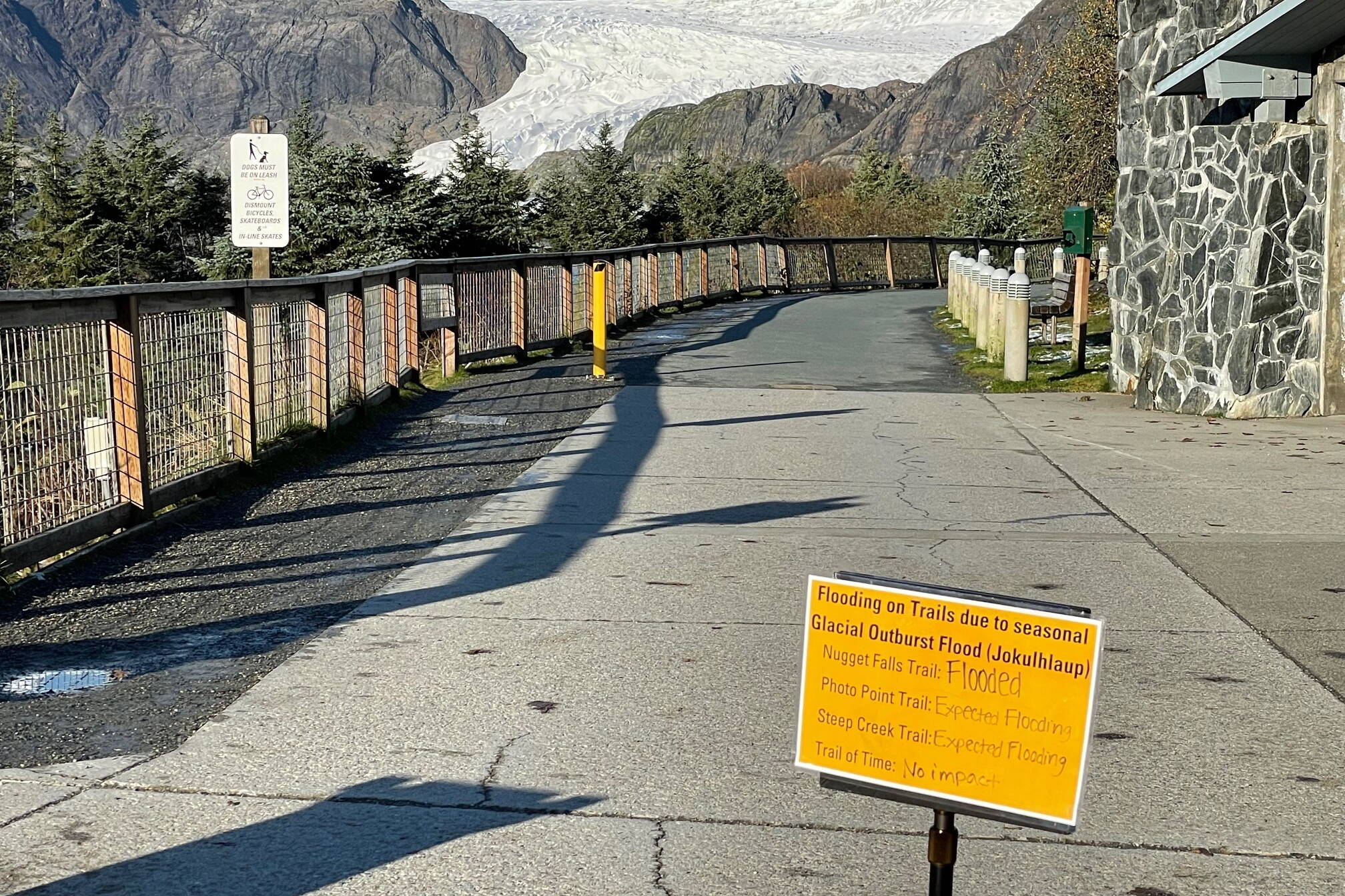
View Drive, Skater’s Cabin Road, Kaxdigoowu Héen Dei (Brotherhood Bridge Trail) and the Dimond Park pedestrian bridge are closed as of Sunday afternoon, according to CBJ.
The weather service’s flood warning is in effect until 10 a.m. Monday.
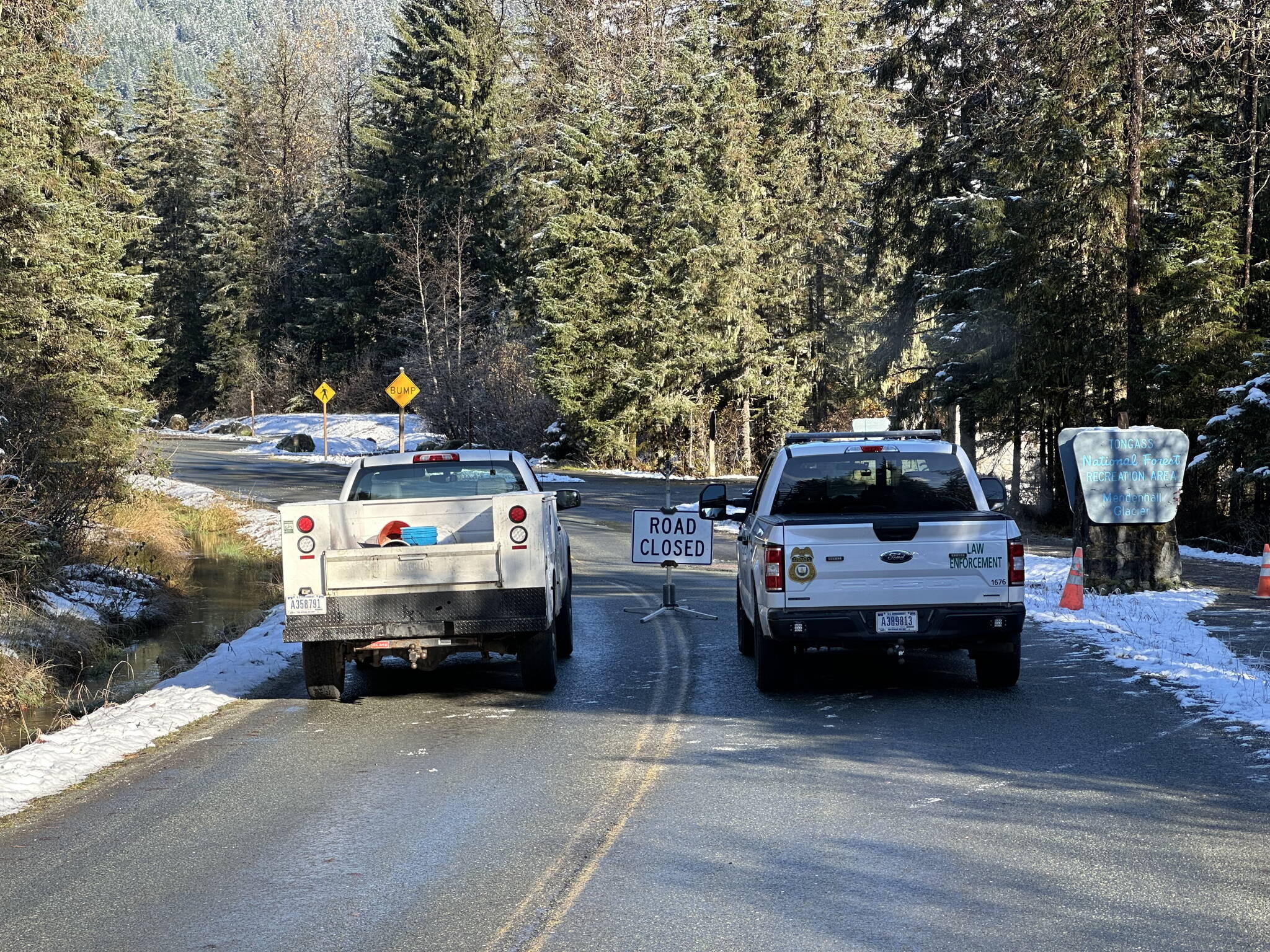
City vehicles are parked in front of a barrier on Skaters Cabin Road on Sunday after it was closed due to a glacial outburst flood expected to peak early Monday morning. (City and Borough of Juneau photo)
The water level in Suicide Basin was at about 1,250 feet when it began dropping Thursday night — compared to 1,381 feet during the outburst flood that peaked Aug. 6. The basin drop during the record flood was about 450 feet.
Concern about high tides has been expressed by numerous people to NWS Juneau officials, the agency noted in a post Sunday morning on its Facebook page. However, “the flood inundation maps created in 2014 take into consideration a high tide of 20ft. While the Mendenhall river is expected to crest near 4am, which is at high tide for the Juneau area, we are only expecting a 15.54ft high tide.”
CBJ distributed about 75,000 sandbags to more than 130 households in the affected area, according to a post at the city’s Facebook page Sunday afternoon. Officials had scheduled distribution through Tuesday, or until the supply was depleted, and only a small number remained by the end of Sunday.
“Staff will be reaching out to a handful of folks who expressed interest in receiving additional bags if they became available,” Meredith Thatcher, a CBJ spokesperson, wrote in an email Sunday night. “But for all intents and purposes we’ve distributed the whole stockpile.”
• Contact Mark Sabbatini at mark.sabbatini@juneauempire.com or (907) 957-2306.
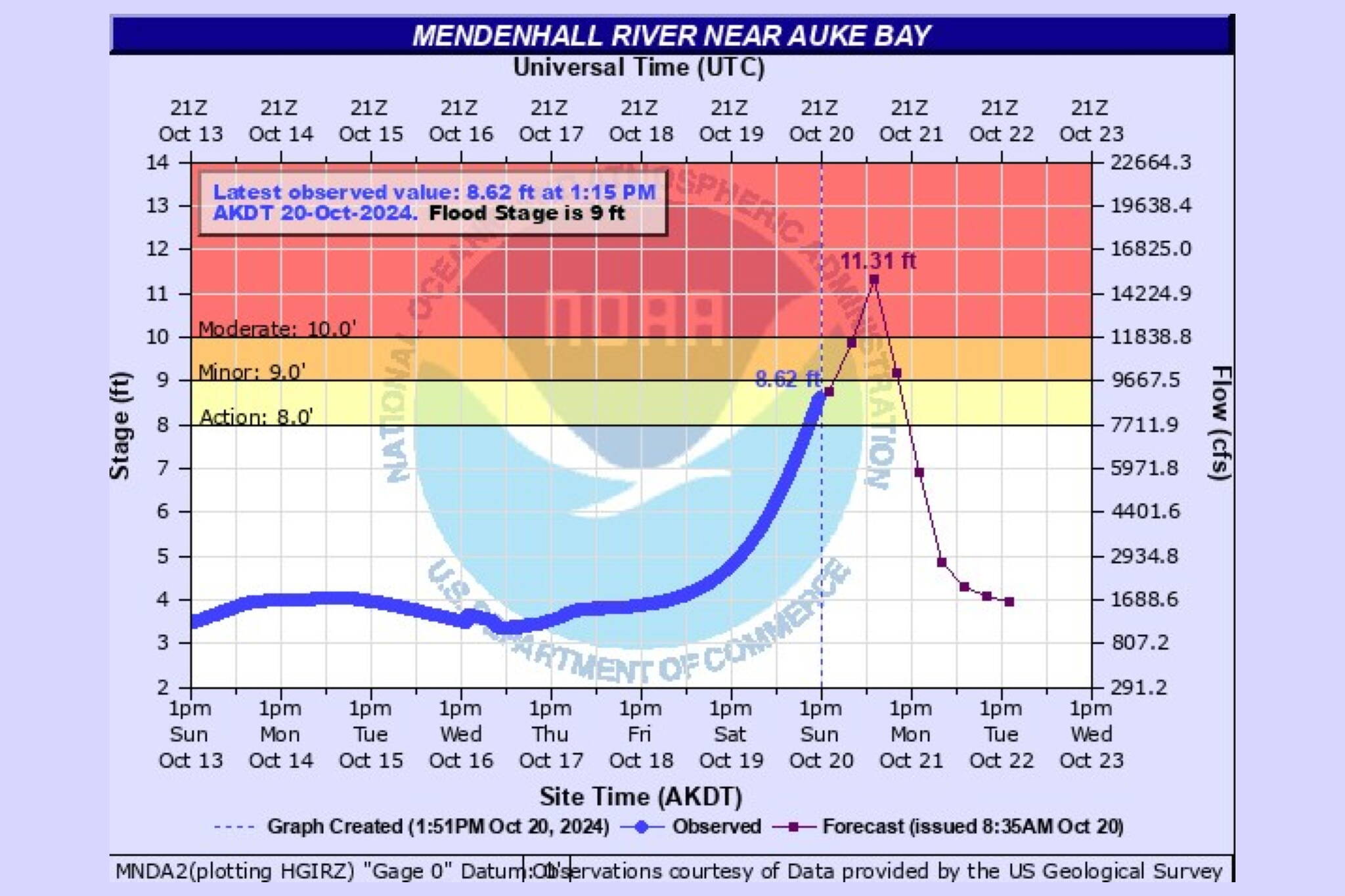
A hydrograph updated Sunday afternoon shows the Mendenhall River cresting at of 11.31 feet at about 4 a.m. Monday due to flooding from Suicide Basin. (National Weather Service Juneau)
