Researcher hopes map project can aid pandemic response
Published 10:30 pm Sunday, August 30, 2020
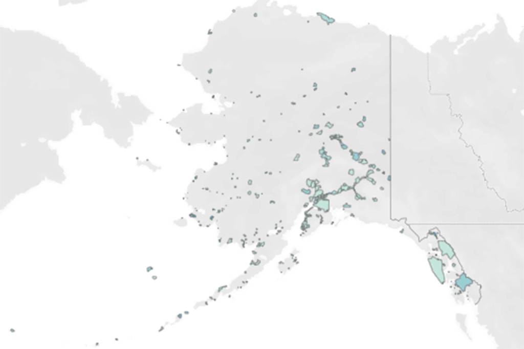


Most maps of Alaska show governmental boundaries and geographic features, but offer little insight into where people live or which places might be especially vulnerable to pandemic or in need of relief.
A new project made by John Harley, a postdoctoral researcher at the University of Alaska Southeast, attempts to show exactly that via an interactive map of the state that identifies the pockets of populations scattered throughout the state and identifies potentially at-risk areas using factors such as age, financial security and more.
“The census regions and blocks and block groups that the Census Bureau uses to kind of slice up the populations, those work pretty well in heavily populated areas,” Harley said. “But one of the stipulations of those areas is they have to fill in the entire area of the stat, whereas in Alaska, you don’t have many people or any people living some pretty vast swaths of land. Having a
social vulnerability index that’s calculated for this huge area —kind of like Northwestern Alaska —it’s not really representative of where people are actually living, so that was sort of one of the motivations. ”
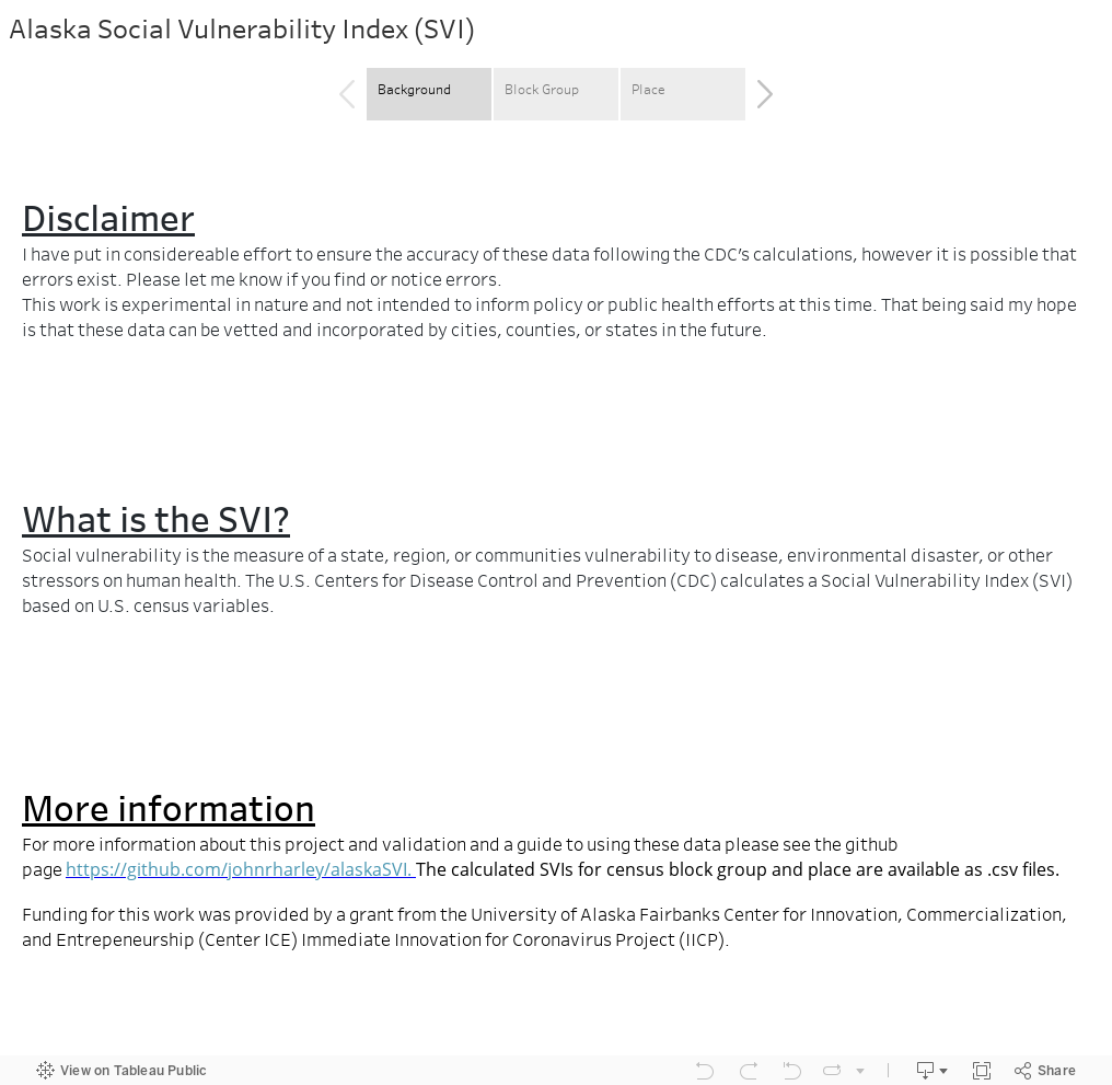
Social vulnerability index is a measurement of a community’s vulnerability to stressors such as disease or natural disaster. The federal Centers for Disease Control calculates SVI using census data to help emergence response planners and public health officials identify places most likely to need support before, during and after a hazardous event.
Harley’s map, which is
open-source so other states or communities could adapt it to their locale, allows users to apply filters to view the map in either traditional block groups or as a collection of more than 300 cities and census-designated places. The latter option essentially only displays the places people actually live.
[How the first week of schools went, according to school district staff]
Darker shades of blue on the map denote communities that are more at-risk to external stressors. Generally, Southeast Alaska, including City and Borough of Juneau, are a light shade of blue as is South Central Alaska. The western edge of the state is comparatively much darker, and the North Slope is somewhere in between the shades.
The project was made possible by a $5,000 coronavirus response grant through University of Alaska Fairbanks’ Center for Innovation, Commercialization and Entrepreneurship.
Harley emphasized that the map is not yet ready to inform action. Instead, he hopes that now that his map exists, he can work with someone with a public health background to help it offer maximum public benefit.
“I have a data science background, and that’s kind of been my wheelhouse,” Harley said. “I don’t have a public health background, so it’d be great if we could collaborate on this, so someone from DHSS could come in and say ‘Hey, this looks great, let’s tweak it here and here, and then we can actually use this as a product going forward.’ And hopefully, they’d be able to use that for monitoring pandemic response, identifying vulnerable communities and planning distribution of resources that way. That’s my hope that DHSS will eventually pick up this tool.”
While Harley said the map was born of the pandemic, it also has future applications, since social vulnerability indices are calculated to account for susceptibility to many maladies.
“Even once we hopefully conquer this current coronavirus pandemic, hopefully, this will still be useful,” Harley said.