Alaska taking shape near Yakutat
Published 3:00 am Friday, March 8, 2019


A version of this column ran in 2002.
The forces shaping Alaska never sleep, especially near Yakutat.
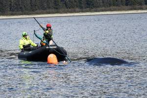
I visited the fishing town of about 800 people and many dogs a few years back. My assignment was to write about scientists studying Hubbard Glacier, which slammed the door on Russell Fiord in summer 2002, creating the largest glacier-dammed lake in the world for a few weeks until the dam broke.
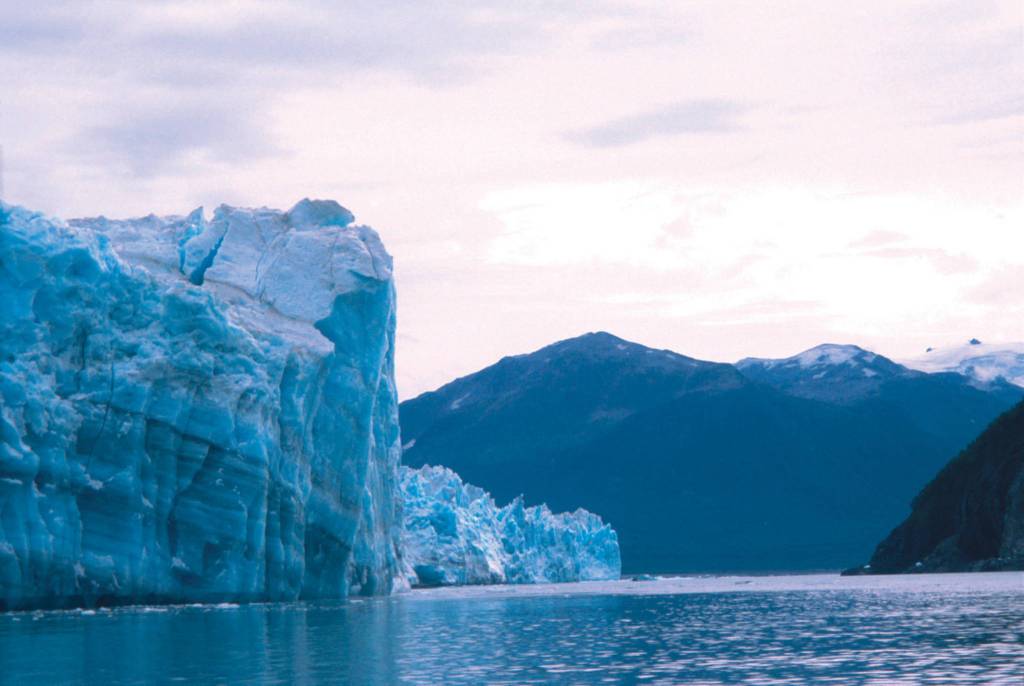
The relentless advance of Hubbard Glacier takes center stage in Yakutat, but the area surrounding the town is one of the world’s great examples of geology in action.
To the west of Yakutat, Mt. St. Elias rises like a white pyramid to an elevation of 18,008 feet in one of the world’s most dramatic transitions from sea to summit. The Yakutat block, a chunk of Earth’s crust larger in area than Pennsylvania, is responsible for forming Mt. St. Elias and the other mountains of the St. Elias and Chugach ranges.
The Yakutat block formed somewhere off the west coast of the U.S. or Canada and, in a trip that took a few million years, rode the top of the Pacific plate to its present location along Alaska’s southeast coast. The Yakutat block rams into the North American plate at a speed of about two inches each year, twice as fast as India is shoving into Asia to form the Himalaya, according to GPS measurements by researchers with the Geophysical Institute at the University of Alaska Fairbanks.
Near West Nunatak Glacier, about 30 miles northwest of Yakutat, scientists including Chris Larsen used GPS receivers to find a hillside rising toward the sky at one-and-one-third inches each year. The rise is due the ground rebounding from the weight of melting glaciers, and to a lesser extent earthquake activity.
Along with the Glacier Bay area to the south, the land around Yakutat is rising faster than any other place measured, except for scattered volcanoes that are inflating with molten rock.
Running through the mountains east of Yakutat is the Fairweather fault, a weak point in Earth’s crust and a tectonic feature that would be famous if it cut through a more populated area. The side-to-side slippage of the Earth along the Fairweather fault is about one-and-three-quarters inches each year, compared to one-and-one-half inches along the San Andreas fault in northern California.
These rapid rates of stress buildup within Earth’s crust and complex interactions between the faults, Earth’s plates, and the Yakutat block cause huge earthquakes, such as three giants that hit the area in September 1899. The earthquakes, occurring a few days apart, had magnitudes of 7.8, 8.2, and 8.6. After the 8.6 earthquake, an area near Haenke Island north of Yakutat rose about 47 feet.
Along with all the Earth’s moving and shaking near Yakutat, the mountains to the southeast of town may be the wettest place on the planet. There are no rain gauges in the high country between Glacier Bay and the Pacific Ocean, but a computer weather model based on real data from 1961 to 1990 predicted the area should receive more than 450 inches of precipitation each year. That would top Alaska’s current champion, Little Port Walter in Southeast, which gets more than 220 inches of precipitation, and the world champ, Mount Waialeale in Hawaii, which gets more than 400 inches of rain per year.
Yakutat is also the Alaska leader in days with precipitation of .01 inches or more, according to the Alaska Climate Research Center. Yakutat has 235 days with at least that much rain and snow, topping Annette at 223 and Cold Bay with 225.
Along with the largest, the fastest, and the wettest, Yakutat is also home to some of Alaska’s smallest. Walking outside a bunkhouse one night, I watched a little brown bat pick insects out of the night air. It worked its delicate wings less than 30 miles from a glacier that is larger than Rhode Island.
• Since the late 1970s, the University of Alaska Fairbanks’ Geophysical Institute has provided this column free in cooperation with the UAF research community. Ned Rozell (ned.rozell@alaska.edu) is a science writer for the Geophysical Institute.