Kayaking into a scientific adventure
Published 6:00 am Friday, October 5, 2018


We had no idea what to expect, and the feeling was absolutely exhilarating.
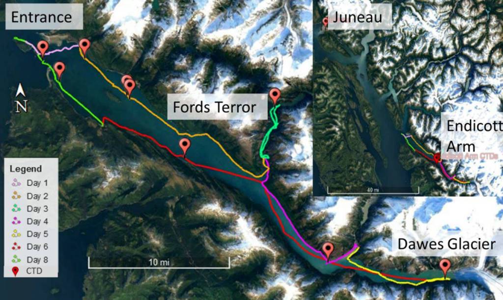
Our goal was simple: from July 23-30 we would kayak the ambit of Endicott Arm, sampling seawater along the way. A large body of evidence has shown rapid environmental change among many fjords, yet few studies have investigated Endicott Arm. Kayaks can access places many research ships cannot (including shallow nearshore fish nurseries), enable observation of sound-sensitive animals like porpoise, are cost effective, carbon neutral, can be used for rapid deployment, and offer a sense of adventure not otherwise possible. But kayaks have minimal storage space for necessary supplies including food, tents, and first-aid, not to mention scientific equipment. Also, unlike research vessels where the expedition can continue if someone becomes sick or injured, the kayak expedition ends. Still, our curiosity drove us to see what type of data we could acquire, if any.
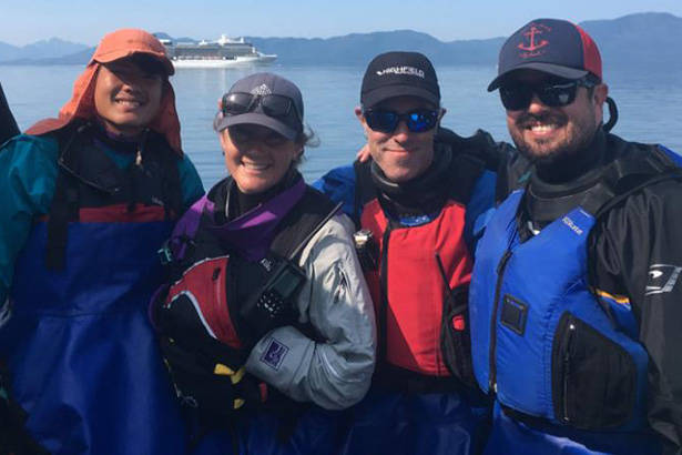
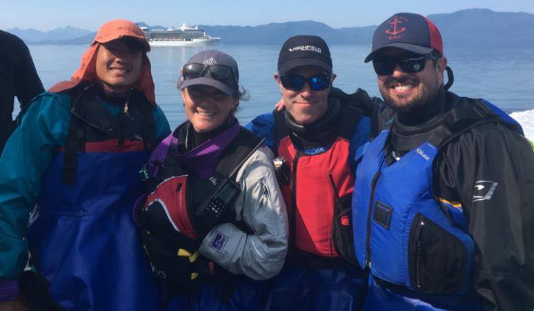
Hallie Heath, a coastal steward from Monterey Bay, California, led the route planning and safety logistics. She reviewed maps, campgrounds, tidal changes, seasonal weather patterns, experience of the scientists (none), kayak capacities, and transportation options to Holkham Bay. She decided our crew should be kept to four, bringing along her friend Greg Watson, an experienced kayaker and skilled carpenter.
Using my halibut rod, I connected a Sontek Castaway Conductivity, Temperature, and Depth (CTD) instrument. Instead of fish, CTD casts collect hydrographic data between the surface and the seafloor, including seawater temperature and salinity. If successful, I could gather important and usually inaccessible data from nearshore environments. Daniel Yee, Scripps Institution of Oceanography Ph.D. candidate with over a decade’s experience studying phytoplankton, brought a Handy Duet field microscope to record images of plankton. He collected plankton from the surface with a net and from deeper waters using a Niskin bottle. Our instruments and cameras required portable power banks, solar panels and a water turbine to recharge. Greg took on the task of packing everything and somehow managed to fit it all into the kayaks. Dan and I felt lucky that our excessive equipment and our inexperience didn’t scare away our partners.
We navigated just over 100 miles, averaging about 13 miles a day. On day six, we opted to explore our limits and paddled from Dawes Glacier to Sanford Cove (over 28 miles).
We had prepared for the cold and wet weather typical of the Tongass National Forest, but instead we paddled under cloudless skies and a relentless sun — weather that may become the norm thanks to climate change. The camping was atypically easy, with wildlife largely absent from land and sea. We did spot humpbacks feeding at the entrance of Endicott Arm (our entry and exit point). As we entered Fords Terror, we saw our first and only bear in the early morning, and had a porpoise join us for a few miles. Some harbor seals had hauled out on icebergs, and eagles perched on rafting icebergs for a free ride (although beautiful, rafting icebergs can also be deadly; we avoided more active areas). Salmon, however, were not seen in the creeks and rivers nor at sea.
Preliminary analysis shows a thermocline (a sharp contrast between warm surface water and colder, deeper waters) present at most locations in the fjord. The unusually persistent summer sunlight warmed the top layers of the fjord and may, at least temporarily, impact important species such as the salmon we expected to find (and eat!). While a few small areas had the cold nutrient-rich water at the surface, thermoclines existed throughout the rest of the fjord (These same thermoclines allowed us to swim in bathing suits as icebergs floated by). We couldn’t help but wonder, is this a glimpse of the “new normal” for Endicott Arm?
The Juneau Empire reported July was the warmest month ever recorded in Southeast Alaska. A rapidly changing climate calls for effective monitoring of sensitive environments that house valuable Alaskan resources. Kayak oceanography may provide a complimentary tool to meet upcoming needs for a rapid, low-cost surveying system, accessing tough-to-reach areas and that allows participants a rewarding and fun experience! Connect with University of Alaska Southeast on social media to learn about future training opportunities for using sea kayaks for science.
Dr. Navarro is an Assistant Professor at University of Alaska Southeast and affiliate of the UAS Sustainability Committee and lives in Juneau. “Sustainable Alaska” is a monthly column, appearing on the first Friday of every month. It’s written by UAS Sustainability Committee members who wanted to promote sustainability. The views expressed here do not necessarily represent the views of the University of Alaska Southeast.