Weather Service issues flood watch as Juneau awaits glacial outburst
Published 9:23 am Wednesday, July 18, 2018


The National Weather Service has issued a flood watch for Mendenhall Lake and Mendenhall River as Suicide Basin drains into the lake.
According to the watch notice, issued at 8:48 a.m. Wednesday, flooding is expected to begin Thursday and peak around midnight Friday morning.
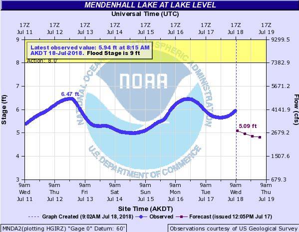
At 9 a.m. Wednesday, the hydrological gauge at Mendenhall Lake measured a stage of 6 feet. Flood stage is 9 feet. The flood is expected to crest at 12 feet when it hits its peak.
If that happens, it would be a new record, topping the old mark set in July 2016 by another Suicide Basin-driven flood.
The Weather Service is cautioning that not much is known about this particular flood, which means the height of the crest and its timing is uncertain.
While glacial outburst floods from Suicide Basin have been occurring regularly for the past eight years, this year’s cycle was interrupted when a chunk of ice a fifth of a mile long splashed into the basin.
That event appears to have blocked normal drainage channels, and now the basin is emptying only because it overtopped its icy dam. The water is now eroding that dam, allowing more to escape and flow downward.
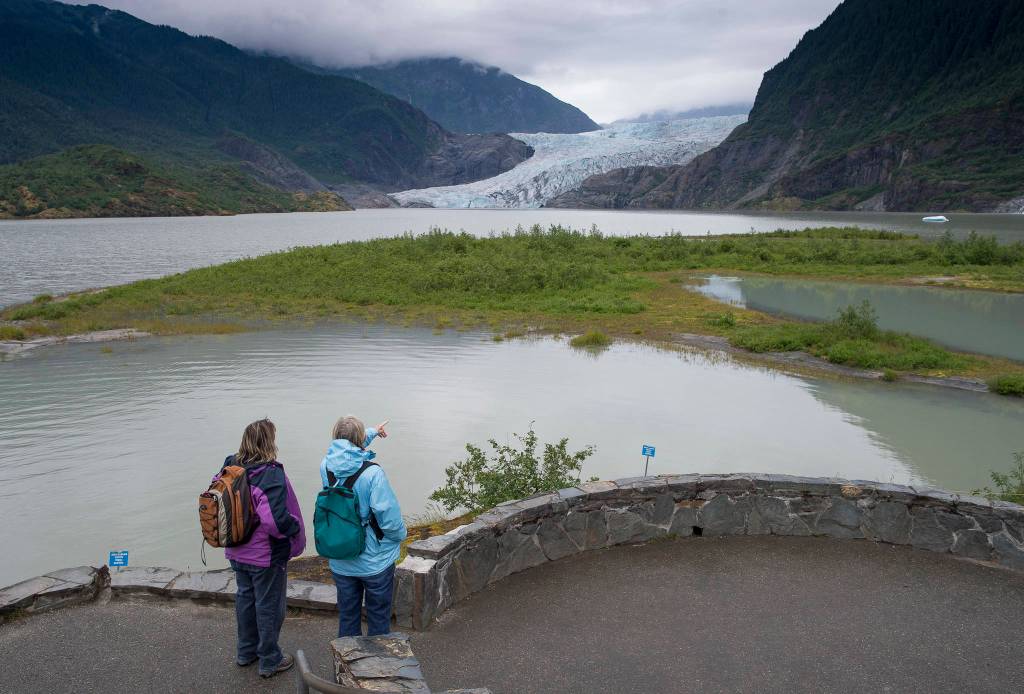
Aerial photographs and videos show the water flowing from the basin — which is in an eastern side lobe of the Mendenhall Glacier — and along the boundary between the glacier and the rocky cliffs that define its border. The water flows into (and presumably beneath) the glacier at some point before Mendenhall Lake. Subglacial channels are carrying the water to the lake.
Impacts of this year’s flooding will be determined by the ultimate height of the flood. When the lake stage reaches 9.1 feet, water will cover West Glacier Spur Road between Skaters’ Cabin and the West Glacier trailhead, according to the Weather Service. At 9.4 feet, homes along View Drive will see their yards flooded. At 10 feet, Mendenhall Campground will be flooded. At 11 feet, View Drive will be flooded, and some homes will experience significant flooding.
• Contact reporter James Brooks at jbrooks@juneauempire.com or 523-2258.