The thin line between Alaska and Canada
Published 3:00 am Friday, July 12, 2019


Marked by metal cones and a clear-cut swath 20 feet wide, Alaska’s border with Canada is one of the great feats of wilderness surveying.
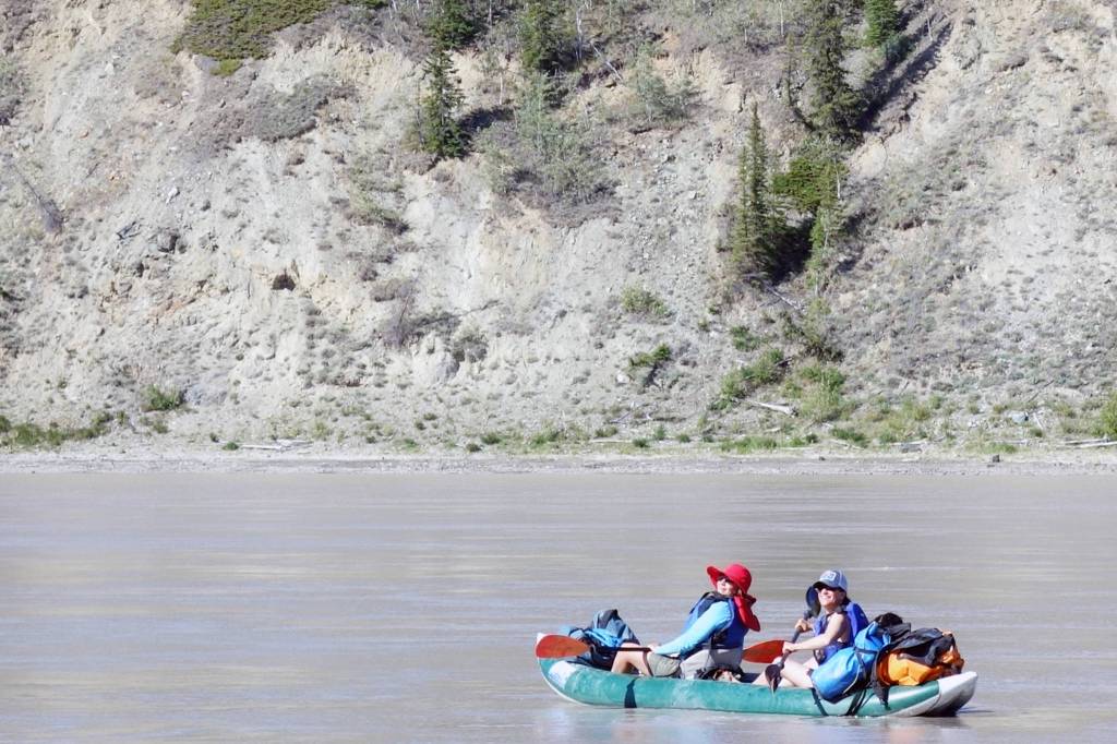
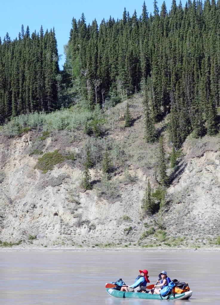
The boundary between Alaska and Canada is 1,538 miles long. The line is obvious in some places, such as the Yukon River valley, where crews have cut a straight line through forest on the 141st Meridian. The boundary is invisible in other areas, such as the summit of 18,008-foot Mt. St. Elias.
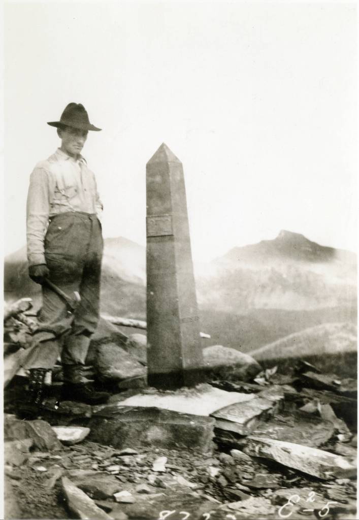
In the early 1900s, workers cemented boundary monuments made of aluminum-bronze and standing 2.5-feet tall along much of the border’s length.
The country that makes up the border is some of the wildest in North America. Spanning a gap equal to the distance between San Francisco and St. Louis, the line of the border touches just one town: Hyder in Southeast Alaska.
Starting in 1905, surveyors and other workers of the International Boundary Commission trekked into this wilderness to etch into the landscape a brand-new political boundary.
The border was unknown in 1867, when the U.S. purchased Alaska from Russia for two cents an acre. An 1825 treaty between Russia and Great Britain, then the controlling power of Canada, described the boundary as following a range of mountains in Southeast parallel to the Pacific Coast, but in some places no such mountains existed.
The undefined border in Southeast became a problem during the Klondike gold rush of the late 1890s, when Canadian officials requested ownership of Skagway and Dyea, which would allow Canadians access to the Klondike gold fields without crossing American soil.
To settle the dispute in 1903, President Theodore Roosevelt gathered a committee of three Americans, two Canadians, and England’s chief justice. The British representative, Lord Richard Alverstone, sided with the three Americans, and the committee rejected the Canadian claims by a vote of four to two.
With a boundary agreed upon, the next step was the immense job of surveying and marking it. In 1904, crews of men from both the U.S. and Canada started work on the panhandle of southeast Alaska. They used boats, packhorses and backpacks to reach the remote mountains of Southeast.
In a typical effort, a Canadian crew led by H.S. Mussell in 1911 searched for a boundary point near Mount St. Elias. The crew landed a ship in the rough surf of Disenchantment Bay and transferred hundreds of pounds of gear to the foot of a glacier. Assisted by 10 Natives, the crew cut a trail across tangled brush, and set up an aerial tramway across a glacial stream that the Natives thought too dangerous. Without local escorts, the crew made its way up Malaspina Glacier using sleds and identified the boundary point on an unnamed peak.
By 1913, crews farther north had marked the straight line of the 141st Meridian from the Arctic Ocean to the south side of Logan Glacier. They left behind 202 obelisks — shaped like tiny Washington Monuments — that now line the border.
Thomas Riggs was a crew chief for the International Boundary Commission. He spent eight summers, which he called the happiest of his life, marking the border. After his crew tied in the final section of border east of McCarthy in 1914, he described his feelings for the raw wilderness work with a short telegram to his supervisor at the end of August 1914:
“REGRET MY WORK COMPLETED.”
• Since the late 1970s, the University of Alaska Fairbanks’ Geophysical Institute has provided this column free in cooperation with the UAF research community. Ned Rozell ned.rozell@alaska.edu is a science writer for the Geophysical Institute. A version of this column ran in 2001.