New maps show updated landslide and avalanche risk downtown
Published 10:30 pm Wednesday, July 21, 2021
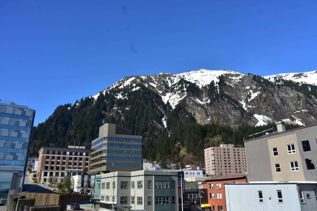


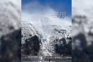
More structures and swaths of land in downtown Juneau are located in avalanche or landslide-prone areas, according to new maps commissioned by the City and Borough of Juneau and paid for by a grant from the Federal Emergency Management Agency.
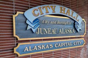
City officials hosted a virtual neighborhood meeting Thursday night to share updated avalanche and landslide maps. CBJ’s current hazard maps, adopted in 1987, are based on maps created in the 1970s. CBJ contracted with Tetra Tech, a global provider of consulting and engineering services, to make the new maps.
“The point is to introduce the new maps for greater public safety,” said Teri Camery, senior planner and project manager in CBJ’s community development office. “The current maps are from the 1970s. We know they are outdated, and the storms and landslide in Haines last year made the need for that critically clear.”
Rita Kors-Olthof, Tetra Tech’s senior geotechnical engineer for the Arctic Region, presented the team’s findings on landslides. She said that historical events all seem associated with water and heavy rainfall.
“That’s why it’s important to know what we are dealing with and where your trouble spots are,” she said.
Update: Masks required in city facilities, encouraged in other indoor spaces
More precision
The new maps are more precise and offer a better view of the risks, officials said. The older maps are low-resolution and combine landslide and avalanche areas into a single map that identifies moderate and severe hazard areas.
Officials said that creating distinct maps for avalanches and landslides offers greater insight.
“Avalanches and landslides are completely different processes,” said Alan Jones, who worked on the project as part of the Tera Tech team, and identified 52 distinct avalanche paths in the study area.
Jones is a professional engineer and avalanche professional with 25 years of avalanche and geotechnical engineering consulting experience. He’s currently the principal snow avalanche specialist at Dynamic Avalanche Consulting out of British Columbia.
He said that the new maps were drawn first, and property lines were later overlayed. Jones explained that this process allows for a better view of the risk.
“The mapping was done agnostic of property lines,” he said. “If a line goes through a house, that’s not something we planned. Following property lines is not considered best practice.”
Creating the new maps
Team members said multiple inputs were used to make the new maps, including previous studies of the area, aerial photos going back to the 1940s, historical reports from newspapers and state archives and field investigations of the area.
Scientists on the team also used Lidar images to evaluate the risk. According to the National Oceanography and Atmospheric Administration, Lidar stands for light detection and ranging and “is a remote sensing method used to examine the surface of the Earth.” Additionally, the team also used avalanche modeling and snow climate studies in the assessment.
“We used high-resolution images with a high level of confidence. The level of accuracy is considerably higher for this study than in previous studies, said Vladislav Roujanski, Senior Geologist for the Arctic Region at Tetra Tech.
Camery said the city received the maps from the project team in August of 2020 and shared them with about 20 local, regional, and state experts and FEMA for review and vetting.
“The scientific analysis really held up to scrutiny. The science is considered to be rock solid,” she said.
Salmon returns set records in Bristol Bay while Southeast runs struggle
Regulatory process to follow
City officials said that there are currently no proposed regulatory changes beyond adopting the new map. Conversations about changes will begin next year and will include a public process.
CBJ planning manager Alexandra Pierce acknowledged that the new maps could affect homeowners but said the city didn’t know what those effects will be.
“We don’t know what the impact on the real estate market will be. We don’t know what this means for assessment or insurance,” Pierce said. “The regulatory process is coming next year. We will use these maps to guide the conversation around that.”
Next steps
On Tuesday, Aug. 10, the CBJ Planning Commissions will review the maps and hold a public hearing of a draft hazard assessment. In September, the CBJ Assembly will review the maps and hold a public hearing.
Additional information about the project and a link to the updated maps are available on the special project’s portion of the Community Development department’s website at juneau.org/community-development/special-projects/landslide-avalanche-assessment.
Officials said that a recording of the July 21 meeting would be available on the site.
• Contact reporter Dana Zigmund at dana.zigmund@juneauempire.com or 907-308-4891.