Authorities, residents brace for annual flooding
Published 4:39 pm Thursday, July 19, 2018


At a little after noon Thursday, U.S. Forest Service Officer Dave Zuniga stood on Skaters Cabin Road, directing drivers away from the area.
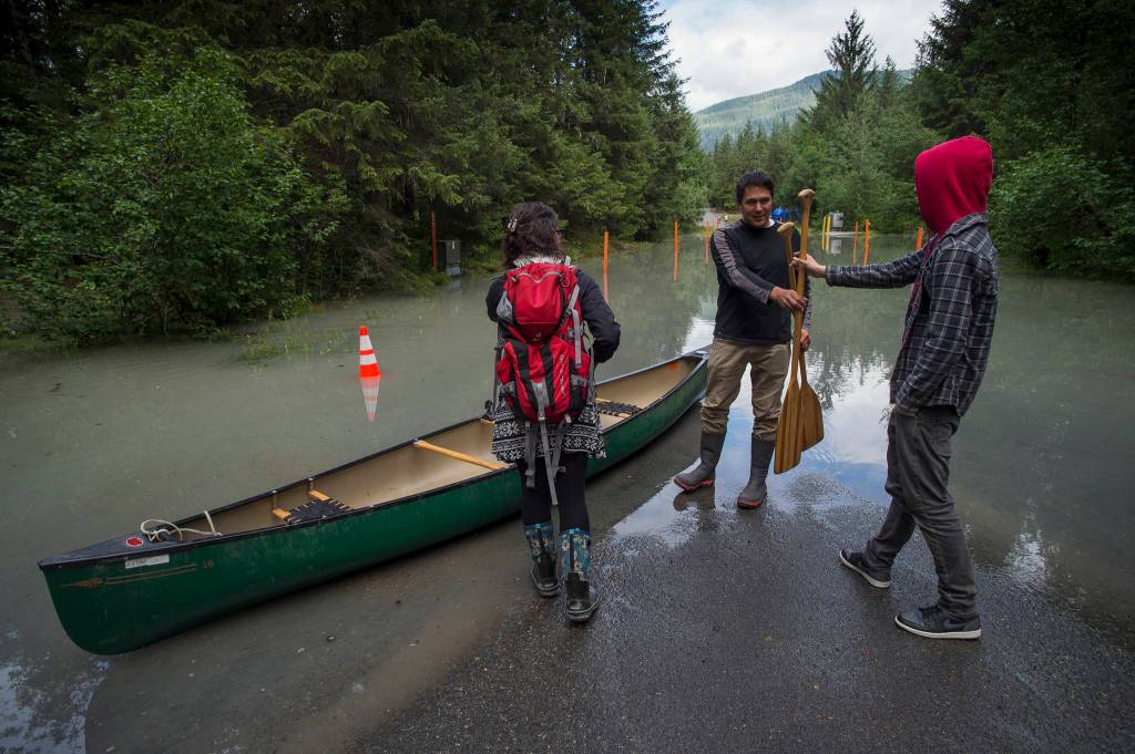
Suicide Basin, in a side lobe of the Mendenhall Glacier, had begun its long-awaited release of water Monday evening and Mendenhall Lake and River were flooding.
[Weather Service issues flood watch as Juneau awaits glacial outburst]
The Forest Service evacuated about a dozen people from the Mendenhall Campground on Thursday morning, Recreation Program Manager for the Juneau Ranger District Ed Grossman said, and Zuniga was there to make sure people stayed away from the campground, Skaters Cabin and the West Glacier Trail.
A man in a Dodge Ram pickup truck pulled up to the orange cones blocking the road. He had come to see the flood.
“I don’t see the water!” the man in the truck yelled.
“It’s coming,” Zuniga said calmly. “It’s right around the corner.”
For some in the area, including View Drive resident Don Habeger, the water had already arrived.
Habeger has lived in his home since 2002 and has become accustomed to the recent glacial floods, also known as jökulhlaup, that have been occurring once or twice a year since 2011. He stood at the back of his carport, eating a piece of Costco pizza on an orange plate and explaining as he stood about a foot away from the water that was quickly making its way to the house.
“If we did nothing, the garage would get about eight inches of water at the height of the event,” Habeger said. “We’re trying to mitigate that by putting in sandbags and a little dam there. This year we’ll also have, essentially a two-inch gas-powered pump.”
Flooding as expected
The flooding was at just above nine feet at that point. The National Weather Service initially expected it to approach 12 feet — which would break the previous record set in 2016 — by 10 p.m. Thursday. But Mendenhall River crested early at 4:30 p.m. Thursday at 10.9 feet. The water level began falling right away after that, though significant flooding was still underway.
NWS Senior Service Hydrologist Aaron Jacobs was monitoring the flooding in comparison with the 2016 flood, and said the pace of the flooding was originally “in lockstep” with the pace in 2016. He said that long before the flood is imminent, organizations are working together to monitor the state of the glacier to try and predict how severe the jökulhlaup might be that year. He said UAS and UAF help out in this aspect.
“It’s not just one entity,” Jacobs said. “It’s a big team effort.”
The organizations communicating with each other in the case of flooding like this include NWS, the U.S. Geological Survey, USFS, the City and Borough of Juneau, Capital City Fire/Rescue, the Department of Transportation and Public Facilities and even the University of Alaska Southeast and University of Alaska Fairbanks.
CBJ Emergency Program Manager Tom Mattice said the coordination has gotten easier over the years.
“It’s getting to where we’ve done it enough now where everything just kind of falls into place,” Mattice said.
Preparing in advance
Long-term preparation doesn’t just fall on weather forecasters. John Neary, the director of the Mendenhall Glacier Visitor Center, said they have raised the level of the popular Nugget Falls trail specifically as a result of the jökulhlaup.
In previous years, he said, people would still walk down that trail even as it flooded. He said people would go off the trail to get to higher ground so they could get out of the water but still walk along basically the same path.
In order to cut down on people walking around and damaging the wildlife that grows along the trail, the Forest Service (which runs the visitor center) used gravel to raise the height of the trail, Neary said.
DOT&PF Public Information Officer Aurah Landau said that DOT&PF is responsible for two bridges over the Mendenhall River — the Brotherhood Bridge and the one that carries Mendenhall Loop Road over the river — and that both of those bridges have been thoroughly inspected during the past two years.
Grossman said they evacuated the Mendenhall Campground before the flooding began and found other places around town for people to set up their tents. He said they told guide companies to stay off the lake.
Grossman said they also had to contact people who had reserved spots at the campground over the weekend and tell them they might have to make other plans. Still, he said there’s a real possibility that the campground will be back open by Friday night. Multiple authorities said that as well, that after the flooding peaks it usually abates rapidly.
Habeger has a front-row seat, and said he has learned the river’s language over the years.
“I think the river can talk to you,” Habeger said. “You can see the energy coming down the river and the waves building up. When it hits the peak, you can almost watch those waves begin to calm and then everything starts receding.”
• Contact reporter Alex McCarthy at 523-2271 or amccarthy@juneauempire.com. Follow him on Twitter at @akmccarthy.