Glacial lake outburst swells Salmon River near Hyder
Published 9:30 pm Wednesday, July 9, 2025


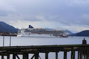
Glacial lake outburst events caused a spike in the water levels of the Taku River in early July and are responsible for increased erosion on the banks of the Salmon River near Hyder on Wednesday. Mendenhall River has yet to release as increased precipitation fills Suicide Basin.
The National Weather Service issued a flood advisory for the area around Salmon River near Hyder on Wednesday. The advisory expired Thursday night.
The U.S. Geological Survey monitors water height of the Mendenhall and Taku rivers in the Juneau area, while the National Weather Service observes the Salmon River near Hyder.
About 9:30 p.m. Wednesday, a National Weather Service spotter reported elevated water levels, and murky, rough water as well as bank erosion, causing trees to fall into the river. Thursday afternoon, the NWS recieved a report of icebergs in Salmon River. These conditions indicate a glacier dammed lake outburst has begun on a glacier that feeds into the river, according to NWS lead meteorologist Brian Bezenek.
Water accumulates in glacial lakes throughout the summer from precipitation and meltwater. A glacial lake outburst occurs when an ice dam fails, releasing the water suddenly and often flooding nearby rivers.
According to Bezenek, the Salmon, Taku, and Mendenhall are the only three rivers in Southeast that are monitored for glacial outburst events due to their proximity to Juneau.
Unlike the Taku and Mendenhall rivers, the Salmon River is isolated from human infrastructure. Bezenek said the only concern is flooding on the highway that runs alongside the Salmon River.
This is the second glacial outburst release near Juneau this summer. On June 30, the NWS reported a glacier-dammed lake on the Tulsequah Glacier had released, increasing water levels on the Taku River, but no flooding. The water level crested at almost 41 feet early on the morning of July 1, then steadily decreased.
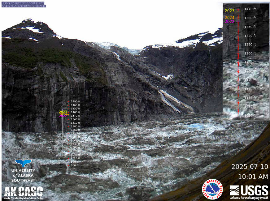
The most infamous glacial outburst flooding in Juneau is on the Mendenhall River, due to ice dam failure in Suicide Basin. Record setting glacial outburst floods in the Mendenhall River occurred the past two years. Last year’s flood damaged more than 300 homes. Based on the current Suicide Basin fill rate and height of the spillway, NWS estimates Suicide Basin will fill on Aug. 14.
However, the NWS predicted heavy rainfall starting Thursday afternoon, which is expected to continue through Friday, due to a potent frontal system creating an atmospheric river — a plume of moisture that results in heavy rain over a prolonged period. The NWS 7-day forecast predicts that precipitation will continue until Monday.
“It will help fill the basin up a little bit more,” Bezenek said. “Rain at that elevation will also add to the possibility of snow melt or ice melt on any of the glaciers as well, which will also help fill the basin up, and then it’s just a matter of time on when the mechanics for creating its release occur.”
The City and Borough of Juneau and individual residents living near the river are preparing for this year’s flood. However, when the basin will release and how protected the neighborhood near the river will be when it does remains uncertain.
USGS tracks the water level in Suicide Basin using time-lapse cameras with elevation scale bars and precise laser range finders, looking for changes in water level, according to the Juneau Glacial Flood Dashboard. Water from the basin typically reaches Mendenhall Lake one to two days after drainage begins.
The NWS’s Suicide Basin Monitoring and Current Conditions page contains more information about the status of Suicide Basin.
The Juneau Glacial Flood Dashboard, created by the University of Alaska Southeast and the Alaska Climate Adaptation Science Center, is another comprehensive resource for flood maps, basin footage, and the history of Juneau floods.
• Contact Natalie Buttner at natalie.buttner@juneauempire.com.