DOT&PF has a plan to reduce avalanche hazard near Juneau amid record snowfall
Published 5:00 am Thursday, January 1, 2026
The Alaska Department of Transportation and Public Facilities plans to trigger a controlled avalanche over Thane Road around noon Jan. 1, in an effort to reduce avalanche hazard above the roadway. The plan comes as the City and Borough of Juneau rolls out changes to how it communicates emergency risk to residents.
CBJ issued an avalanche warning Tuesday afternoon for areas above Behrends Avenue and Thane Road, due to a growing snowpack and changing conditions. DOT&PF closed Thane Road overnight Tuesday due to increased avalanche hazard to the roadway, and will keep it closed during the controlled trigger.
The warning follows a historic storm. On Wednesday morning, officials measured 46.8 inches of snow at Juneau International Airport over a four-day period, breaking the four-day snowfall record that had stood since 1963. December 2025 is officially the snowiest December on record, according to the National Weather Service Juneau.
Hazardous avalanche mitigation plan
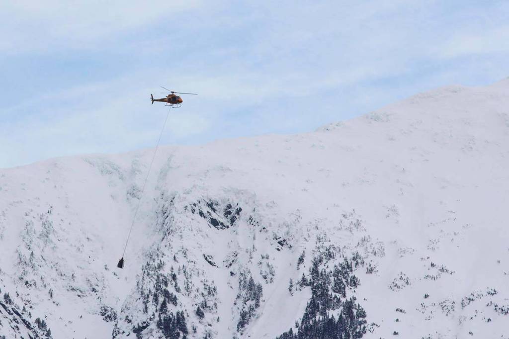
DOT&PF plans to fly over the snowpack above Thane in a helicopter at about noon to trigger the avalanche, according to Pat Dryer, avalanche specialist for DOT&PF. They will be using a DaisyBell — a machine that blasts hydrogen and oxygen — or explosives.
The method used depends on the characteristics of the snow, a decision to be made right prior to the mission.
Snow pack structures, and their avalanche risk, vary from year to year, Dryer said.
“We had a prolonged period of cold, dry weather leading up to this big snowfall event, which generally leads to a weak snow pack structure, and what that means is that it’s just generally not supportive of new snow that’s coming in,” Dryer said.
DOT&PF focuses its mitigation efforts on slopes where avalanches have the size and potential to reach the roadway. While Mount Juneau and Mount Roberts are geographically similar, Dryer said local conditions can differ, depending on the weather, between the local wind direction, between snowfall amounts.
A new model for staying informed
CBJ is shifting how it communicates emergency information to the public.
Ryan O’Shaughnessy, CBJ’s emergency programs manager, said the city is moving away from a five-level hazard scale in favor of a simpler model.
“Folks might remember from this past summer, some of our messaging around evacuation for the flood was centered on the idea of a Ready, Set, Go mentality,” O’Shaughnessy said.
Under the new system, the current avalanche warning is at the “Set” level, meaning conditions are dangerous and residents should be prepared to act quickly if needed.
There is a large snowpack above the Behrends Avenue and Thane Road subdivisions, and officials say changing weather could increase the risk rapidly.
“With changes in the weather, those could turn into more hazardous conditions really quickly,” O’Shaughnessy said. “So we really appreciate everybody being prepared.”
He said preparedness includes having a go-bag ready, knowing evacuation routes, and understanding risk by location. Residents can use CBJ’s “Know Your Risk” map by entering their address to see where their property falls within the avalanche study area.
O’Shaughnessy said that signing up for CBJ emergency alerts is the most reliable way to stay informed.
“That is the absolute best way to stay in the know on what kind of hazards we’re currently experiencing,” he said.
Correction: This story has been corrected to state that the four-day snowfall record measured at the airport was 46.8 inches, not 16 inches. Sixteen inches of snow was measured in just 24 hours. The Empire’s regret for this error is deep, much like this week’s snowfall.