Breaching a gap of 3,296 miles: Iceland’s experience with jökulhlaups
Published 9:30 pm Thursday, November 7, 2024


REYKJAVÍK, Iceland — The record glacial outburst floods that damaged hundreds of homes in Juneau over the past two years are known as jökulhlaups in Iceland, where they have posed a threat to communities for more than 1,100 years.
With Juneau now seeking ways to protect itself from such floods, the generations of jökulhlaups in Iceland and communities’ responses there can offer Juneau a torrent of practical knowledge.
“We have fairly similar experiences,” said Þorsteinn Þorsteinsson, a glaciologist at the Icelandic Meteorological Office.
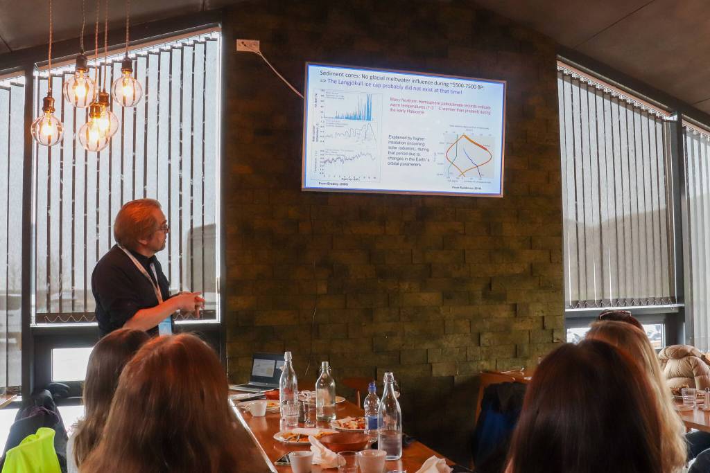
In a presentation following the annual Arctic Circle Assembly in Reykjavík, he discussed the threat jökulhlaups have posed to communities since the settlement of Iceland 1,150 years ago. The Icelandic term for the glacial outburst floods — which have been an annual occurrence in Juneau since 2011 — has been adopted worldwide in glaciology terminology.
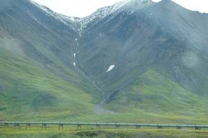
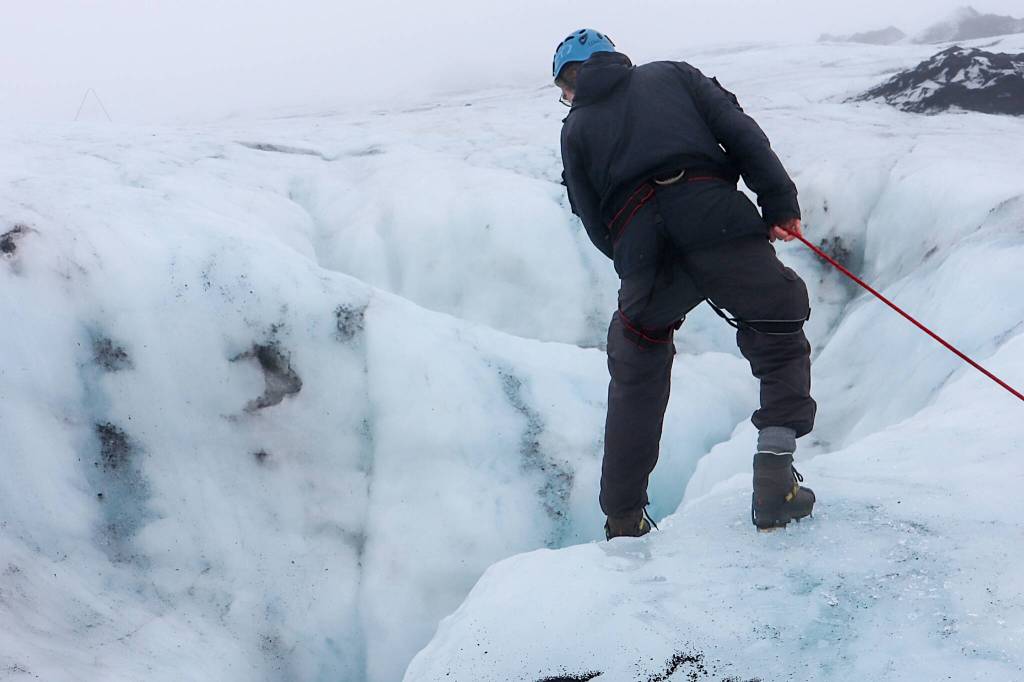
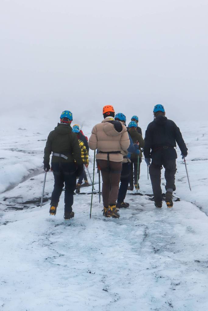
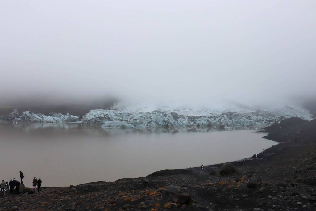
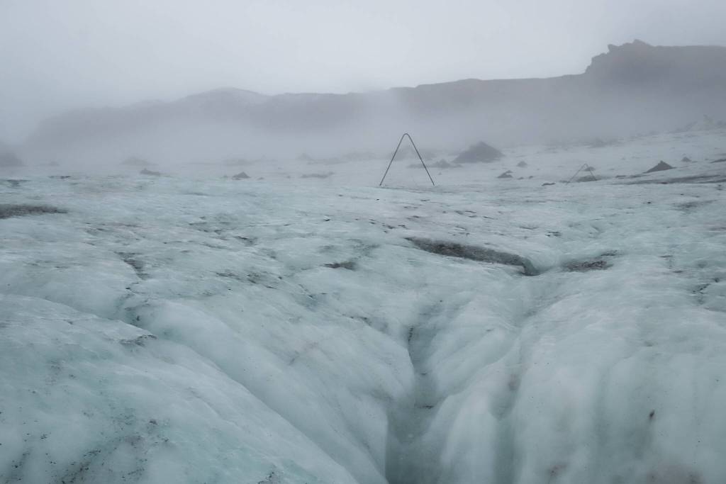
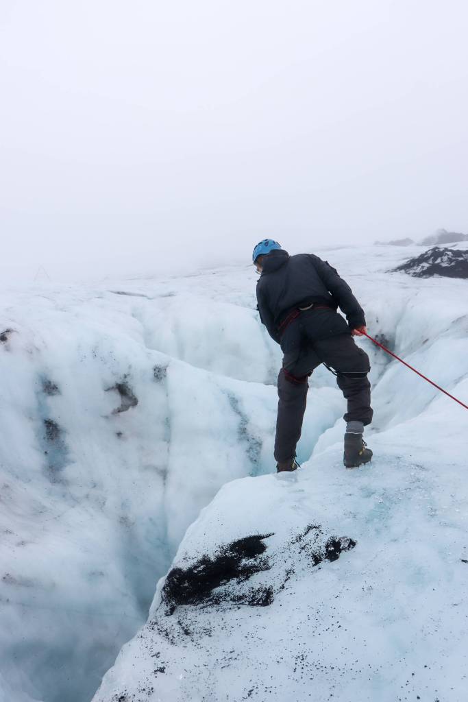
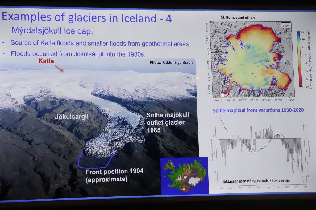
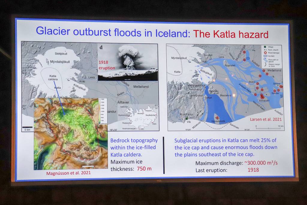
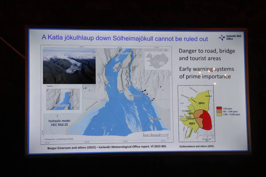
After the three-day Assembly in mid-October, Þorsteinsson led a hike to the Sólheimajökull glacier between the Katla and Eyjafjallajökull volcanoes. Sólheimajökull is an outlet glacier of the larger Mýrdalsjökull ice cap, which lies atop the Katla caldera. The glacier is about 16 miles from Vík í Mýrdal, a community of 639 people in southern Iceland.
In Iceland, alerts and evacuation plans were developed, and levees were built in the 20th century through government-funded programs. The Juneau Assembly moved toward a similar approach when it voted on Oct. 22 to spend up to $2 million to install military-grade flood barriers provided by the U.S. Army Corps of Engineers.
The largest flood barrier in Iceland was built on the Skeiðarársandur plain south of the Vatnajökull ice cap in connection with the completion of the Ring Road around Iceland in 1974.
“Before that, it had not been possible to complete roads and bridges there since the sandur plain repeatedly was inundated by jökulhlaups,” Þorsteinsson said. “Levees built then guided glacial meltwater under the 900-meter-long bridge over the Skeiðará river. But in 2009, the Skeiðarárjökull outlet glacier from Vatnajökull had retreated so much that the river stopped flowing in its old course, and the bridge was standing on empty grounds.”
Þorsteinsson said protective walls to stop lava flow have also been built in several areas in Iceland.
Along one side of Juneau’s Mendenhall River, the U.S. Army Corps of Engineers recommended a levee of up to four miles where most of the homes are. But there are still many questions about the levee’s potential impacts on homeowners’ properties and what share they may be forced to pay, according to the Juneau Assembly.
Apart from building levees, which have proven successful in Iceland, preventive measures are near impossible, Þorsteinsson said. This is due to the sheer volumes of water and the inaccessibility of the subglacial and, in some cases, marginal lakes from which the floods emerge.
“But there was one example of a human-induced jökulhlaup, in which we probably released water from a subglacial lake, which meant that the jökulhlaup was smaller than it would have been had we not — accidentally — done this,” he said. “We were doing hot-water drilling into one of the subglacial lakes beneath Vatnajökull in 2015 when we hit an englacial water body that then suddenly rushed water down the borehole and into the subglacial lake. A jökulhlaup from the lake started in the immediate aftermath.”
An outburst flood in Iceland triggers an emergency alert and evacuation notice for everyone in the vicinity. The cellphone notifications are updated throughout the flood’s progression, according to Þorsteinsson. People regularly check the Icelandic Meteorological Office’s website for updates, just as people in Juneau utilize the National Weather Service Suicide Basin monitoring page. Juneau has also implemented an emergency phone alert system that allows residents to opt in for certain notifications and automatic location-based alerts for urgent situations.
The outburst floods in Iceland sometimes occur regularly, “so we can sort of predict reasonably well when they are likely to occur,” Þorsteinsson said. “But we have to take into account that the behavior changes with time.”
A notable difference is most communities in Iceland are far enough away that when a jökulhlaup does occur, it doesn’t pose a significant threat like it does to Juneau homes near the Mendenhall River.
Þorsteinsson said people learned to live with the hazard early on and did not settle in affected areas.
“The danger to inhabited areas in Iceland is very limited because the country is sparsely populated,” he said. “But still, there are some recreation areas where you have to be on alert all the time.”
When new lagoons form at the glacier margins due to the retreat of a glacier, a sudden outburst can occur where no one thought there was a danger before, he said.
Þorsteinsson said smaller outbursts from the Katla volcano region sometimes occur, like the one not far from Sólheimajökull glacier that surprised everyone this past summer. The flood started in Skálm east of Mýrdalsjökull.
“There was a rise in water level that was detected on automatic stations that sent data automatically,” he said. “Then that rise sort of came down again. This was on a Saturday and people said, ‘OK, is it just a small burst and then it’s over?’ And all of a sudden there was a big flood coming, and it took a different route than had been expected.”
The Icelandic Meteorological Office also provided consistent updates throughout the flood, and internal assessments were made on how to monitor moving forward.
Juneau’s jökulhlaup on Aug. 6 also took a different route than expected this year. The Mendenhall River crested at 15.99 feet — a foot higher than the worst-case forecast and exceeding last year’s high by more than a foot, according to the National Weather Service Juneau. It damaged nearly 300 homes, including many neighborhoods untouched by floodwaters last year. Þorsteinsson said the reason why a different path was taken is similar for both Juneau and Iceland.
“This is both due to changes in the forefield of the glacier where more and more sediment is being accumulated, so leading to changes in the river courses, and also due to maybe changes in the flow of the water underneath the ice before it comes out of the ice,” Þorsteinsson said.
He said the glacier fronts and thickness must be monitored carefully to avoid being taken by surprise in the future.
The flood near Sólheimajökull glacier this past summer did not cause extensive damage or accidents but alerted scientific institutions that the area needed to be closely observed.
Þorsteinsson said it’s more likely a glacial outburst flood will occur in the summer because increased surface meltwater flowing down to the bed of the glacier helps create new channels and open waterways from subglacial or marginal lakes.
“There are some places where there are subglacial lakes beneath our ice caps that fill up slowly over a year or two and even longer and then they empty out. And these have been monitored for decades,” Þorsteinsson said.
Juneau’s Oct. 21 glacial outburst flood from Suicide Basin had a lower-than-expected crest of 10.77 feet.
A National Weather Service alert noted the event was unusually late and snow was interfering with equipment used to provide readings of the basin’s water level.
Þorsteinsson said it’s common for Icelandic storms to rage for days, interfering with satellite and aerial views needed to monitor glacial outburst floods. The weather also makes it impossible to fly. However, the hydrometric stations that measure conductivity, water level, and discharge can continue to operate under adverse conditions.
Þorsteinsson said retreating glaciers can remove the threat of a glacial outburst flood by removing the dam in a particular valley, but at the same time, the opposite can occur.
Arctic Circle Assembly
The nonprofit, nonpartisan Arctic Circle Assembly is a network of international dialogue and cooperation on the future of the Arctic. More than 2,500 participants from 75 countries took part in the Assembly this year. Attendees represented governments, organizations, corporations, universities, environmental associations, Indigenous communities, concerned citizens, and others.
Þorsteinsson said he has attended the meeting since 2013 and is on the advisory board, which convenes annually on the day before the start of the Assembly. The board discusses progress and developments, each year’s assembly program, and evolving plans for future meetings.