Photos: The patterns and textures of the Mendenhall wetlands

Photos: The patterns and textures of the Mendenhall wetlands

Pay closer attention to the tiny things.

I was told there are some really interesting areas of the Mendenhall Wetlands State Game Refuge on the North Douglas Island side. I don’t spend enough time exploring alongside the ocean. There are always so much to see in the intertidal zones.

Monday evening was the beginning of Juneau’s rainy season again, but I knew I couldn’t start a habit of avoiding the rain. I went out after a half day at work. None of my adventure buddies could join me because everyone is trying to be an adult, has a job or whatever. It was super gloomy and wet. I suited up in Xtratufs and full rain gear, but still got soaked.

I’m already seeing advertisements for ski and mountaineering gear. Soon I’ll have to actually schedule getting outside in order to make it happen during the daylight hours. Let’s start a coalition of people who don’t want to work but just go hang out outside.

According to the state game refuge sign by the road, there are three trails to access this area: Nine Mile Creek Road, Nine Mile Creek and apparently the North Douglas Boat Ramp. That reminds me: I saw a dude fly fishing peacefully, and a dude running his obnoxiously loud boat up and down the Gastineau Channel shooting birds. Nice one!

A few facts about the Mendenhall wetlands:

They are growing from waste materials left by three glaciers: the Mendenhall, the Thomas and the Lemon. These areas are slowly rising as they are alleviated of the immense weight of the melting glaciers, a process called isostatic rebound.

A section of a small landing strip that was built in the 1930s protrudes into the wetlands. The Juneau airport continues to spread into the surrounding area. The U.S. Army Corps of Engineers dredged a channel from Juneau to northern Stephens Passage in the 1950s, dumping the unearthed material into the wetlands. Egan Highway was constructed through the wetlands in the 1970s. Because of all this human activity, Juneauites advocated to protect the area and established the wetlands as a refuge in the late 1970s. Nice one, Juneauites

One of the passages of water I tried to cross on Monday held onto my foot. It felt like quick sand. The mud was kind of like Oobleck, that goop you made out of cornstarch when you were little. The harder I tried to get out, the more stuck I got. I realized it’s only when you move slowly that you can get out. As I was walking back around 6.30 p.m., the sun shone through and danced around a little with the clouds. It is starting to set really early. Not a fan.

My style of photography tends to be super wide angle, grand images with big bright colors. The wetlands, at least this time of year, are brown and soupy, so I decided to pay closer attention to the tiny things, the patterns and textures. For this adventure, I wanted to look at things at more of a micro level.

My Mendenhall Wetland facts came from here: http://www.adfg.alaska.gov/index.cfm?adfg=mendenhallwetlands.main


• California-born and Alaska-bred, Gabe Donohoe is an adventurer and photographer. He is a graduate of the University of Alaska Southeast Outdoors Studies Program. His photo archives can be seen on www.gabedonohoe.com. “Rainforest Photos” photo blog publishes every other Friday in the Empire’s Outdoors section.

Solo bolder in a tall grass field. (Photo by Gabe Donohoe)

Solo bolder in a tall grass field. (Photo by Gabe Donohoe)

Waves in the sand texture. (Photo by Gabe Donohoe)

Waves in the sand texture. (Photo by Gabe Donohoe)

Water drops hang on delicate strands connecting tiny beach shrubs. (Photo by Gabe Donohoe)

Water drops hang on delicate strands connecting tiny beach shrubs. (Photo by Gabe Donohoe)

A turn in the river feeding the wetlands. (Photo by Gabe Donohoe)

A turn in the river feeding the wetlands. (Photo by Gabe Donohoe)

Eagle perches on light 19 in the Mendenhall Wetlands. (Photo by Gabe Donohoe)

Eagle perches on light 19 in the Mendenhall Wetlands. (Photo by Gabe Donohoe)

Xtratuffs in the fluffy quicksand mud. (Photo by Gabe Donohoe)

Xtratuffs in the fluffy quicksand mud. (Photo by Gabe Donohoe)

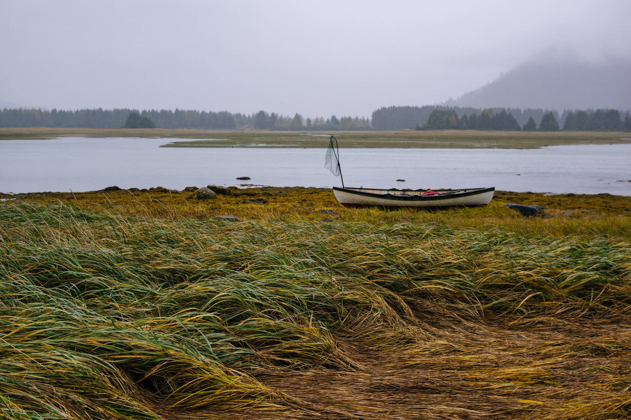
Greens, yellows, and browns in the laying down tall grass. (Photo by Gabe Donohoe)

Greens, yellows, and browns in the laying down tall grass. (Photo by Gabe Donohoe)

Birds in flight over the Mendenhall Wetlands. (Photo by Gabe Donohoe)

Birds in flight over the Mendenhall Wetlands. (Photo by Gabe Donohoe)

Falling tall grass in the Mendenhall Wetlands.

Falling tall grass in the Mendenhall Wetlands.

Rain drops as it hits the face of the muddy water. (Photo by Gabe Donohoe)

Rain drops as it hits the face of the muddy water. (Photo by Gabe Donohoe)

Cracked, segmented mud create geometric shapes in the ground. (Photo by Gabe Donohoe)

Cracked, segmented mud create geometric shapes in the ground. (Photo by Gabe Donohoe)

<span class="neFMT neFMT_PhotoCredit"><span class='IDappliedStyle' title='InDesign: Regular'>Photos By</span><strong> Gabe Donohoe</strong> | For the Juneau Empire</span>                                <span class="neFMT neFMT_PhotoCredit"><span class='IDappliedStyle' title='InDesign: Light'>Leaves turn red in the small beach brush. </span></span>

Photos By Gabe Donohoe | For the Juneau Empire Leaves turn red in the small beach brush.

More in News

(Juneau Empire file photo)
Aurora forecast through the week of Nov. 3

These forecasts are courtesy of the University of Alaska Fairbanks’ Geophysical Institute… Continue reading

Tesla Cox (left) explains the damage done to her home and possessions by record flooding Aug. 6 to a delegation of municipal, tribal and federal officials on Aug. 11. The City and Borough of Juneau is considering a memorandum of agreement with the Central Council Tlingit and Haida Indian Tribes of Alaska for public safety issues such as emergency response, plus a similar agreement involving solid waste operations. (Mark Sabbatini / Juneau Empire file photo)
City leaders, Tlingit and Haida considering operational pacts for public safety, solid waste

Assembly members Monday will also discuss flood barriers, short-term rentals, homeless.

(Michael Penn / Juneau Empire file photo)
Police calls for Wednesday, Oct. 30, 2024

This report contains public information from law enforcement and public safety agencies.

The Tongass National Forest near Sitka on Oct. 10, 2024. The remains of a hunter who the authorities believe was fatally mauled by a bear were recovered on Wednesday, Oct. 30, 2024, from a remote region in Alaska where such attacks are rare. (Christopher Miller/The New York Times)
Deer hunter is killed in apparent bear attack near Sitka, authorities say

The remains of a hunter who authorities believe was fatally mauled by… Continue reading

(Michael Penn / Juneau Empire file photo)
Police calls for Tuesday, Oct. 29, 2024

This report contains public information from law enforcement and public safety agencies.

(Michael Penn / Juneau Empire file photo)
Police calls for Monday, Oct. 28, 2024

This report contains public information from law enforcement and public safety agencies.

People arrive at a Federal Emergency Management Agency disaster recovery center set up in a meeting room at the Mendenhall Valley Public Library on Wednesday. The center is to provide assistance to people affected by record flooding from Suicide Basin in August. (Mark Sabbatini / Juneau Empire)
30 Juneau households already OK’d for $605K in flood aid, FEMA official says as disaster center opens

About half of the funds actually paid out during first two weeks after federal disaster declaration.

City harbor staff inspect a sunken vessel in Harris Harbor on July 11. An increase in fees for uninsured vessels is being proposed in part to pay the cost of salvaging and removing an increasing number of such vessels without insurance. (Juneau Harbors photo)
Higher payments for waterfront vendor permits, docking uninsured vessels get initial OK

Docks and Harbors Board also recommends changes involving delinquent payments.

Most Read